File:Map and profile of the Erie Canal, 1834 (cropped).jpg
Jump to navigation
Jump to search

Size of this preview: 800 × 500 pixels. Other resolutions: 320 × 200 pixels | 640 × 400 pixels | 1,024 × 640 pixels | 1,280 × 800 pixels | 2,250 × 1,406 pixels.
Original file (2,250 × 1,406 pixels, file size: 699 KB, MIME type: image/jpeg)
Captions
Captions
Add a one-line explanation of what this file represents
Summary
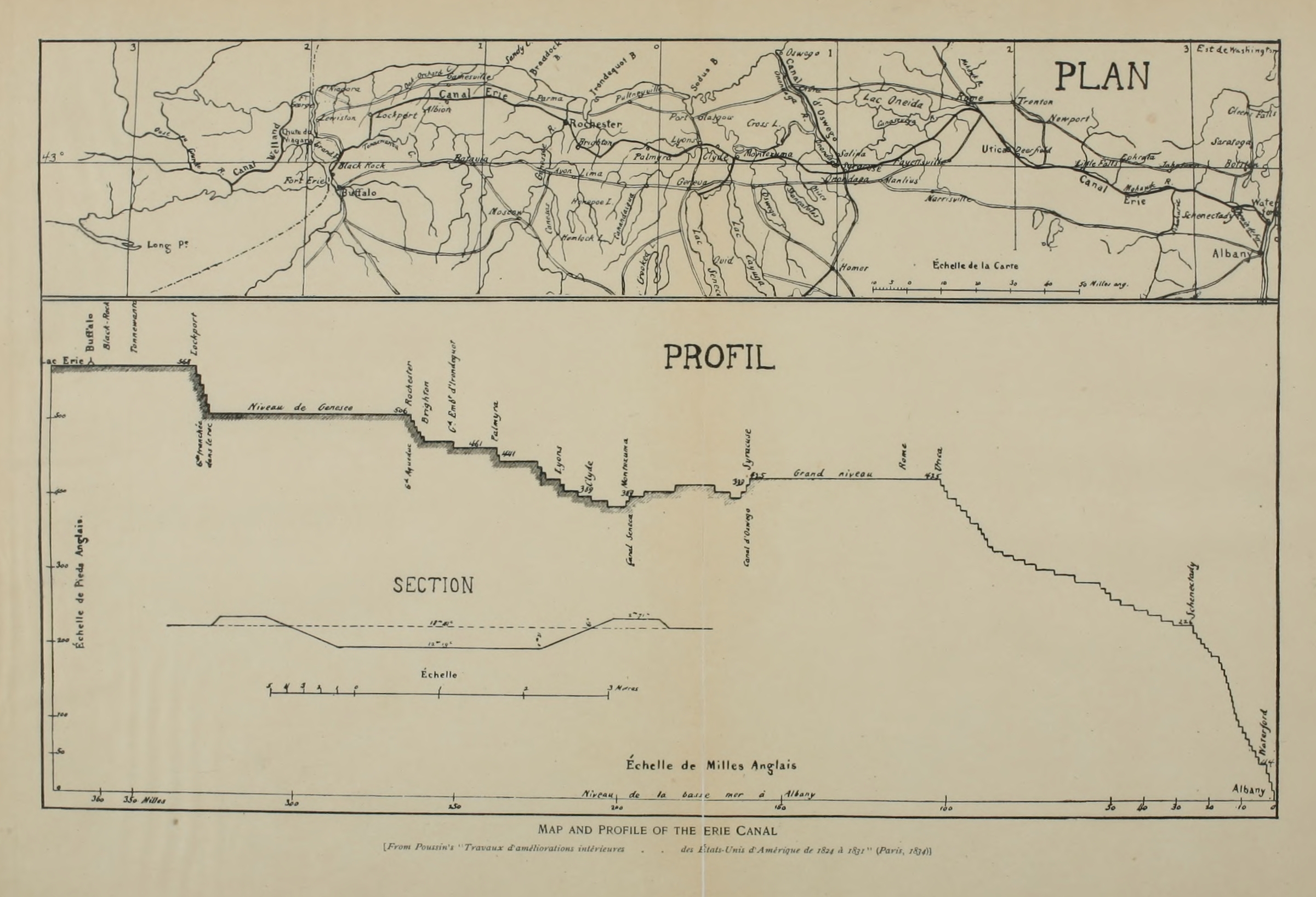
[edit]| Description | A Map and profile of the Erie Canal, found on the book "Historic highways of America (Volume 14)". It originally came from a book entitled "Travaux d’améliorations intérieures ... des États-Unis d’Amérique de 1824 à 1831" | ||||||||||||||||
| Date | |||||||||||||||||
| Source |
Direct source: https://www.gutenberg.org/files/41008/41008-h/images/i_107_large.jpg (non-direct link) Original Publication: Travaux d’améliorations intérieures ... des États-Unis d’Amérique de 1824 à 1831 by Guillaume Tell Poussin |
||||||||||||||||
| Author |
|
||||||||||||||||
| Permission (Reusing this file) |
|
||||||||||||||||
| Other versions | |||||||||||||||||
| JPG development | This map was created with Adobe Photoshop. |
||||||||||||||||

.jpg&action=edit§ion=1)
File history
Click on a date/time to view the file as it appeared at that time.
| Date/Time | Thumbnail | Dimensions | User | Comment | |
|---|---|---|---|---|---|
| current | 14:24, 31 May 2023 | | 2,250 × 1,406 (699 KB) | 痛 (talk | contribs) | Black and white |
| 17:17, 26 May 2023 |  | 2,250 × 1,406 (1.13 MB) | Matrix (talk | contribs) | File:Map and profile of the Eric Canal, 1834.jpg cropped 6 % horizontally, 14 % vertically using CropTool with precise mode. |
You cannot overwrite this file.
File usage on Commons
The following 4 pages use this file:
.jpg&redirect=no)
File usage on other wikis
The following other wikis use this file:
- Usage on en.wikisource.org
.jpg&oldid=769082119)