File:Map Stuttgart 21 outer.png
Jump to navigation
Jump to search
Size of this preview: 649 × 600 pixels. Other resolutions: 260 × 240 pixels | 519 × 480 pixels | 831 × 768 pixels | 1,040 × 961 pixels.
Original file (1,040 × 961 pixels, file size: 495 KB, MIME type: image/png)
Captions
Captions
Add a one-line explanation of what this file represents
Summary
[edit]
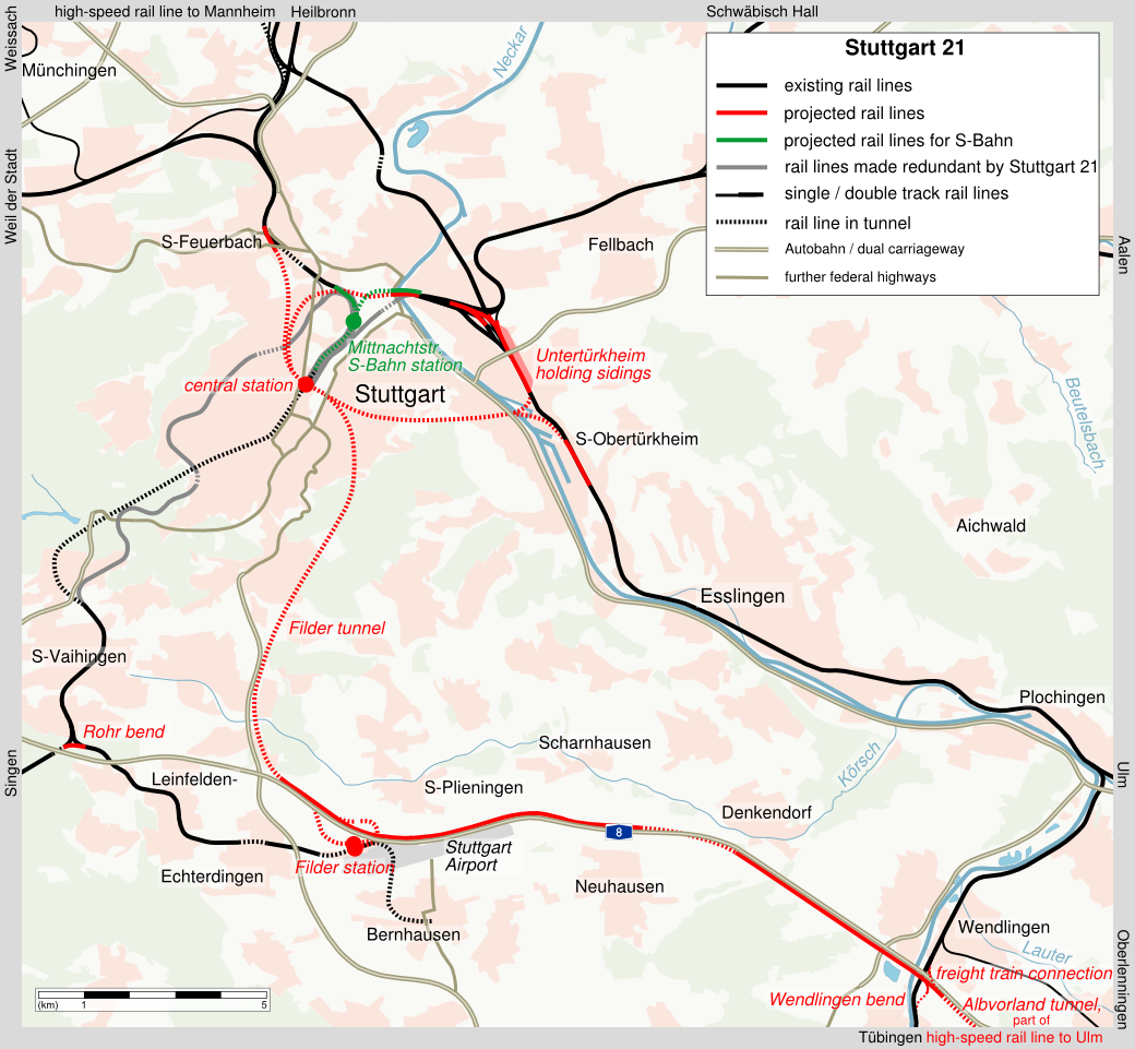
| Description |
|
| Date | |
| Source | conversion of Image:Map Stuttgart 21 outer.svg to PNG format |
| Author | K. Jähne |

|
File:Map Stuttgart 21 outer.svg is a vector version of this file. It should be used in place of this PNG file when not inferior.
File:Map Stuttgart 21 outer.png → File:Map Stuttgart 21 outer.svg
For more information, see Help:SVG. |
 |
Licensing
[edit]
| This work has been released into the public domain by its author, kjunix. This applies worldwide. In some countries this may not be legally possible; if so: |
File history
Click on a date/time to view the file as it appeared at that time.
| Date/Time | Thumbnail | Dimensions | User | Comment | |
|---|---|---|---|---|---|
| current | 20:31, 19 October 2010 | | 1,040 × 961 (495 KB) | Kjunix (talk | contribs) | adding freight train connection near Wendlingen |
| 15:05, 1 May 2008 |  | 1,040 × 961 (493 KB) | Kjunix (talk | contribs) | fix | |
| 21:37, 20 April 2008 |  | 1,040 × 961 (493 KB) | Kjunix (talk | contribs) | == Description == {{Information| |Description = *{{de|Karte von Stuttgart 21 (englische Beschriftung).}} *{{en|map of project Stuttgart 21 (english labeling).}} |Source = translation of [[:Karte Stuttgart 21 ausse |
You cannot overwrite this file.
File usage on Commons
The following page uses this file:
File usage on other wikis
The following other wikis use this file:
- Usage on de.wikipedia.org
- Usage on en.wikipedia.org
- Usage on fr.wikipedia.org
- Usage on hu.wikipedia.org