File:Map Stockholm Akrel 1802 (Stockholm 277A).png
Jump to navigation
Jump to search

Size of this preview: 800 × 519 pixels. Other resolutions: 320 × 208 pixels | 640 × 415 pixels | 1,024 × 665 pixels | 1,280 × 831 pixels | 3,000 × 1,947 pixels.
Original file (3,000 × 1,947 pixels, file size: 9.75 MB, MIME type: image/png)
Captions
Captions
Add a one-line explanation of what this file represents
Summary
[edit].png&action=edit§ion=1)
| Description |
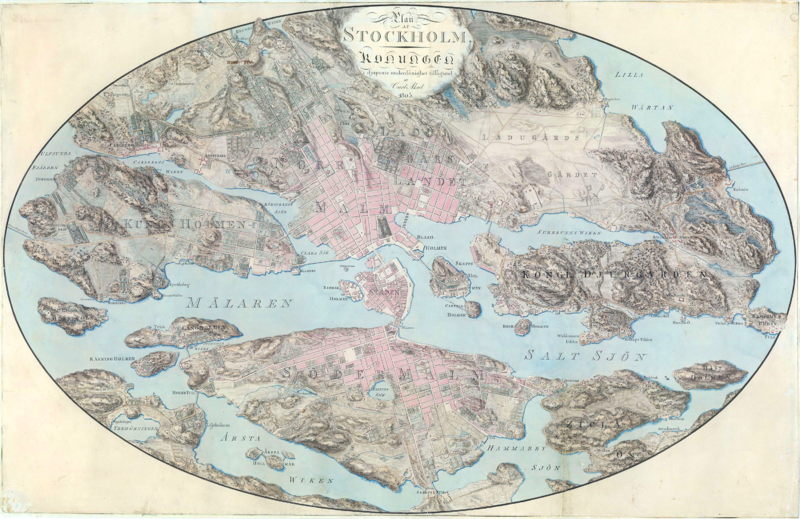
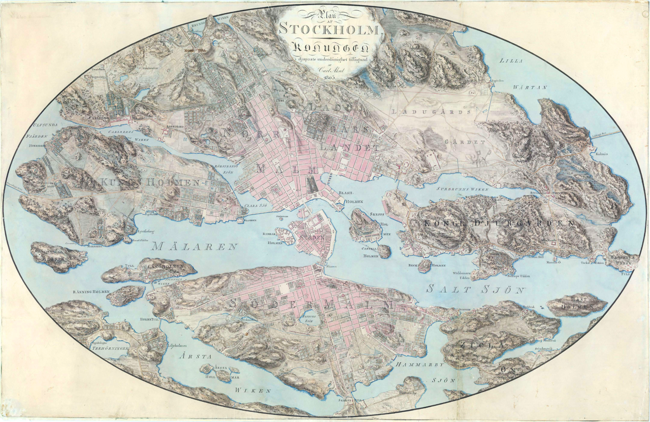
English: Map of Stockholm in 1802-1803 by Carl Akrel. Roads, buildings, topography.
Svenska: Karta över Stockholm ritad av Carl Akrel 1802-1803. "Plan af Stockholm. Konungen i djupaste underdånighet tillägnad af Carl Akrel 1805". |
||||
| Date | |||||
| Source | Krigsarkivet; http://62.20.57.210/kra/bilder/0424/144/277a.pdf | ||||
| Author | Carl Fredrik Akrell (1779-1868); Koyos | ||||
| Permission (Reusing this file) |
|
||||
Licensing
[edit].png&action=edit§ion=2)
| I, the copyright holder of this work, release this work into the public domain. This applies worldwide. In some countries this may not be legally possible; if so: I grant anyone the right to use this work for any purpose, without any conditions, unless such conditions are required by law. |
File history
Click on a date/time to view the file as it appeared at that time.
| Date/Time | Thumbnail | Dimensions | User | Comment | |
|---|---|---|---|---|---|
| current | 23:46, 5 August 2009 | | 3,000 × 1,947 (9.75 MB) | Koyos (talk | contribs) | {{Information |Description={{en|1=Map of Stockholm in 1802-1803 by Carl Akrel. Roads, buildings, topography. }} {{sv|1=Karta över Stockholm ritad av Carl Akrel 1802-1803. "Plan af Stockholm. Konungen i djupaste underdånighet tillägnad af Carl Akrel 180 |
You cannot overwrite this file.
File usage on Commons
There are no pages that use this file.
File usage on other wikis
The following other wikis use this file:
- Usage on sv.wikipedia.org
.png&oldid=493232698)