File:Map Saint-Brieuc.jpg
Jump to navigation
Jump to search
Size of this preview: 800 × 539 pixels. Other resolutions: 320 × 216 pixels | 640 × 432 pixels | 1,024 × 691 pixels | 1,280 × 863 pixels | 2,426 × 1,636 pixels.
Original file (2,426 × 1,636 pixels, file size: 2.34 MB, MIME type: image/jpeg)
Captions
Captions
Add a one-line explanation of what this file represents
Summary
[edit]
| Description |
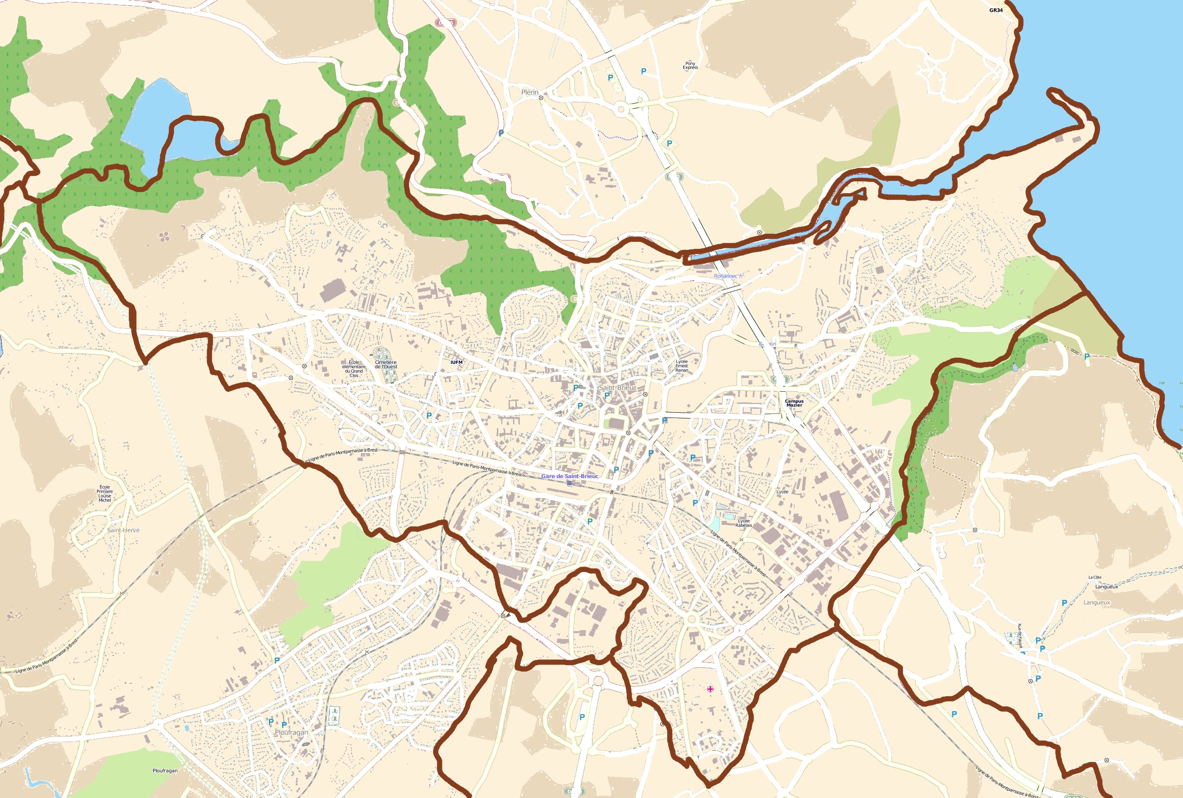
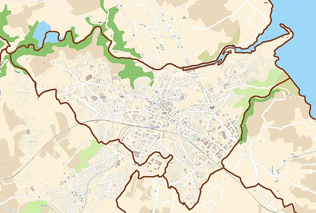
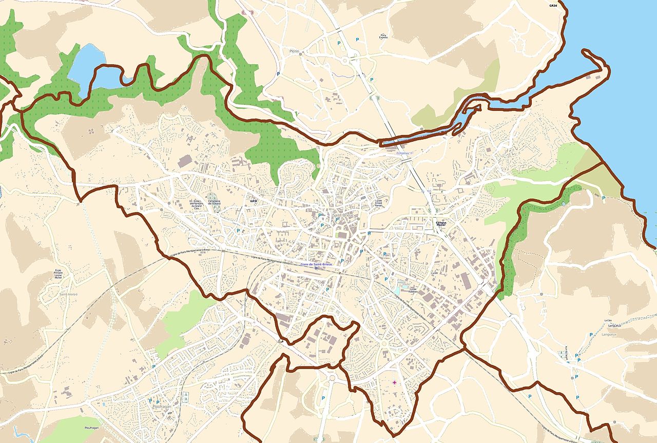
English: Map of Saint-Brieuc, France
Français : Carte de Saint-Brieuc, France |
||||||||||||
| Date | |||||||||||||
| Source |
|
||||||||||||
| Author | OpenStreetMap contributors |
Licensing
[edit]
This file is licensed under the Creative Commons Attribution-Share Alike 3.0 Unported license.
- You are free:
- to share – to copy, distribute and transmit the work
- to remix – to adapt the work
- Under the following conditions:
- attribution – You must give appropriate credit, provide a link to the license, and indicate if changes were made. You may do so in any reasonable manner, but not in any way that suggests the licensor endorses you or your use.
- share alike – If you remix, transform, or build upon the material, you must distribute your contributions under the same or compatible license as the original.
File history
Click on a date/time to view the file as it appeared at that time.
| Date/Time | Thumbnail | Dimensions | User | Comment | |
|---|---|---|---|---|---|
| current | 15:43, 27 July 2011 | | 2,426 × 1,636 (2.34 MB) | XIIIfromTOKYO (talk | contribs) | {{Information |Description ={{en|1=Map of Saint-Brieuc, France}} {{fr|1=Carte de Saint-Brieuc, France}} |Source ={{openstreetmap}} |Author =OpenStreetMap contributors |Date =2011-07-27 |Permission = |other_versions = }} [ |
You cannot overwrite this file.
File usage on Commons
There are no pages that use this file.
File usage on other wikis
The following other wikis use this file:
- Usage on ar.wikipedia.org
- Usage on bg.wikipedia.org
- Usage on ceb.wikipedia.org
- Usage on da.wikipedia.org
- Usage on eu.wikipedia.org
- Usage on fa.wikipedia.org
- Usage on fr.wikipedia.org
- Grève du Joint français
- Légué
- Viaduc de Souzain
- Viaduc de Douvenant
- Viaduc du Vau-Hervé
- Viaduc de Toupin
- Pont sur la rue de Gouédic
- Pont des Courses
- Viaduc de Tosse-Montagne
- Viaduc de la Horvaie
- Viaduc de Grognet
- Viaduc de Colvé
- Pont de la Cage
- Pont de Rohannec'h
- Stade Fred-Aubert
- Modèle:Infobox Ligne de transport en commun
- Modèle:Infobox Ligne de transport en commun/Documentation
- Lycée Saint-Charles (Saint-Brieuc)
- Campus Mazier
- Pont d'Armor de Saint-Brieuc
- Musée d'Art et d'Histoire de Saint-Brieuc
- Hôtel de préfecture des Côtes-d'Armor
- École des beaux-arts de Saint-Brieuc
- Viaduc ferroviaire du Gouédic
- Modèle:Géolocalisation/Saint-Brieuc
- Gare de Saint-Brieuc-Centrale
- Église Saint-Michel de Saint-Brieuc
- Viaduc du Gouët
- Attentat contre la compagnie de CRS 13 de Saint-Brieuc
- Archives départementales des Côtes-d'Armor
- Modèle:Infobox Ligne de transport en commun/Bac à sable
- Bus à haut niveau de service de Saint-Brieuc
- Bois Boissel
- Tour de Cesson
- Aérodrome des Plaines-Villes
- Basilique Notre-Dame-d'Espérance de Saint-Brieuc
- Villa Rohannec'h
- Parc des Promenades (Saint-Brieuc)
- Place Du Guesclin
- Pont de Gouédic
- Tour du Saint-Esprit
- Parc et ferme de La Ville Oger
View more global usage of this file.