File:Map Rouen.jpg
Jump to navigation
Jump to search
Size of this preview: 800 × 503 pixels. Other resolutions: 320 × 201 pixels | 640 × 402 pixels | 1,024 × 644 pixels | 1,280 × 805 pixels | 2,518 × 1,583 pixels.
Original file (2,518 × 1,583 pixels, file size: 3.64 MB, MIME type: image/jpeg)
Captions
Captions
Add a one-line explanation of what this file represents
Summary
[edit]| Description |
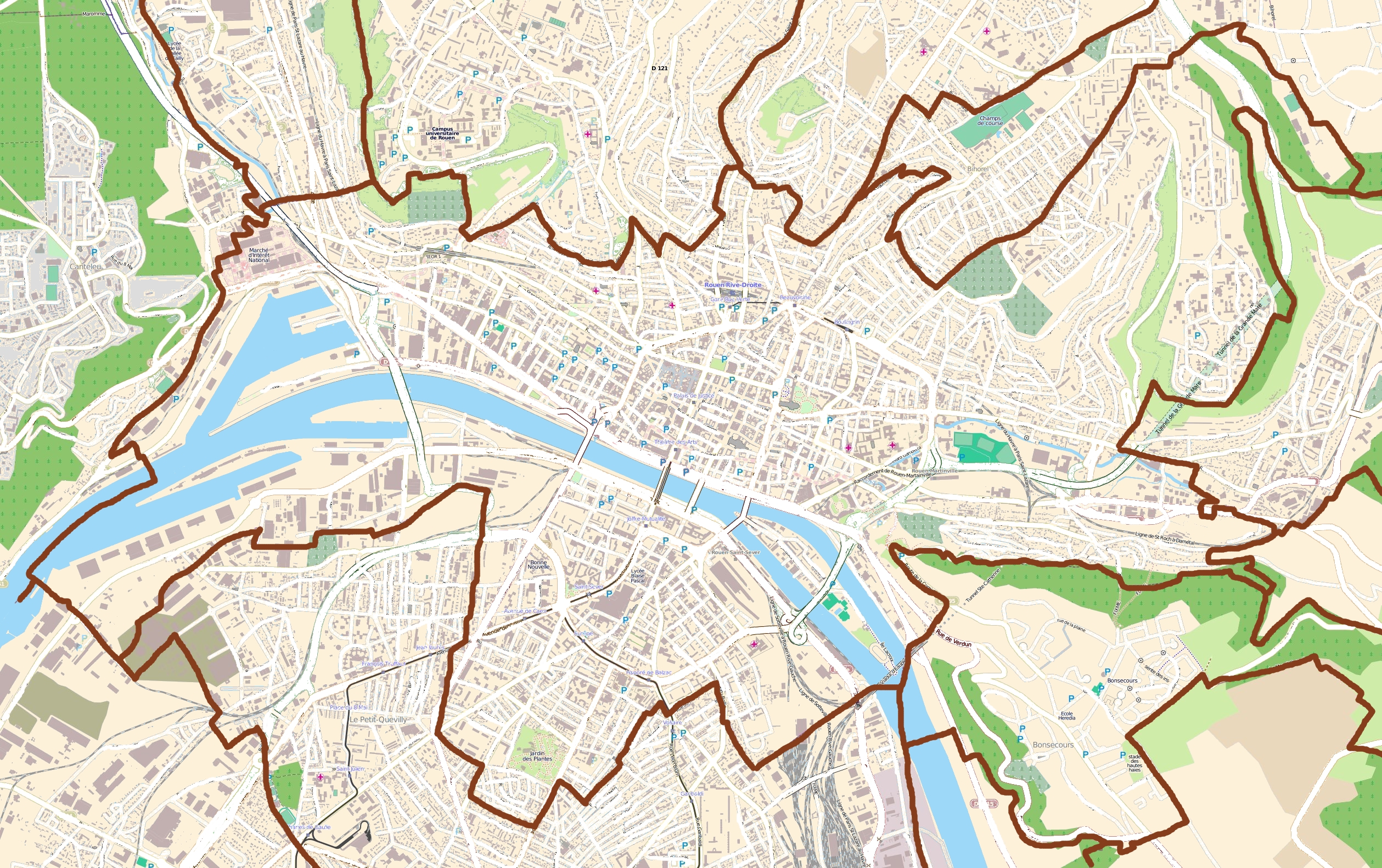
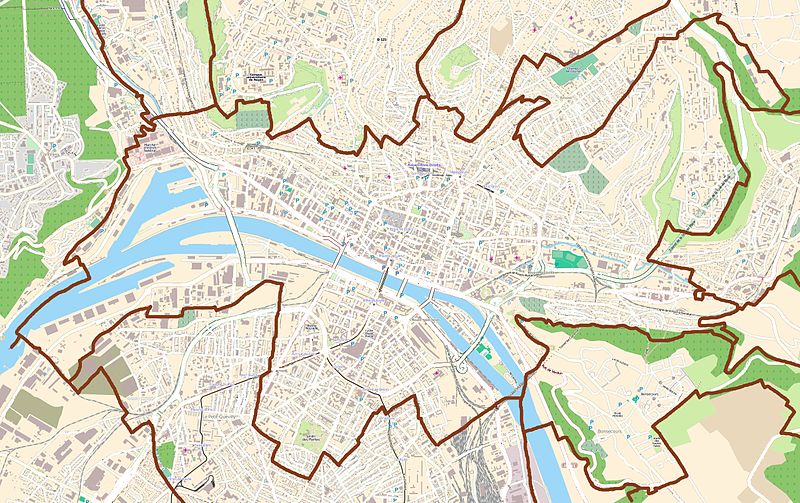
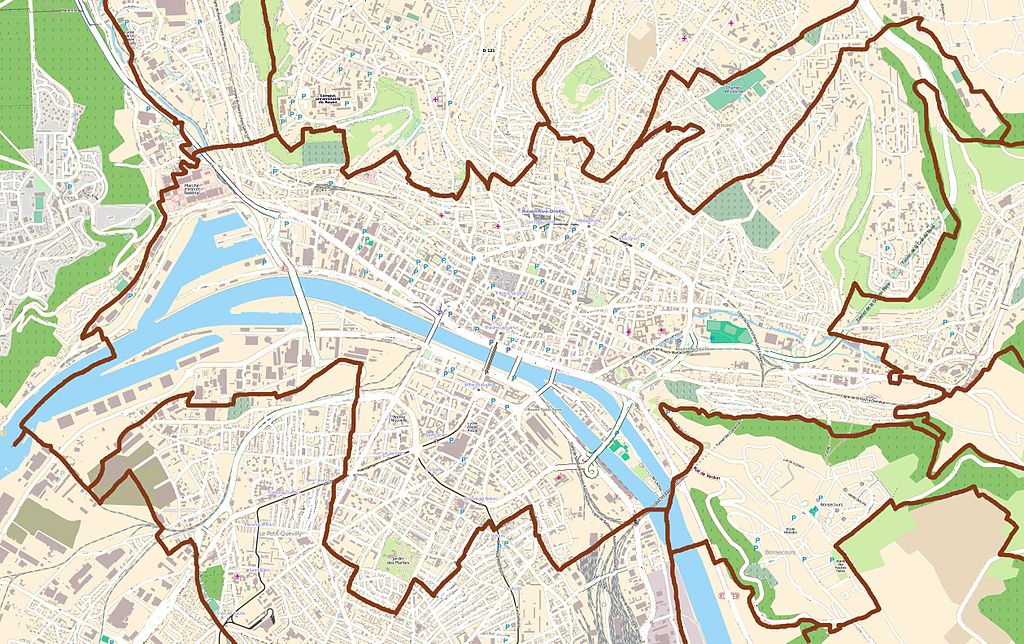
English: Map of Rouen, France
Français : Carte de Rouen, France |
||||||||||||
| Date | |||||||||||||
| Source |
|
||||||||||||
| Author | OpenStreetMap contributors |

|
This map image could be re-created using vector graphics as an SVG file. This has several advantages; see Commons:Media for cleanup for more information. If an SVG form of this image is available, please upload it and afterwards replace this template with
{{vector version available|new image name}}.
It is recommended to name the SVG file “Map Rouen.svg”—then the template Vector version available (or Vva) does not need the new image name parameter. |


Licensing
[edit]
This file is licensed under the Creative Commons Attribution-Share Alike 3.0 Unported license.
- You are free:
- to share – to copy, distribute and transmit the work
- to remix – to adapt the work
- Under the following conditions:
- attribution – You must give appropriate credit, provide a link to the license, and indicate if changes were made. You may do so in any reasonable manner, but not in any way that suggests the licensor endorses you or your use.
- share alike – If you remix, transform, or build upon the material, you must distribute your contributions under the same or compatible license as the original.
File history
Click on a date/time to view the file as it appeared at that time.
| Date/Time | Thumbnail | Dimensions | User | Comment | |
|---|---|---|---|---|---|
| current | 20:57, 28 July 2011 | | 2,518 × 1,583 (3.64 MB) | XIIIfromTOKYO (talk | contribs) | {{Information |Description ={{en|1=Map of Rouen, France}} {{fr|1=Carte de Rouen, France}} |Source ={{openstreetmap}} |Author =OpenStreetMap contributors |Date =2011-07-28 |Permission = |other_versions = }} [[Category:Maps |
You cannot overwrite this file.
File usage on Commons
The following page uses this file:
File usage on other wikis
The following other wikis use this file:
- Usage on ar.wikipedia.org
- Usage on ceb.wikipedia.org
- Usage on da.wikipedia.org
- Usage on eo.wikipedia.org
- Muzeo pri maro, rivero kaj haveno de Rueno
- Placo de la Malnova Merkato
- Abatopreĝejo Sankta Oveno
- Rouen-Rive-Droite (stacidomo)
- Katedralo Nia-Damo de Rueno
- Rouen-Saint-Sever (stacidomo)
- Rouen-Martainville (stacidomo)
- Rouen-Orléans (stacidomo)
- Muséum d'Histoire Naturelle de Rouen
- Ŝablono:Situo sur mapo Francio Rueno
- Usage on es.wikipedia.org
- Usage on fa.wikipedia.org
- Usage on fr.wikipedia.org
- Musée des Beaux-Arts de Rouen
- École supérieure de commerce de Rouen
- Patinoire de l'Île Lacroix
- Salle des Cotonniers
- Université de Rouen-Normandie
- Abbaye Saint-Ouen de Rouen
- Musée Jeanne-d'Arc
- Île Lacroix
- Gare de Rouen-Saint-Sever
- Stade Robert-Diochon
- Muséum de Rouen
- Musée national de l'Éducation
- Quartier Saint-Sever
- Musée Le Secq des Tournelles
- Viaduc d'Eauplet
- Musée maritime fluvial et portuaire de Rouen
- École nationale supérieure d'architecture de Normandie
- Musée des Antiquités (Rouen)
- Musée de la Céramique de Rouen
- Palais des sports de Rouen
- Tunnel de la Grand'Mare
- Pensionnat Jean-Baptiste-de-La-Salle (Rouen)
- Quartier Croix de Pierre
- Académie de Rouen (éducation)
- Square Marcel-Halbout
- Centre hospitalier universitaire de Rouen
- Quartier Saint-Clément - Jardin-des-Plantes
- Musée Flaubert et d'histoire de la médecine
View more global usage of this file.