File:Map OSM - NL - municipality Urk - 2007.png
Jump to navigation
Jump to search
No higher resolution available.
Map_OSM_-_NL_-_municipality_Urk_-_2007.png (389 × 260 pixels, file size: 56 KB, MIME type: image/png)
Captions
Captions
Add a one-line explanation of what this file represents
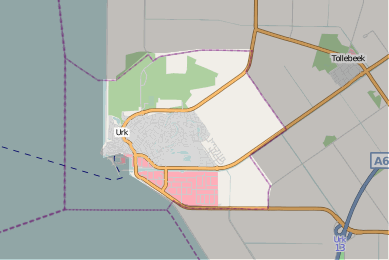
Map of the Dutch municipality of Urk.
Sources:
- Highlighted shape is derived from the Wijk- en Buurtkaart 2007 by Centraal Bureau voor de Statistiek (w:Statistics Netherlands).
- Background map is derived from OpenStreetMap (mapnik map, 2008-07-16).
- License: CC-BY-SA 2.0, acknowledging as authors the OpenStreetMap contributors (including AND), Statistics Netherlands, and Topografische Dienst Kadaster. (See below).
This file is licensed under the Creative Commons Attribution-Share Alike 2.0 Generic license.
- You are free:
- to share – to copy, distribute and transmit the work
- to remix – to adapt the work
- Under the following conditions:
- attribution – You must give appropriate credit, provide a link to the license, and indicate if changes were made. You may do so in any reasonable manner, but not in any way that suggests the licensor endorses you or your use.
- share alike – If you remix, transform, or build upon the material, you must distribute your contributions under the same or compatible license as the original.
File history
Click on a date/time to view the file as it appeared at that time.
| Date/Time | Thumbnail | Dimensions | User | Comment | |
|---|---|---|---|---|---|
| current | 21:48, 17 July 2008 | | 389 × 260 (56 KB) | Eugene van der Pijll (talk | contribs) | clearer map |
| 21:36, 17 July 2008 |  | 519 × 346 (81 KB) | Eugene van der Pijll (talk | contribs) | Map of the Dutch municipality of Urk. Sources: * Highlighted shape is derived from the [http://www.cbs.nl/nl-NL/menu/themas/dossiers/nederland-regionaal/publicaties/geografische-data/archief/2008/2007-wijk-buurtkaart.htm Wijk- en Buurtkaart 2007] by ''Ce |
You cannot overwrite this file.
File usage on Commons
There are no pages that use this file.
File usage on other wikis
The following other wikis use this file:
- Usage on nl.wikipedia.org