File:Map New Orleans-east-central and West Bank1949.jpg
Jump to navigation
Jump to search

Size of this preview: 450 × 599 pixels. Other resolutions: 180 × 240 pixels | 360 × 480 pixels | 577 × 768 pixels | 769 × 1,024 pixels | 1,538 × 2,048 pixels | 3,379 × 4,500 pixels.
Original file (3,379 × 4,500 pixels, file size: 5.63 MB, MIME type: image/jpeg)
Captions
Captions
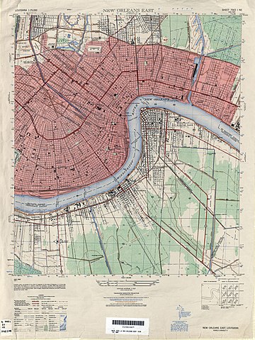
1949 map of part of New Orleans
Summary
[edit]
| Description |
English: 1949 map of part of New Orleans and nearby communities on the West Bank of the Mississippi River. |
| Date | |
| Source | U.S. Army Map Service, Series V885, map via [1] |
| Author | U.S. Army Map Service |
Licensing
[edit]
This image is in the public domain in the United States because it only contains materials that originally came from the United States Geological Survey, an agency of the United States Department of the Interior. For more information, see the official USGS copyright policy.
|
File history
Click on a date/time to view the file as it appeared at that time.
| Date/Time | Thumbnail | Dimensions | User | Comment | |
|---|---|---|---|---|---|
| current | 23:21, 27 March 2019 | | 3,379 × 4,500 (5.63 MB) | Infrogmation (talk | contribs) | User created page with UploadWizard |
You cannot overwrite this file.
File usage on Commons
There are no pages that use this file.