File:Map Kobe.jpg
Jump to navigation
Jump to search

Size of this preview: 734 × 600 pixels. Other resolutions: 294 × 240 pixels | 587 × 480 pixels | 940 × 768 pixels | 1,253 × 1,024 pixels | 2,210 × 1,806 pixels.
Original file (2,210 × 1,806 pixels, file size: 1.19 MB, MIME type: image/jpeg)
Captions
Captions
Add a one-line explanation of what this file represents
Summary
[edit]
| Description |
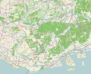
This map of Kobe, Japan was created from OpenStreetMap project data, collected by the community. This map may be incomplete, and may contain errors. Don't rely solely on it for navigation. |
|||||||||
| Date | (see file history) | |||||||||
| Source | openstreetmap.org | |||||||||
| Creator |
OpenStreetMap contributors |
|||||||||
| Permission (Reusing this file) |
OpenStreetMap data and maps are licensed under the Creative Commons Attribution-ShareAlike 2.0 license (CC-BY-SA 2.0). This file is licensed under the Creative Commons Attribution-Share Alike 2.0 Generic license.
|
|||||||||
| Geotemporal data | ||||||||||
| Bounding box |
|
|||||||||
| Georeferencing | If inappropriate please set warp_status = skip to hide. | |||||||||
Licensing
[edit]
This file is licensed under the Creative Commons Attribution-Share Alike 3.0 Unported license.
- You are free:
- to share – to copy, distribute and transmit the work
- to remix – to adapt the work
- Under the following conditions:
- attribution – You must give appropriate credit, provide a link to the license, and indicate if changes were made. You may do so in any reasonable manner, but not in any way that suggests the licensor endorses you or your use.
- share alike – If you remix, transform, or build upon the material, you must distribute your contributions under the same or compatible license as the original.
File history
Click on a date/time to view the file as it appeared at that time.
| Date/Time | Thumbnail | Dimensions | User | Comment | |
|---|---|---|---|---|---|
| current | 10:42, 24 December 2013 | | 2,210 × 1,806 (1.19 MB) | XIIIfromTOKYO (talk | contribs) | wrong geoloc |
| 10:25, 24 December 2013 |  | 2,349 × 1,696 (1.19 MB) | XIIIfromTOKYO (talk | contribs) | User created page with UploadWizard |
You cannot overwrite this file.
File usage on Commons
There are no pages that use this file.
File usage on other wikis
The following other wikis use this file:
- Usage on ar.wikipedia.org
- Usage on az.wikipedia.org
- Usage on ceb.wikipedia.org
- Usage on en.wikipedia.org
- Kobe-Sannomiya Station
- Shin-Kōbe Station
- Kobe Airport
- Seishin-minami Station
- Gakuen-Toshi Station
- Wadamisaki Station
- Motomachi, Kobe
- Tanigami Station
- Shin-Nagata Station
- Kenchōmae Station (Hyōgo)
- Ōkurayama Station (Hyōgo)
- Minatogawa-kōen Station
- Kamisawa Station (Hyōgo)
- Nagata Station (Kobe Municipal Subway)
- Itayado Station
- Myōhōji Station (Hyōgo)
- Myōdani Station
- Sōgō Undō Kōen Station
- Ikawadani Station
- Seishin-chūō Station
- Sannomiya-Hanadokeimae Station
- Kyūkyoryūchi-Daimarumae Station
- Minato Motomachi Station
- Harborland Station
- Chūō-Ichibamae Station
- Misaki-Kōen Station (Hyōgo)
- Karumo Station
- Komagabayashi Station
- Module:Location map/data/Japan Kobe/doc
- Module:Location map/data/Japan Kobe
- Usage on es.wikipedia.org
- Usage on fr.wikipedia.org
- Ikuta-jinja
- Île de Rokkō
- Université de Kobe
- Stade du parc Misaki
- Stade du Mémorial de l'Universiade
- Skymark Stadium
- Île du Port (Japon)
- Kobe City Hall
- Shin Kobe Oriental City
- Kobe Portopia Hotel
- Minatogawa-jinja
- Gare de Nada
- Gare de Rokkōmichi
- Gare de Settsu-Motoyama
- Gare de Kōnan-Yamate
- Gare de Kanebōmae
View more global usage of this file.