File:Map Geigelstein.png
Jump to navigation
Jump to search

Size of this preview: 781 × 600 pixels. Other resolutions: 313 × 240 pixels | 625 × 480 pixels | 1,000 × 768 pixels | 1,280 × 983 pixels | 1,881 × 1,445 pixels.
Original file (1,881 × 1,445 pixels, file size: 975 KB, MIME type: image/png)
Captions
Captions
Add a one-line explanation of what this file represents
| Description |
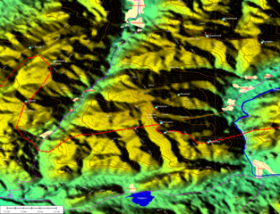
English: Map of mount Geigelstein in Germany. |
|||||||
| Date | ||||||||
| Source | Map created by Kogo. | |||||||
| Author | Kogo | |||||||
| Permission (Reusing this file) |
Kogo put it under the GFDL.
|


File history
Click on a date/time to view the file as it appeared at that time.
| Date/Time | Thumbnail | Dimensions | User | Comment | |
|---|---|---|---|---|---|
| current | 20:21, 23 August 2005 | | 1,881 × 1,445 (975 KB) | Kogo (talk | contribs) | |
| 21:22, 29 July 2005 |  | 1,900 × 1,432 (1.16 MB) | Kogo (talk | contribs) | ||
| 23:19, 23 July 2005 |  | 1,645 × 1,306 (436 KB) | Kogo (talk | contribs) |
You cannot overwrite this file.
File usage on Commons
The following page uses this file:
File usage on other wikis
The following other wikis use this file:
- Usage on de.wikipedia.org
- Usage on fr.wikipedia.org