File:Map Anatolia ancient regions-sl.svg
Jump to navigation
Jump to search

Size of this PNG preview of this SVG file: 800 × 518 pixels. Other resolutions: 320 × 207 pixels | 640 × 414 pixels | 1,024 × 663 pixels | 1,280 × 828 pixels | 2,560 × 1,657 pixels | 921 × 596 pixels.
Original file (SVG file, nominally 921 × 596 pixels, file size: 274 KB)
Captions
Captions
Add a one-line explanation of what this file represents
Summary
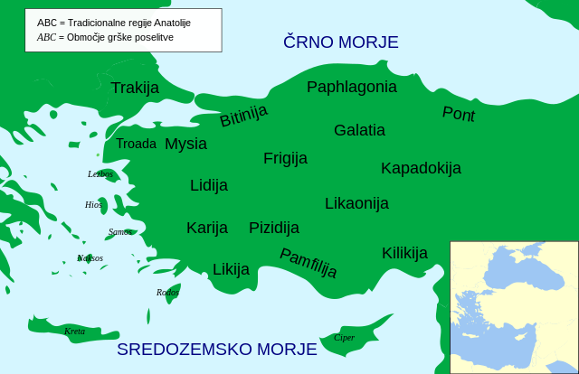
[edit]| Description | preveden zemljevid Anatolije |
| Date | |
| Source | File:Map Anatolia ancient regions-en.svg |
| Author | User:MinisterForBadTimes |
| Other versions |
[]
|


.svg)


Licensing
[edit]
This file is licensed under the Creative Commons Attribution 3.0 Unported license.
- You are free:
- to share – to copy, distribute and transmit the work
- to remix – to adapt the work
- Under the following conditions:
- attribution – You must give appropriate credit, provide a link to the license, and indicate if changes were made. You may do so in any reasonable manner, but not in any way that suggests the licensor endorses you or your use.
File history
Click on a date/time to view the file as it appeared at that time.
| Date/Time | Thumbnail | Dimensions | User | Comment | |
|---|---|---|---|---|---|
| current | 19:50, 23 July 2021 | | 921 × 596 (274 KB) | A09 (talk | contribs) | Uploaded a work by User:MinisterForBadTimes from File:Map Anatolia ancient regions-en.svg with UploadWizard |
You cannot overwrite this file.
File usage on Commons
The following 20 pages use this file:
- User:Magog the Ogre/Multilingual legend/2021 July 21-31
- File:AnatoliaAncientRegions.png
- File:Anatolia Ancient Regions ID.png
- File:Map Anatolia ancient regions-af.jpg
- File:Map Anatolia ancient regions-el.svg
- File:Map Anatolia ancient regions-en.svg
- File:Map Anatolia ancient regions-es.svg
- File:Map Anatolia ancient regions-grc.svg
- File:Map Anatolia ancient regions-hu.svg
- File:Map Anatolia ancient regions-it.svg
- File:Map Anatolia ancient regions-mk.svg
- File:Map Anatolia ancient regions-pt.svg
- File:Map Anatolia ancient regions-ru.png
- File:Map Anatolia ancient regions-ru.svg
- File:Map Anatolia ancient regions-sl.svg
- File:Map Anatolia ancient regions-uk.svg
- File:Map Anatolia ancient regions-zh.svg
- File:Map Anatolia ancient regions (Indonesian version).svg
- File:مناطق آناتولی باستان.svg
- Template:Other versions/Map Anatolia ancient regions