File:Map - Moens Klint.jpg
Jump to navigation
Jump to search
Size of this preview: 414 × 600 pixels. Other resolutions: 166 × 240 pixels | 415 × 601 pixels.
Original file (415 × 601 pixels, file size: 313 KB, MIME type: image/jpeg)
Captions
Captions
Add a one-line explanation of what this file represents
| Description |
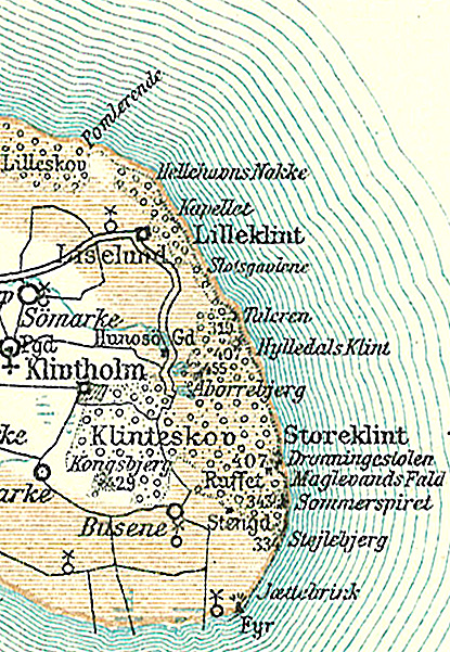
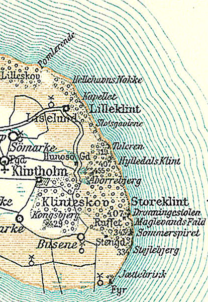
Dansk: Kort over Møns Klint
English: Map of the Cliffs of Møn, in Denmark |
||||
| Date | circa 1900 | ||||
| Source | Frems Amtskort over Danmark | ||||
| Author | Fotolitograferede i Generalstabens Topografiske Afdeling | ||||
| Permission (Reusing this file) |
|
||||
| Other versions | used in da:Møns Klint, | ||||
File history
Click on a date/time to view the file as it appeared at that time.
| Date/Time | Thumbnail | Dimensions | User | Comment | |
|---|---|---|---|---|---|
| current | 11:08, 19 November 2008 | | 415 × 601 (313 KB) | Nico-dk (talk | contribs) | {{Information |Description=da:Kort over Møns Klint <br/>en:Map of the Cliffs of Møn, in Denmark |Source=''Frems Amtskort over Danmark'' |Date=ca. 1900 |Author= Fotolitograferede i Generalstabens Topografiske Afdeling |Permission={{PD-old}} |other_versi |
You cannot overwrite this file.
File usage on Commons
There are no pages that use this file.
File usage on other wikis
The following other wikis use this file:
- Usage on da.wikipedia.org
- Usage on es.wikipedia.org
- Usage on pt.wikipedia.org
- Usage on www.wikidata.org