File:Map -- Carlsbad, Guadalupe.jpg
Jump to navigation
Jump to search
No higher resolution available.
Map_--_Carlsbad,_Guadalupe.jpg (573 × 488 pixels, file size: 87 KB, MIME type: image/jpeg)
Captions
Captions
Add a one-line explanation of what this file represents
Summary
[edit]
| Description |
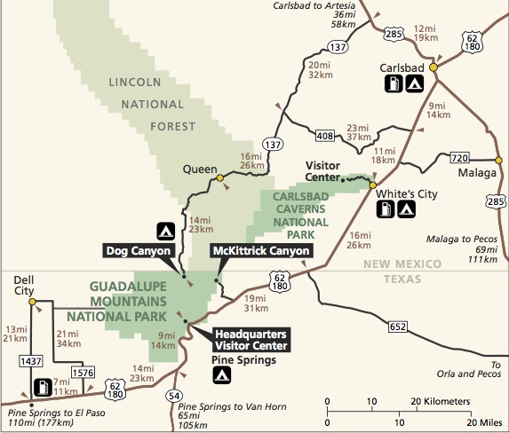
English: A map of the Guadalupe Mountains area — showing Carlsbad Caverns National Park and Guadalupe Mountains National Park, and the region's travel routes.
|
| Date | |
| Source | pdf map converted to jpg found at http://www.nps.gov/gumo/planyourvisit/maps.htm |
| Author | National Park Service |
Licensing
[edit]
| This image or media file contains material based on a work of a National Park Service employee, created as part of that person's official duties. As a work of the U.S. federal government, such work is in the public domain in the United States. See the NPS website and NPS copyright policy for more information. |
File history
Click on a date/time to view the file as it appeared at that time.
| Date/Time | Thumbnail | Dimensions | User | Comment | |
|---|---|---|---|---|---|
| current | 16:01, 15 March 2012 | | 573 × 488 (87 KB) | Ww2censor (talk | contribs) | better directly downloaded image non cropped |
| 15:57, 15 March 2012 |  | 568 × 486 (75 KB) | Ww2censor (talk | contribs) | Better quality image found on NPS website | |
| 15:25, 29 June 2011 |  | 575 × 486 (67 KB) | Smallchief (talk | contribs) |
You cannot overwrite this file.
File usage on Commons
There are no pages that use this file.