File:Map-TLV-europe-HE.svg
Jump to navigation
Jump to search

Size of this PNG preview of this SVG file: 573 × 444 pixels. Other resolutions: 310 × 240 pixels | 620 × 480 pixels | 991 × 768 pixels | 1,280 × 992 pixels | 2,560 × 1,984 pixels.
Original file (SVG file, nominally 573 × 444 pixels, file size: 396 KB)
Captions
Captions
Add a one-line explanation of what this file represents
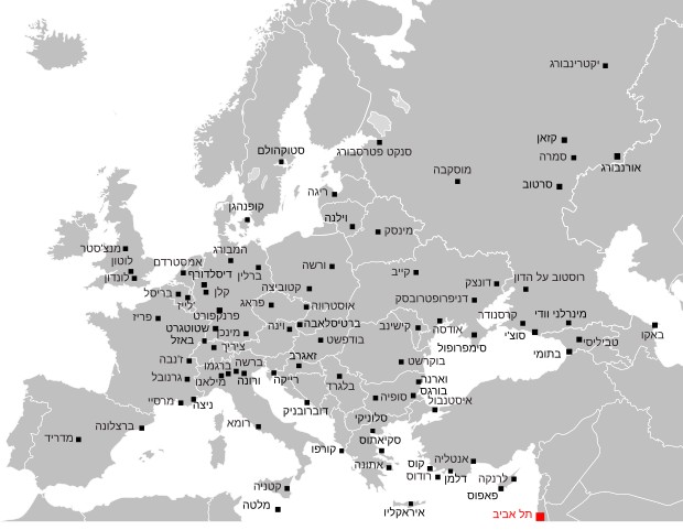
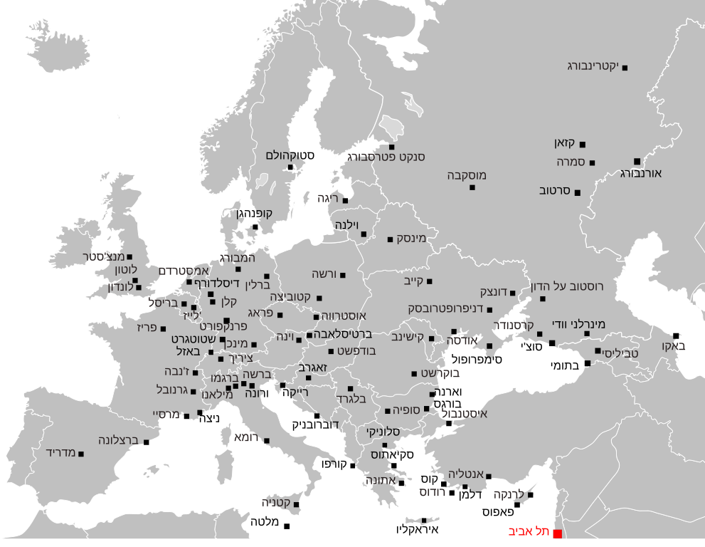
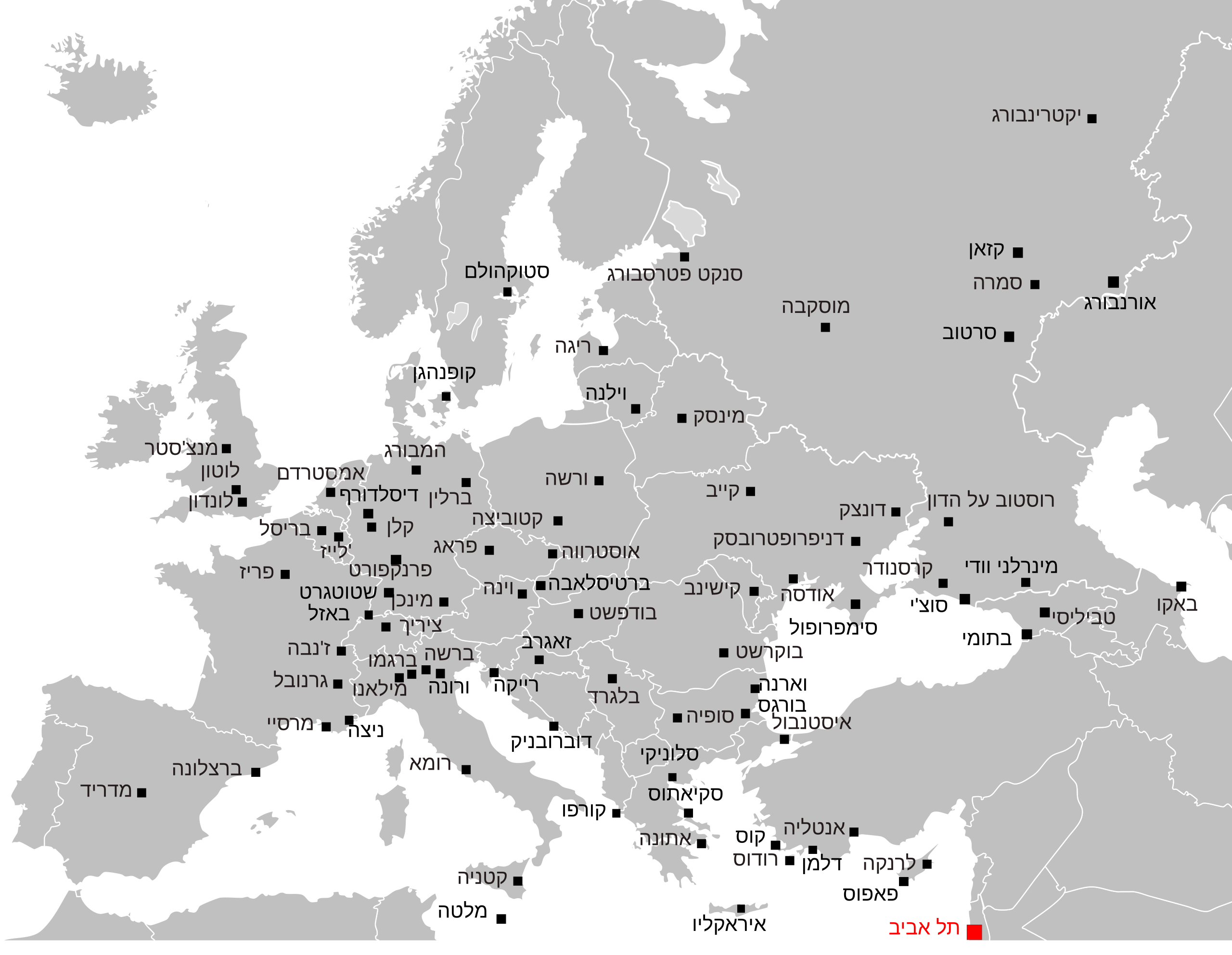
| Description | יעדים מנתב"ג אירופה |
| Date | |
| Source | Own work After File:Blank map europe.svg |
| Author | Ori~ |
This image is in the public domain because it contains materials that originally came from the United States Central Intelligence Agency's World Factbook.
|
 |
File history
Click on a date/time to view the file as it appeared at that time.
| Date/Time | Thumbnail | Dimensions | User | Comment | |
|---|---|---|---|---|---|
| current | 06:00, 9 April 2011 | | 573 × 444 (396 KB) | Ori~ (talk | contribs) | aa |
| 05:58, 9 April 2011 |  | 573 × 444 (396 KB) | Ori~ (talk | contribs) | Stand april 2011 | |
| 18:09, 27 January 2010 |  | 573 × 444 (367 KB) | Cumulus (talk | contribs) | yet another crop. hope this one is ok | |
| 07:36, 27 January 2010 |  | 565 × 392 (345 KB) | Cumulus (talk | contribs) | crop as per author's request | |
| 02:21, 27 January 2010 |  | 680 × 520 (575 KB) | Ori~ (talk | contribs) | ed | |
| 01:56, 27 January 2010 |  | 680 × 520 (572 KB) | Ori~ (talk | contribs) | ed | |
| 01:54, 27 January 2010 |  | 680 × 520 (572 KB) | Ori~ (talk | contribs) | ed | |
| 01:51, 27 January 2010 |  | 680 × 520 (572 KB) | Ori~ (talk | contribs) | {{Information |Description=יעדים מנתב"ג אירופה |Source={{own}} After File:Blank map europe.svg |Date=2010-01-27 |Author= Ori~ |Permission= |other_versions= }} {{PD-USGov-CIA-WF}} [[Category:Ben Gurion International Airp |
You cannot overwrite this file.
File usage on Commons
There are no pages that use this file.
File usage on other wikis
The following other wikis use this file:
- Usage on he.wikipedia.org