File:Map-France-Finistère-Commune-Ya d'ar brezhoneg.svg
Jump to navigation
Jump to search

Size of this PNG preview of this SVG file: 706 × 599 pixels. Other resolutions: 283 × 240 pixels | 566 × 480 pixels | 905 × 768 pixels | 1,207 × 1,024 pixels | 2,413 × 2,048 pixels | 1,468 × 1,246 pixels.
Original file (SVG file, nominally 1,468 × 1,246 pixels, file size: 210 KB)
Captions
Captions
Add a one-line explanation of what this file represents
| Description |
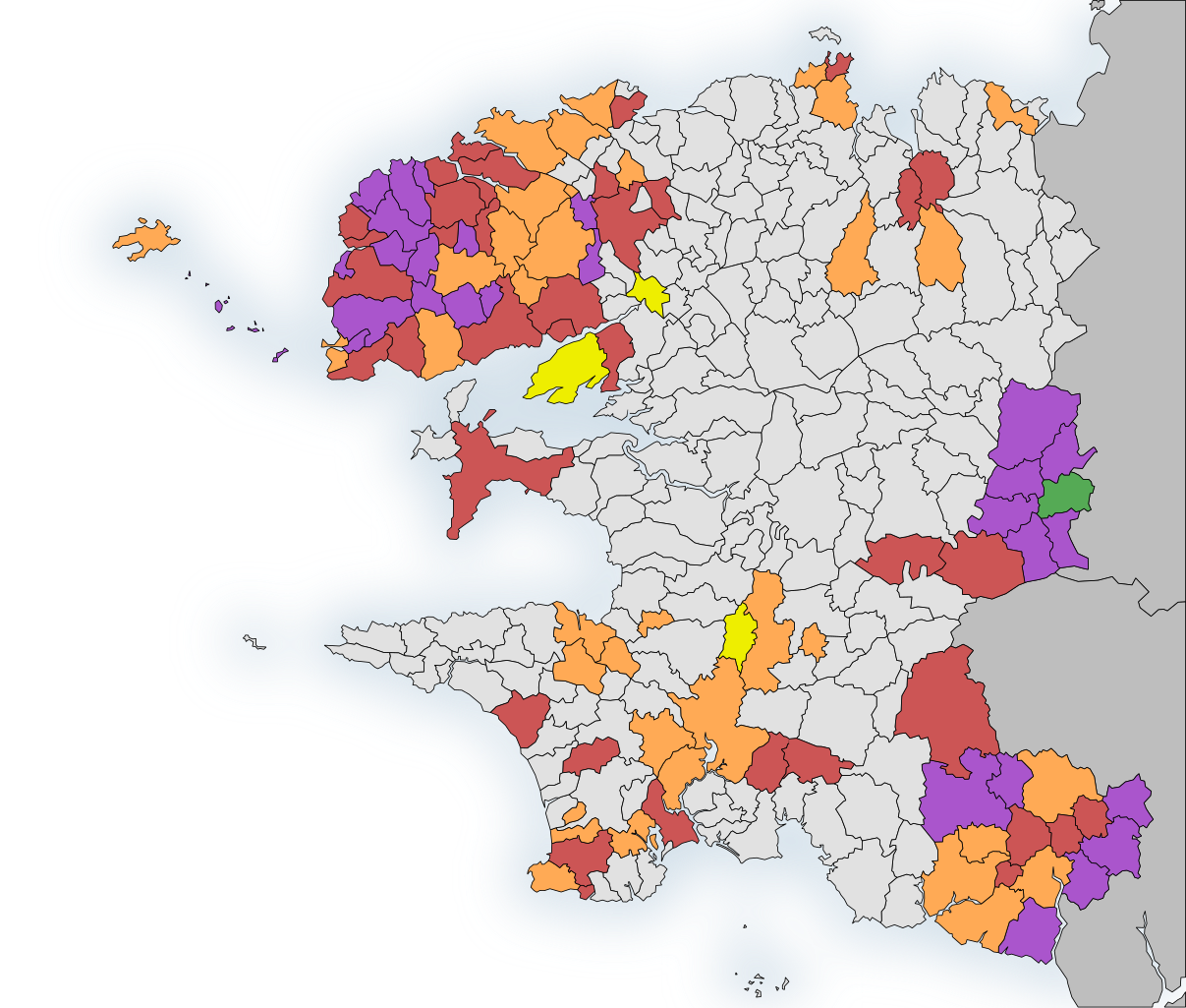
English: "Ya d'ar brezhoneg" Finistère map, France
Level 4 convention
Level 3 convention
Level 2 convention
Level 1 convention
Intercommunity conventionned town Français : Carte des communes signataire de la charte "Ya d'ar brezhoneg" du Finistère, France
Charte de niveau 4
Charte de niveau 3
Charte de niveau 2
Charte de niveau 1
Autres communes dont l'intercommunauté est signataire |
| Date | (UTC) |
| Source | |
| Author |
|
| This is a retouched picture, which means that it has been digitally altered from its original version. Modifications: ya d'ar brezhoneg. The original can be viewed here: Map-France-Finistère-Commune-blank.svg:
|
I, the copyright holder of this work, hereby publish it under the following licenses:
This file is licensed under the Creative Commons Attribution-Share Alike 3.0 Unported, 2.5 Generic, 2.0 Generic and 1.0 Generic license.
- You are free:
- to share – to copy, distribute and transmit the work
- to remix – to adapt the work
- Under the following conditions:
- attribution – You must give appropriate credit, provide a link to the license, and indicate if changes were made. You may do so in any reasonable manner, but not in any way that suggests the licensor endorses you or your use.
- share alike – If you remix, transform, or build upon the material, you must distribute your contributions under the same or compatible license as the original.

|
Permission is granted to copy, distribute and/or modify this document under the terms of the GNU Free Documentation License, Version 1.2 or any later version published by the Free Software Foundation; with no Invariant Sections, no Front-Cover Texts, and no Back-Cover Texts. A copy of the license is included in the section entitled GNU Free Documentation License. |
You may select the license of your choice.
Original upload log
[edit]
This image is a derivative work of the following images:
- File:Map-France-Finistère-Commune-blank.svg licensed with Cc-by-sa-3.0,2.5,2.0,1.0, GFDL
- 2011-01-13T11:26:35Z Ju gatsu mikka 1468x1246 (213728 Bytes) == {{int:filedesc}} == {{Information |Description={{en|1=Map of the borders of communes in Finistère, France}} {{fr|1=Carte des limites de communes du Finistère}} |Source={{own}} |Author=[[User:Ju gatsu mikka|Ju gatsu
Uploaded with derivativeFX
File history
Click on a date/time to view the file as it appeared at that time.
| Date/Time | Thumbnail | Dimensions | User | Comment | |
|---|---|---|---|---|---|
| current | 18:31, 12 August 2011 | | 1,468 × 1,246 (210 KB) | Ju gatsu mikka (talk | contribs) | + "niveau 0" |
| 13:06, 9 August 2011 |  | 1,468 × 1,246 (210 KB) | Ju gatsu mikka (talk | contribs) | {{Information |Description={{en|1="Ya d'ar brezhoneg" Finistère map, France}} {{fr|1=Carte des communes signataire de la charte "Ya d'ar brezhoneg" du Finistère}} |Source=*File:Map-France-Finistère-Commune-blank.svg |Date=2011-08-09 13:05 (UTC) | |
You cannot overwrite this file.
File usage on Commons
The following page uses this file:
File usage on other wikis
The following other wikis use this file:
- Usage on ca.wikipedia.org
- Usage on de.wikipedia.org
- Usage on fr.wikipedia.org