File:Mannheim Fahrradstrasse karl Ladenburg Str D Schmidt 04 2017 GROSS.jpg
Jump to navigation
Jump to search
Size of this preview: 800 × 533 pixels. Other resolutions: 320 × 213 pixels | 640 × 427 pixels | 1,024 × 683 pixels | 1,280 × 853 pixels | 2,560 × 1,707 pixels | 5,184 × 3,456 pixels.
Original file (5,184 × 3,456 pixels, file size: 4.46 MB, MIME type: image/jpeg)
Captions
Captions
Add a one-line explanation of what this file represents
Summary
[edit]
| Description |
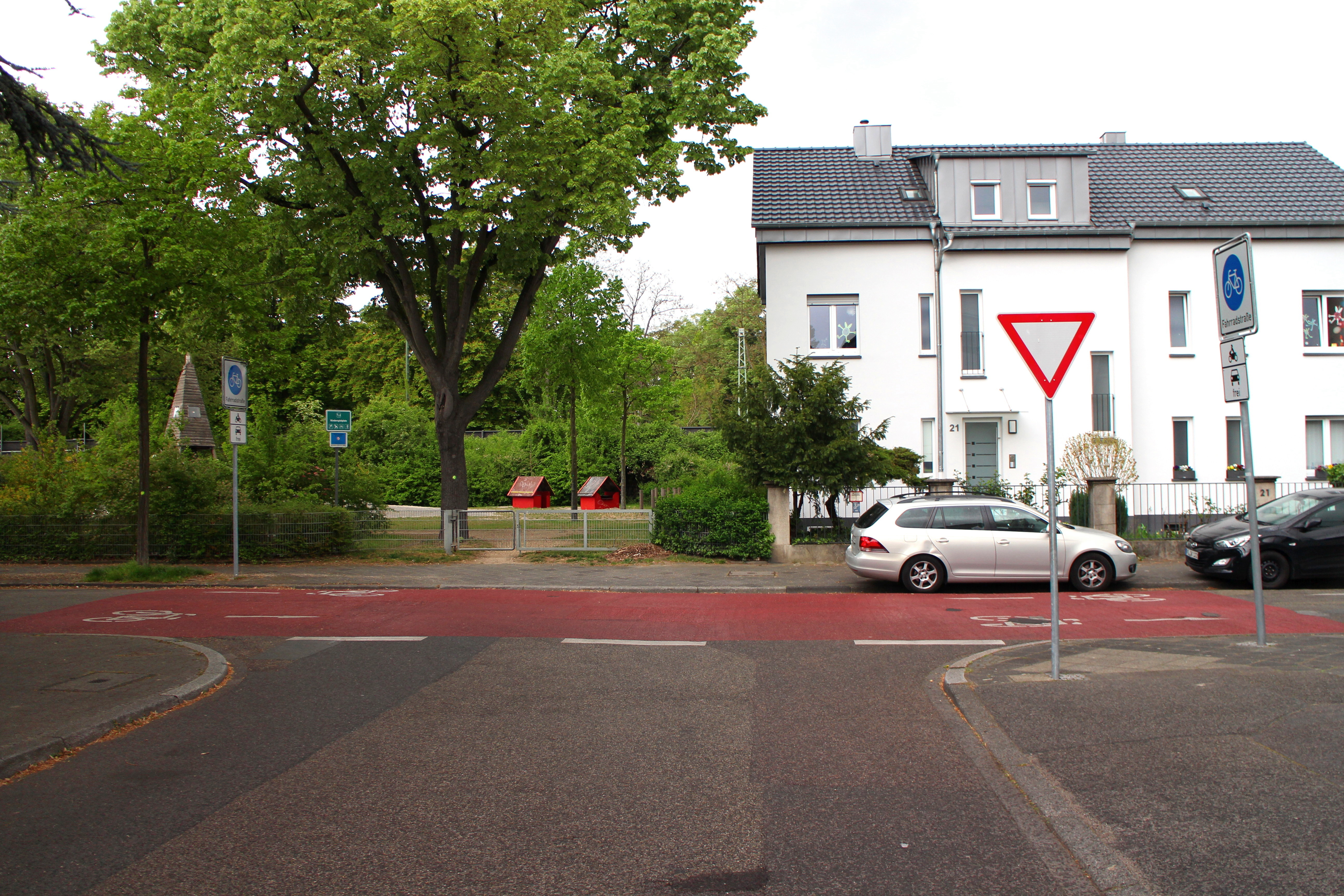
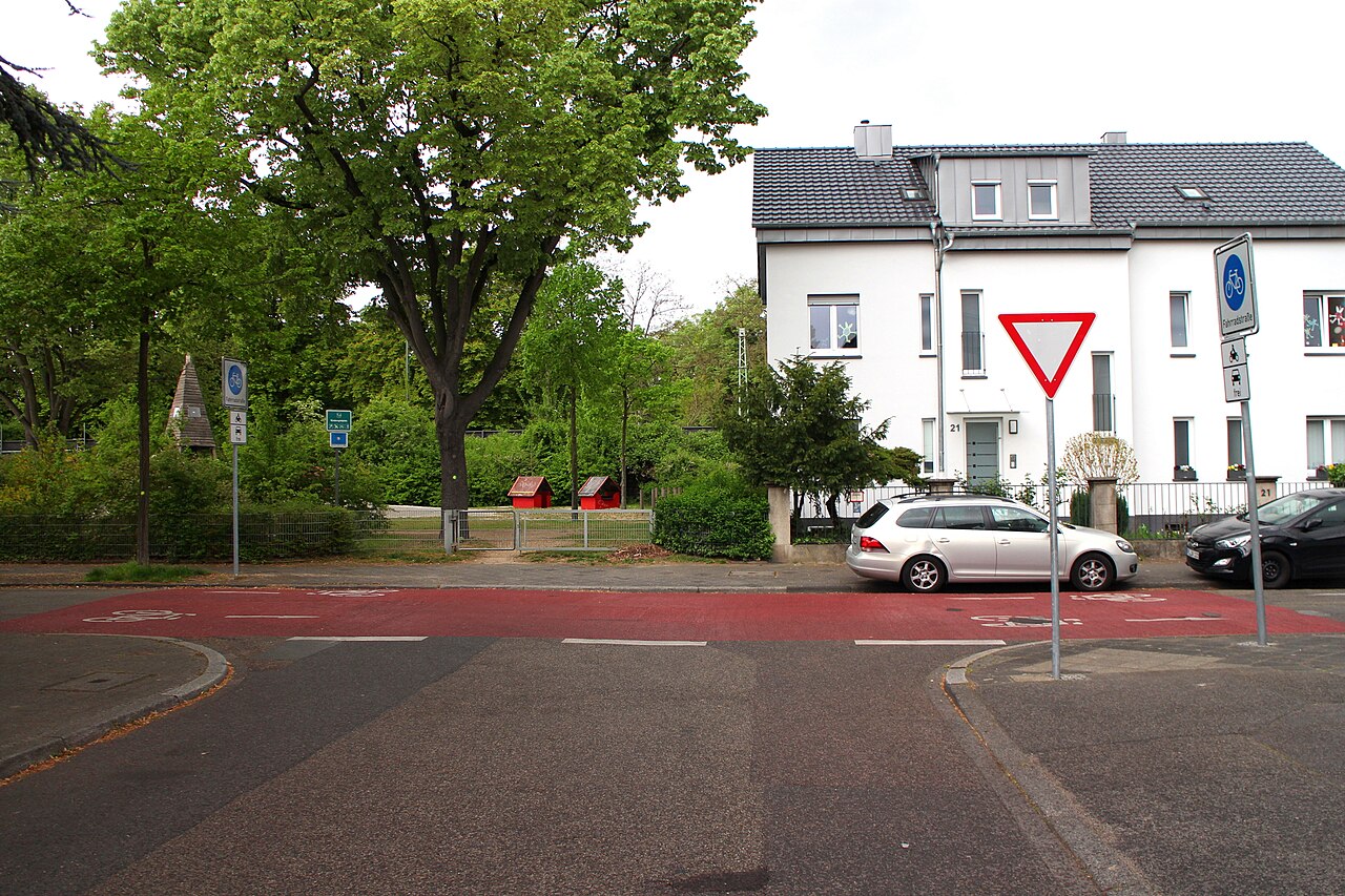
English: Germany: Bicycle road „Karl-Ladenburg-Straße“ in Mannheim
Deutsch: Blick auf die Fahrradstraße Karl-Ladenburg-Straße Höhe Einmündung Böcklinstraße. Zur besseren Verdeutlichung des Vorrangs der Fahrradstraße wurde der Einmündungsbereich zusätzlich zur Beschilderung (Vorfahrt achten) rot markiert. |
| Date | |
| Source | Own work |
| Author | Dirk Schmidt |
| Camera location | | View this and other nearby images on: OpenStreetMap |
|---|
Licensing
[edit]
I, the copyright holder of this work, hereby publish it under the following license:
| This file is made available under the Creative Commons CC0 1.0 Universal Public Domain Dedication. | |
| The person who associated a work with this deed has dedicated the work to the public domain by waiving all of their rights to the work worldwide under copyright law, including all related and neighboring rights, to the extent allowed by law. You can copy, modify, distribute and perform the work, even for commercial purposes, all without asking permission.
|
File history
Click on a date/time to view the file as it appeared at that time.
| Date/Time | Thumbnail | Dimensions | User | Comment | |
|---|---|---|---|---|---|
| current | 13:54, 28 June 2020 | | 5,184 × 3,456 (4.46 MB) | Dirk Schmidt (talk | contribs) | {{Information |description ={{en|1=Germany: Bicycle road „Karl-Ladenburg-Straße“ in Mannheim}} {{de|1=Blick auf die Fahrradstraße Karl-Ladenburg-Straße Höhe Einmündung Böcklinstraße. Zur besseren Verdeutlichung des Vorrangs der Fahrradstraße wurde der Einmündungsbereich zusätzlich zur Beschilderung (Vorfahrt achten) rot markiert. }} |date =2017-04-16 |source ={{own}} |author =User:Dirk Schmidt }} Category:Bicycle boulevards in Germany |
You cannot overwrite this file.
File usage on Commons
There are no pages that use this file.
File usage on other wikis
The following other wikis use this file:
- Usage on de.wikipedia.org