File:Malva moschata 021.jpg
Jump to navigation
Jump to search

Size of this preview: 800 × 533 pixels. Other resolutions: 320 × 213 pixels | 640 × 427 pixels | 1,024 × 683 pixels | 1,280 × 853 pixels | 2,560 × 1,707 pixels | 6,240 × 4,160 pixels.
Original file (6,240 × 4,160 pixels, file size: 5.15 MB, MIME type: image/jpeg)
Captions
Captions
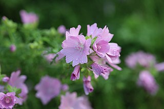
Malva moschata Linné. — Mauve musquée. — (Musk mallow).
Summary
[edit]
| Description |
English: National Capital, Portneuf Regional County Municipality, Deschambault-Grondines (Municipality), Grondines (Sector), Sir-Lomer-Gouin Road, Tuesday, June 29, 2021.
Français : Capitale Nationale, MRC Portneuf, Deschambault-Grondines (Municipalité), Grondines (Secteur), chemin Sir-Lomer-Gouin, le mardi 29 juin 2021. |
| Date | |
| Source | Own work |
| Author | Nichole Ouellette |
| Camera location | | View this and other nearby images on: OpenStreetMap |
|---|
First published by the author: https://florelaurentienne.com/flore/Groupes/Spermatophytes/Angiospermes/Dicotyles/057_Malvacees/03_Malva/moschata.htm
Licensing
[edit]
I, the copyright holder of this work, hereby publish it under the following license:
This file is licensed under the Creative Commons Attribution-Share Alike 4.0 International license.
- You are free:
- to share – to copy, distribute and transmit the work
- to remix – to adapt the work
- Under the following conditions:
- attribution – You must give appropriate credit, provide a link to the license, and indicate if changes were made. You may do so in any reasonable manner, but not in any way that suggests the licensor endorses you or your use.
- share alike – If you remix, transform, or build upon the material, you must distribute your contributions under the same or compatible license as the original.
File history
Click on a date/time to view the file as it appeared at that time.
| Date/Time | Thumbnail | Dimensions | User | Comment | |
|---|---|---|---|---|---|
| current | 15:15, 23 April 2023 | | 6,240 × 4,160 (5.15 MB) | Nichole Ouellette (talk | contribs) | Uploaded own work with UploadWizard |
You cannot overwrite this file.
File usage on Commons
There are no pages that use this file.
File usage on other wikis
The following other wikis use this file:
- Usage on en.wikipedia.org
- Usage on fr.wikipedia.org