File:Malaya Vishera abandoned railway depot (28487231715).jpg
Jump to navigation
Jump to search

Size of this preview: 800 × 533 pixels. Other resolutions: 320 × 213 pixels | 640 × 427 pixels | 1,024 × 683 pixels | 1,280 × 853 pixels | 2,560 × 1,707 pixels | 4,608 × 3,072 pixels.
Original file (4,608 × 3,072 pixels, file size: 7.69 MB, MIME type: image/jpeg)
Captions
Captions
Add a one-line explanation of what this file represents
Summary
[edit].jpg&action=edit§ion=1)
| Description |
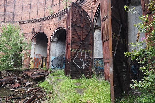
Malaya Vishera railway station has big abandoned circle railway depot, build in 1856. Since 2000-s in disused, and opened for visiting. На станции Малая Вишера есть огромных размеров круглое заброшенное паровозное депо, построенное при пуске дороги к 1856 году. С 2000-х оно заброшено, и открыто для посещения. |
| Date | |
| Source | Malaya Vishera abandoned railway depot |
| Author | Artem Svetlov from Moscow, Russia |
| Camera location | | View this and other nearby images on: OpenStreetMap |
|---|
.jpg¶ms=058.847022_N_0032.222888_E_globe:Earth_type:camera_source:Flickr_&language=en)
Licensing
[edit].jpg&action=edit§ion=2)
This file is licensed under the Creative Commons Attribution 2.0 Generic license.
- You are free:
- to share – to copy, distribute and transmit the work
- to remix – to adapt the work
- Under the following conditions:
- attribution – You must give appropriate credit, provide a link to the license, and indicate if changes were made. You may do so in any reasonable manner, but not in any way that suggests the licensor endorses you or your use.
| This image was originally posted to Flickr by trolleway at https://flickr.com/photos/24415554@N04/28487231715 (archive). It was reviewed on 21 February 2018 by FlickreviewR 2 and was confirmed to be licensed under the terms of the cc-by-2.0. |
File history
Click on a date/time to view the file as it appeared at that time.
| Date/Time | Thumbnail | Dimensions | User | Comment | |
|---|---|---|---|---|---|
| current | 23:47, 21 February 2018 | | 4,608 × 3,072 (7.69 MB) | Artix Kreiger 2 (talk | contribs) | Transferred from Flickr via Flickr2Commons |
You cannot overwrite this file.
File usage on Commons
There are no pages that use this file.
.jpg&oldid=895626610)