File:Maison des fées au bois de Mesnil, Tressé.jpg
Jump to navigation
Jump to search
Size of this preview: 800 × 536 pixels. Other resolutions: 320 × 214 pixels | 640 × 428 pixels | 1,024 × 685 pixels | 1,280 × 857 pixels | 2,560 × 1,714 pixels | 3,872 × 2,592 pixels.
Original file (3,872 × 2,592 pixels, file size: 3.43 MB, MIME type: image/jpeg)
Captions
Captions
Add a one-line explanation of what this file represents
Summary
[edit]
| Description |
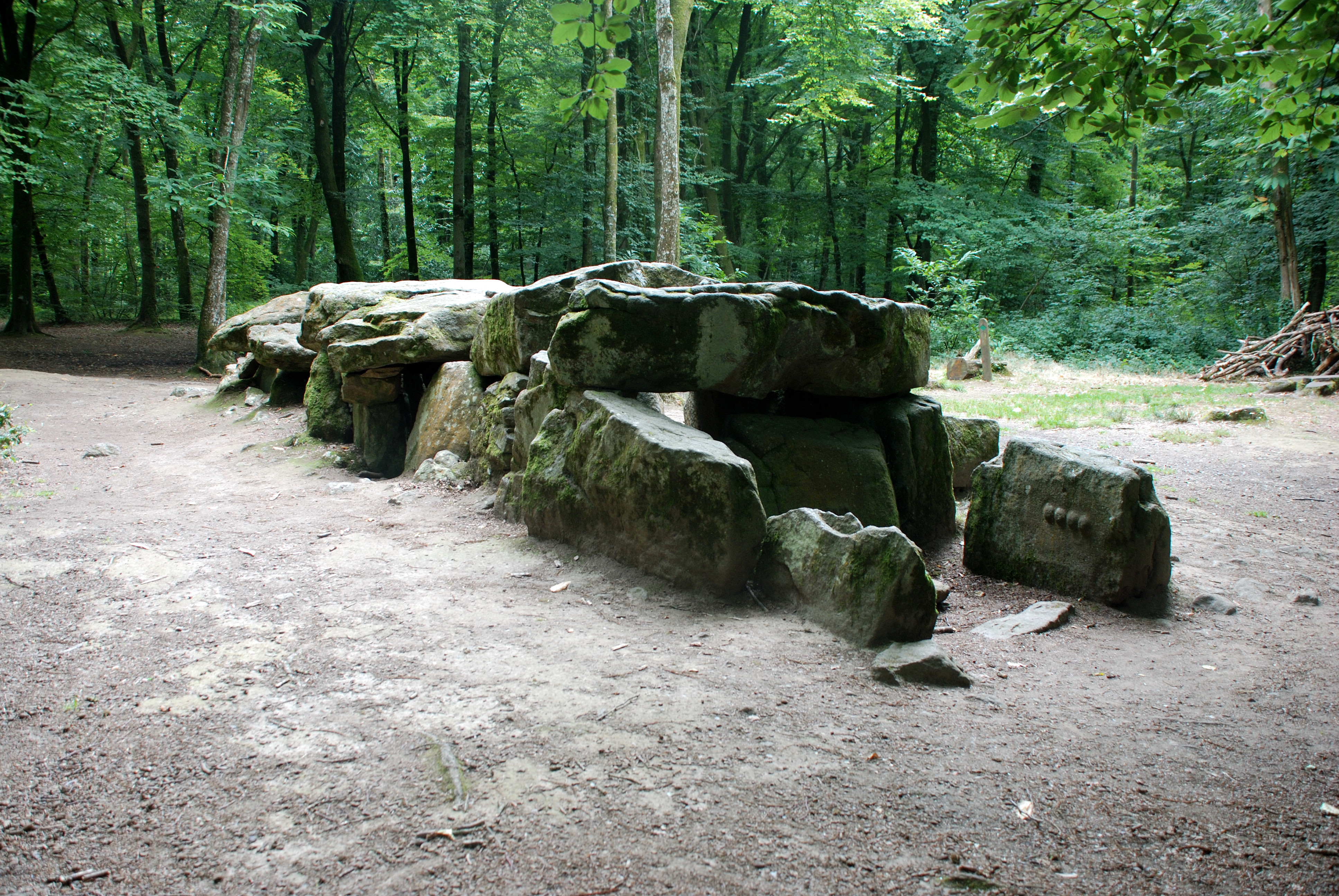
Français : Au centre d'une clairière, se dresse l'allée couverte. Monument funéraire datant de 2500 avant Jésus-Christ, on dit qu'elle abritait le culte de la déesse mère. Cette hypothèse est étayée par les quatre seins sont sculptés dans la pierre la plus à droite. À l'origine, la cella en abritait seize paires. Mais, en 1960, la majorité a été martelée.
Recouverte par sept grandes dalles de granit, mesure 11 mètres de long, 2,60 m de large et 1,60 m de haut. Ce monument est située dans la Forêt du Mesnil.English: Those stones, the Faeries' house, are located in the Mesnil Wood and thought a funeral monument dedicated to the Mother goddess, 4 pairs of breasts being engraved in the stone. Before 1960, they were 16 pairs of breasts, then quarried. Dated 2500 A.C.N. |
||
| Date | |||
| Source | originally posted to Flickr as maison des fées au bois de Mesnil, Tressé | ||
| Author | calaeco | ||
| Permission (Reusing this file) |
This file is licensed under the Creative Commons Attribution-Share Alike 2.0 Generic license.
|
| Camera location | | View this and other nearby images on: OpenStreetMap |
|---|
|
This building is classé au titre des monuments historiques de la France. It is indexed in the base Mérimée, a database of architectural heritage maintained by the French Ministry of Culture, under the reference PA00090891
|
File history
Click on a date/time to view the file as it appeared at that time.
| Date/Time | Thumbnail | Dimensions | User | Comment | |
|---|---|---|---|---|---|
| current | 09:40, 17 October 2017 | | 3,872 × 2,592 (3.43 MB) | VortBot (talk | contribs) | Uploading higher resolution from Flickr |
| 22:18, 18 October 2008 |  | 1,024 × 685 (645 KB) | Flickr upload bot (talk | contribs) | Uploaded from http://flickr.com/photo/30114549@N07/2819412504 using Flickr upload bot |
You cannot overwrite this file.
File usage on Commons
The following 2 pages use this file:
File usage on other wikis
The following other wikis use this file:
- Usage on br.wikipedia.org
- Usage on de.wikipedia.org
- Usage on eo.wikipedia.org
- Usage on fr.wikipedia.org
- Tressé
- Forêt du Mesnil
- Liste des monuments historiques d'Ille-et-Vilaine
- Sites mégalithiques d'Ille-et-Vilaine
- Projet:Monuments historiques/Wikidata/liste/35
- Liste d'allées couvertes en France
- Mesnil-Roc'h
- Liste des monuments historiques protégés en 1889
- Utilisateur:TouN/Brouillon/2
- Nouveaux Meurtres à Saint-Malo
- Usage on nl.wikipedia.org
- Usage on www.wikidata.org