File:Maine.svg
Jump to navigation
Jump to search

Size of this PNG preview of this SVG file: 800 × 600 pixels. Other resolutions: 320 × 240 pixels | 640 × 480 pixels | 1,024 × 768 pixels | 1,280 × 960 pixels | 2,560 × 1,920 pixels | 2,816 × 2,112 pixels.
Original file (SVG file, nominally 2,816 × 2,112 pixels, file size: 268 KB)
Captions
Captions
Add a one-line explanation of what this file represents
Summary
[edit]
| Description |
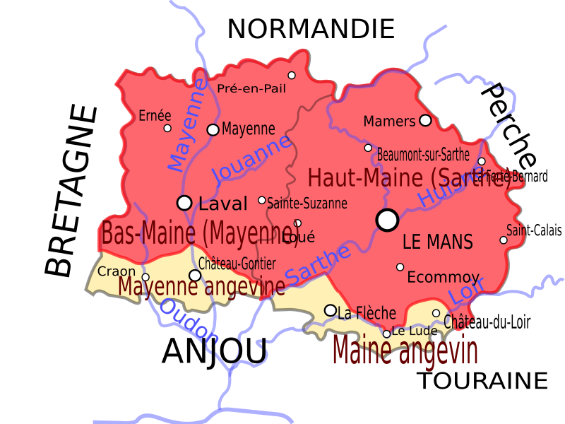
Carte de l'ancienne province française du Maine Map of the ancient french province Maine |
| Date | 10 March 2008 (upload date) |
| Source | Own work |
| Author | Koostia |
Licensing
[edit]
| I, the copyright holder of this work, release this work into the public domain. This applies worldwide. In some countries this may not be legally possible; if so: I grant anyone the right to use this work for any purpose, without any conditions, unless such conditions are required by law. |
File history
Click on a date/time to view the file as it appeared at that time.
| Date/Time | Thumbnail | Dimensions | User | Comment | |
|---|---|---|---|---|---|
| current | 18:35, 10 March 2008 | | 2,816 × 2,112 (268 KB) | Fradeve11 (talk | contribs) | == Description == {{Information |Description=Carte de l'ancienne province française du Maine Map of the ancient french province Maine |Source=travail personnel |Date=10/03/2008 |Author= Koostia |Permission= |other_versions= }} [[Catego |
| 17:21, 10 March 2008 |  | 2,816 × 2,112 (55 KB) | Esprit04 (talk | contribs) | {{Information |Description=Carte de l'ancienne province française du Maine Map of the ancient french province Maine |Source=travail personnel |Date=10/03/2008 |Author= Koostia |Permission= |other_versions= }} Category:Mayenne[[Cate |
You cannot overwrite this file.
File usage on Commons
There are no pages that use this file.