File:Main flow length.png
Jump to navigation
Jump to search

Size of this preview: 800 × 571 pixels. Other resolutions: 320 × 228 pixels | 640 × 457 pixels | 1,024 × 730 pixels | 1,200 × 856 pixels.
Original file (1,200 × 856 pixels, file size: 1.84 MB, MIME type: image/png)
Captions
Captions
Add a one-line explanation of what this file represents
Summary
[edit]
| Description |
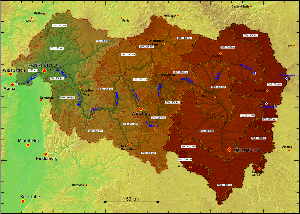
Deutsch: Abflusslänge des Mains und seiner Zuflüsse bis zur Mündung in den Rhein
English: runoff length of river Main and its tributaries down to the mouth into the Rhine |
| Date | |
| Source |
Own work based on open data provided by OpenStreetMap contributers (https://www.openstreetmap.org), Bayerische Vermessungsverwaltung DGM1 (https://geodaten.bayern.de/opengeodata), Thüringer Landesamt für Bodenmanagement und Geoinformation DGM2 (https://www.geoportal-th.de/de-de/Downloadbereiche/Download-Offene-Geodaten-Thüringen), Hessische Verwaltung für Bodenmanagement und Geoinformation DGM1 (https://hvbg.hessen.de/geoinformation/open-data), ASTER Digital Elevation Model data by https://lpdaac.usgs.gov/, and results of own runoff calculations. |
| Author |
Periphrastika |
Licensing
[edit]
I, the copyright holder of this work, hereby publish it under the following license:
This file is licensed under the Creative Commons Attribution-Share Alike 4.0 International license.
- You are free:
- to share – to copy, distribute and transmit the work
- to remix – to adapt the work
- Under the following conditions:
- attribution – You must give appropriate credit, provide a link to the license, and indicate if changes were made. You may do so in any reasonable manner, but not in any way that suggests the licensor endorses you or your use.
- share alike – If you remix, transform, or build upon the material, you must distribute your contributions under the same or compatible license as the original.
File history
Click on a date/time to view the file as it appeared at that time.
| Date/Time | Thumbnail | Dimensions | User | Comment | |
|---|---|---|---|---|---|
| current | 11:06, 18 January 2024 | | 1,200 × 856 (1.84 MB) | Periphrastika (talk | contribs) | more details |
| 16:01, 6 April 2018 |  | 1,320 × 1,078 (804 KB) | Periphrastika (talk | contribs) | User created page with UploadWizard |
You cannot overwrite this file.
File usage on Commons
There are no pages that use this file.