File:Maikopmap.gif
Jump to navigation
Jump to search

Size of this preview: 800 × 537 pixels. Other resolutions: 320 × 215 pixels | 640 × 429 pixels | 1,024 × 687 pixels | 1,280 × 859 pixels | 2,552 × 1,712 pixels.
Original file (2,552 × 1,712 pixels, file size: 2.35 MB, MIME type: image/gif)
Captions
Captions
Add a one-line explanation of what this file represents
Summary
[edit]
| Description |
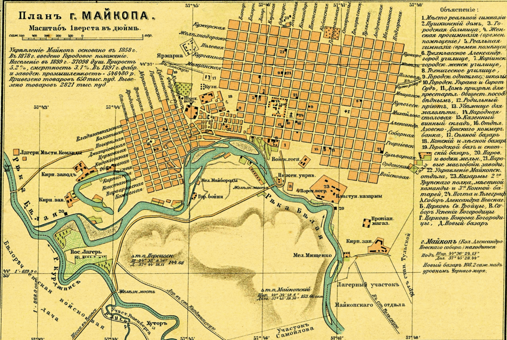
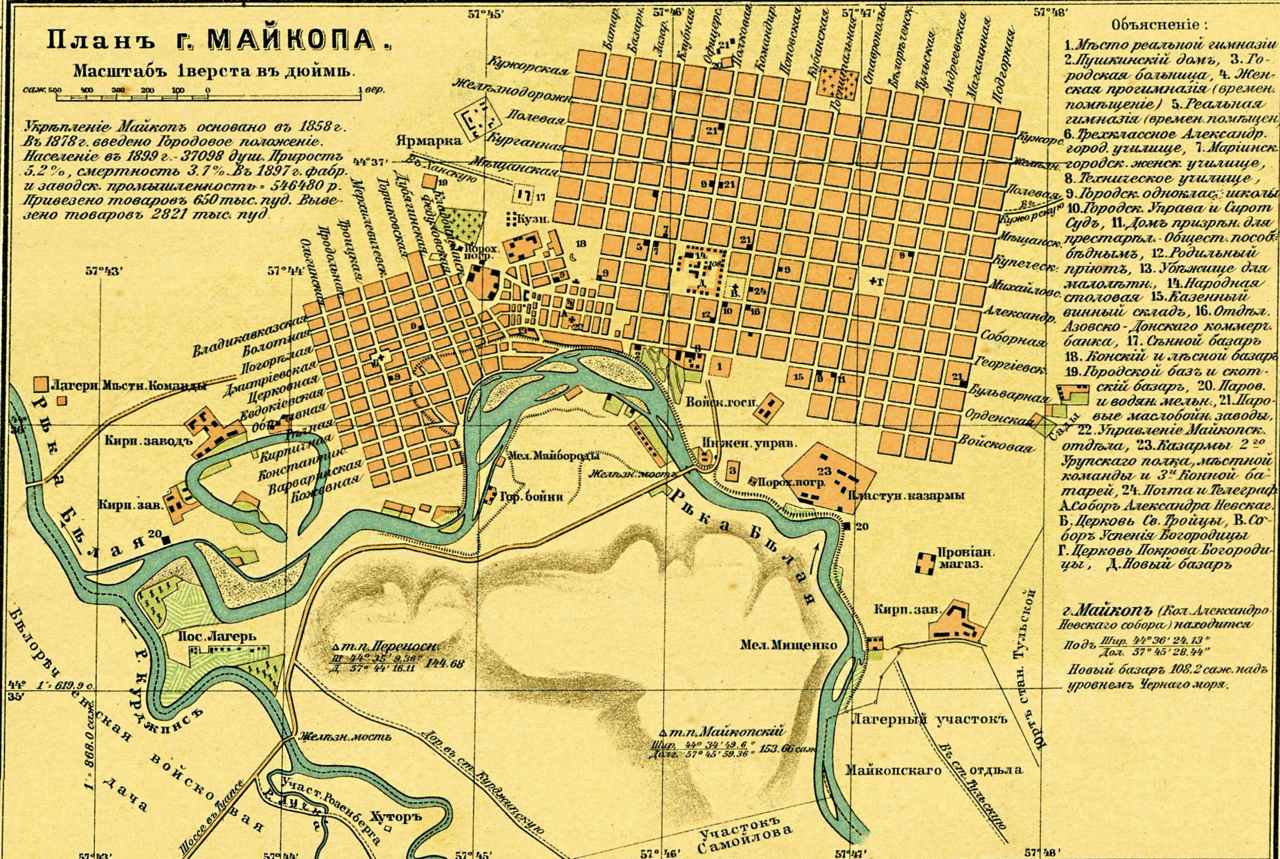
Русский: План Майкопа. Из "Карта Кубанской области и близких к ней Черноморской губернии и части Сухумского округа" |
| Date | 1900-1902 |
| Source | http://kubangenealogy.ucoz.ru/index/karty/0-189 |
| Author | Н.С.Иваненков (Николай Савельевич Иваненков, 1850-1925) |
Licensing
[edit]
|
The author died in 1925, so this work is in the public domain in its country of origin and other countries and areas where the copyright term is the author's life plus 95 years or fewer. This work is in the public domain in the United States because it was published (or registered with the U.S. Copyright Office) before January 1, 1929. | |
| This file has been identified as being free of known restrictions under copyright law, including all related and neighboring rights. | |
File history
Click on a date/time to view the file as it appeared at that time.
| Date/Time | Thumbnail | Dimensions | User | Comment | |
|---|---|---|---|---|---|
| current | 15:17, 11 October 2013 | | 2,552 × 1,712 (2.35 MB) | Закубанец (talk | contribs) | Лучшее качество цвет. |
| 17:58, 4 September 2013 |  | 1,200 × 815 (233 KB) | SKas (talk | contribs) | User created page with UploadWizard |
You cannot overwrite this file.
File usage on Commons
There are no pages that use this file.
File usage on other wikis
The following other wikis use this file: