File:Magnetic meridians lat 0 long 180 1000x1000.png
Original file (1,000 × 1,000 pixels, file size: 491 KB, MIME type: image/png)
Captions
Captions
Summary
[edit]
| Description |
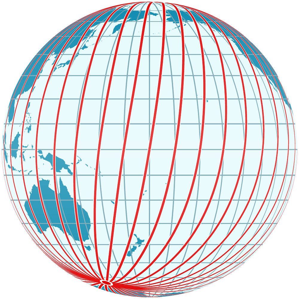
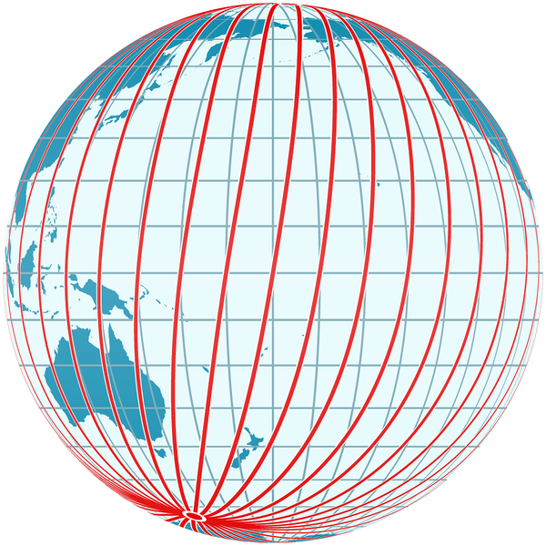
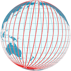
English: The diagram shows the magnetic meridians of the Earth's magnetic field. It is centered on the point at latitude 0° and longitude 180°.
The magnetic meridians (not to be confused with magnetic field lines) follow the directions shown by a magnetic compass, that is, they follow the direction of the horizontal component of the field lines in the vicinity of the Earth's surface and thus show the shape of the field. The angle between the magnetic meridians (red) and the geographic meridians (blue, running precisely north-south) is the magnetic declination. The diagram demonstrates the irregularities of the Earth's magnetic field and the fact that in general compasses point neither towards the geographic north pole nor towards the magnetic north pole. The magnetic field was computed using the coefficients of the International Geomagnetic Reference Field for the epoch 2010. |
| Date | |
| Source | Computed and drawn by myself, using File:Mercator_Projection.svg and File:Mercator-proj.png for the globe texture |
| Author | User:Sch |
Licensing
[edit]

|
Permission is granted to copy, distribute and/or modify this document under the terms of the GNU Free Documentation License, Version 1.2 or any later version published by the Free Software Foundation; with no Invariant Sections, no Front-Cover Texts, and no Back-Cover Texts. A copy of the license is included in the section entitled GNU Free Documentation License. |
- You are free:
- to share – to copy, distribute and transmit the work
- to remix – to adapt the work
- Under the following conditions:
- attribution – You must give appropriate credit, provide a link to the license, and indicate if changes were made. You may do so in any reasonable manner, but not in any way that suggests the licensor endorses you or your use.
- share alike – If you remix, transform, or build upon the material, you must distribute your contributions under the same or compatible license as the original.
File history
Click on a date/time to view the file as it appeared at that time.
| Date/Time | Thumbnail | Dimensions | User | Comment | |
|---|---|---|---|---|---|
| current | 23:12, 8 April 2014 | | 1,000 × 1,000 (491 KB) | Sch (talk | contribs) | {{Information |Description ={{en|1=The diagram shows the magnetic meridians of the Earth's magnetic field. It is centered on the point at latitude 0° and longitude 180°. The magnetic meridians (not to be confused with magnetic field lines) follow... |
You cannot overwrite this file.
File usage on Commons
There are no pages that use this file.
File usage on other wikis
The following other wikis use this file:
- Usage on bg.wikipedia.org
- Usage on de.wikipedia.org