File:Magellan Elcano Circumnavigation-en.svg
Jump to navigation
Jump to search

Size of this PNG preview of this SVG file: 800 × 406 pixels. Other resolutions: 320 × 162 pixels | 640 × 325 pixels | 1,024 × 519 pixels | 1,280 × 649 pixels | 2,560 × 1,298 pixels | 2,246 × 1,139 pixels.
Original file (SVG file, nominally 2,246 × 1,139 pixels, file size: 210 KB)
Captions
Captions
Add a one-line explanation of what this file represents
| Description |
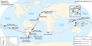
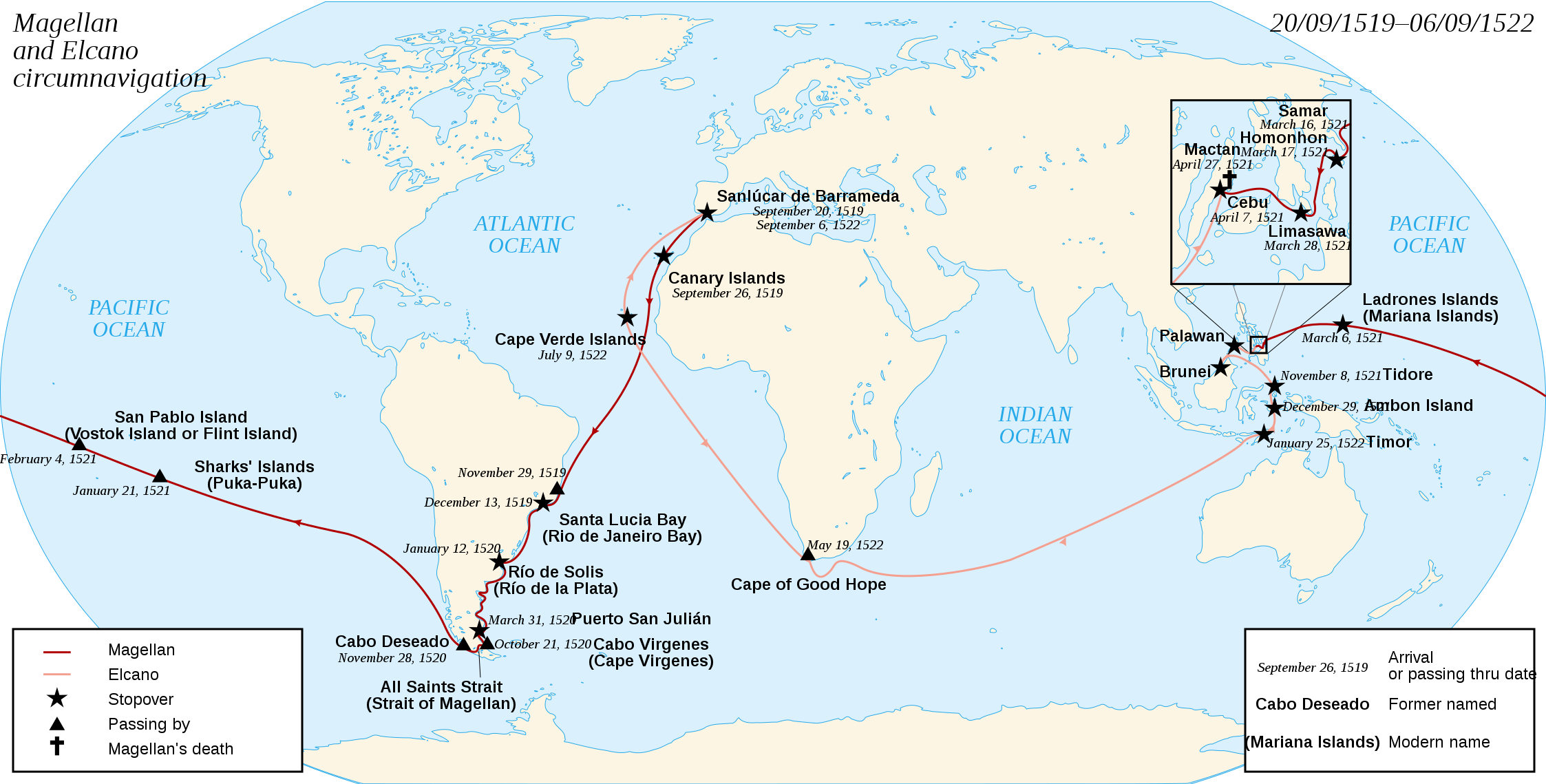
English: French map of the first world circumnavigation of Ferdinand de Magellan and Juan Sebastián Elcano, from 1519 to 1522. Français : Carte de la première circumnavigation autour du monde, par Ferdinand de Magellan et Juan Sebastián Elcano, de 1519 à 1522. |
| Date | (UTC) |
| Source | |
| Author |
|
| Other versions | العربيَّة, Magyar |
| This is a retouched picture, which means that it has been digitally altered from its original version. Modifications: english translation. The original can be viewed here: Magellan Elcano Circumnavigation-fr.svg:
|
I, the copyright holder of this work, hereby publish it under the following licenses:
This file is licensed under the Creative Commons Attribution-Share Alike 3.0 Unported, 2.5 Generic, 2.0 Generic and 1.0 Generic license.
- You are free:
- to share – to copy, distribute and transmit the work
- to remix – to adapt the work
- Under the following conditions:
- attribution – You must give appropriate credit, provide a link to the license, and indicate if changes were made. You may do so in any reasonable manner, but not in any way that suggests the licensor endorses you or your use.
- share alike – If you remix, transform, or build upon the material, you must distribute your contributions under the same or compatible license as the original.

|
Permission is granted to copy, distribute and/or modify this document under the terms of the GNU Free Documentation License, Version 1.2 or any later version published by the Free Software Foundation; with no Invariant Sections, no Front-Cover Texts, and no Back-Cover Texts. A copy of the license is included in the section entitled GNU Free Documentation License. |
You may select the license of your choice.
Original upload log
[edit]
This image is a derivative work of the following images:
- File:Magellan_Elcano_Circumnavigation-fr.svg licensed with Cc-by-sa-3.0,2.5,2.0,1.0, GFDL
- 2008-03-02T15:16:17Z Sémhur 2246x1139 (224858 Bytes) Correction d'un texte
- 2008-03-01T16:18:00Z Sémhur 2246x1139 (224612 Bytes) {{Information |Description= {{en|French map of the first world [[:en:Circumnavigation|circumnavigation]] of [[:en:Ferdinand de Magellan|Ferdinand de Magellan]] and [[:en:Juan Sebastián Elcano|Juan Sebastián Elcano]], from 1
Uploaded with derivativeFX
File history
Click on a date/time to view the file as it appeared at that time.
| Date/Time | Thumbnail | Dimensions | User | Comment | |
|---|---|---|---|---|---|
| current | 17:12, 17 June 2024 | | 2,246 × 1,139 (210 KB) | Alien333 (talk | contribs) | former named -> former name |
| 17:06, 17 June 2024 |  | 2,246 × 1,139 (210 KB) | Alien333 (talk | contribs) | passing thru -> passage | |
| 22:04, 21 September 2019 |  | 2,246 × 1,139 (219 KB) | Colin M (talk | contribs) | Remove duplication of Elcano's name in top-right (mis-transcription of the French version, which says in the top-left corner "Circumnavigation of Ferdinand Magellan and") | |
| 13:32, 14 November 2009 |  | 2,246 × 1,139 (220 KB) | Uxbona (talk | contribs) | date correction | |
| 13:08, 14 November 2009 |  | 2,246 × 1,139 (220 KB) | Uxbona (talk | contribs) | {{Information |Description={{en|French map of the first world circumnavigation of Ferdinand de Magellan and Juan Sebastián Elcano, from 1519 to 1522.}} {{fr|Carte de la |
You cannot overwrite this file.
File usage on Commons
The following 12 pages use this file:
- Spherical Earth
- User:Adeletron 3030/botgalleries/Sports/2019 September 19-21
- User:Adeletron 3030/botgalleries/Sports/2024 June 16-18
- User:Chumwa/OgreBot/Potential transport maps/2019 September 21-30
- User:Chumwa/OgreBot/Transport Maps/2019 September 21-30
- User:Chumwa/OgreBot/Transport Maps/2024 June 11-20
- User:Chumwa/OgreBot/Travel and communication maps/2019 September 21-30
- User:Chumwa/OgreBot/Travel and communication maps/2024 June 11-20
- User:Magog the Ogre/Multilingual legend/2024 June 16-20
- User:OgreBot/Watercraft/2019 September 21
- File:Magellan Elcano Circumnavigation-ar.svg
- File:Magellan Elcano Circumnavigation-de.svg
File usage on other wikis
The following other wikis use this file:
- Usage on af.wikipedia.org
- Usage on ar.wikipedia.org
- Usage on ban.wikipedia.org
- Usage on bcl.wikipedia.org
- Usage on bg.wikipedia.org
- Usage on ckb.wikipedia.org
- Usage on da.wikipedia.org
- Usage on el.wikipedia.org
- Usage on en.wikipedia.org
- Usage on en.wikivoyage.org
- Usage on eo.wikipedia.org
- Usage on fa.wikipedia.org
- Usage on hu.wikipedia.org
- Usage on it.wikipedia.org
- Usage on ja.wikipedia.org
- Usage on ka.wikipedia.org
- Usage on kn.wikipedia.org
- Usage on ko.wikipedia.org
- Usage on li.wikipedia.org
- Usage on lt.wikipedia.org
- Usage on mr.wikipedia.org
- Usage on sah.wikipedia.org
- Usage on sh.wikipedia.org
- Usage on si.wikipedia.org
- Usage on sr.wikipedia.org
- Usage on sv.wikipedia.org
View more global usage of this file.