File:Mafeking Road - 27 July 2009.jpg
Original file (2,400 × 1,800 pixels, file size: 1.28 MB, MIME type: image/jpeg)
Captions
Captions
Summary
[edit]
| Description |
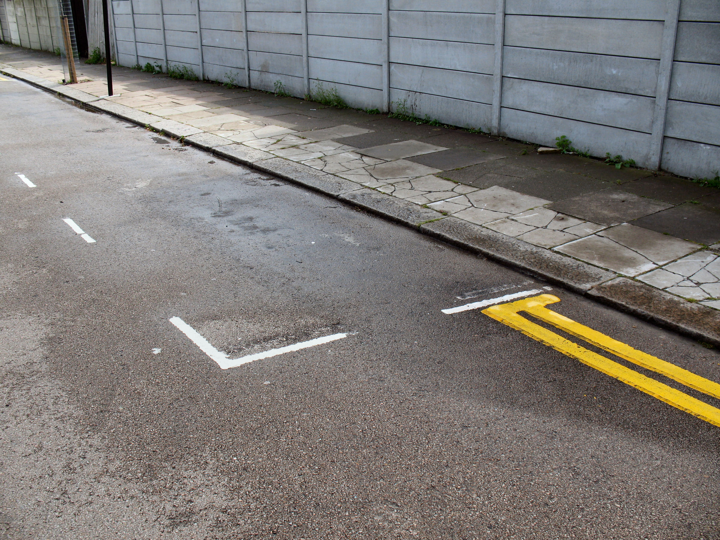
English: 27 July 2009. Parking lines in Mafeking Road N17 in the Tottenham Hale Controlled Parking Zone (CPZ).
The photo is one of a set to help people decide whether to challenge Penalty Charge Notices (PCNs or 'parking tickets') where road markings are faulty. Most are of streets in the London Borough of Haringey, especially Tottenham Hale, where I'm an elected local councillor. But the issues are nationwide. ________________________________________________ Mafeking Road N17 was one of the streets added to Tottenham Hale Controlled Parking Zone in January 2007 when the CPZ was extended northwards to Dowsett Road. Originally, every single parking bay in every street in the extension was wrongly marked out - and failed to comply with the Statutory Regulations. Eventually, after continual nagging by me and former Bruce Grove councillor Ray Dodds, Haringey agreed a "rolling programme" to correct errors in lines and signs across the Borough. Contractors for Haringey's Parking Service corrected lines in Tottenham Hale CPZ between 27 April and 18 May 2009. As you can see, in the parking bay (incorrect) second end-of-bay lines were scraped off. The double yellow lines have been repainted and now have a terminating T-bar. According to my colleague Ray Dodds, this legal requirement was previously dismissed by a Haringey senior officer as " de minimis" — in other words, so minor as to be disregarded. ► To read more please click here. ► Click (1) (2) (3) for photos of the markings in Mafeking Road in 2008 |
| Date | |
| Source | https://www.flickr.com/photos/53921762@N00/3582969098/ |
| Author | Alan Stanton |
| Camera location | | View this and other nearby images on: OpenStreetMap |
|---|
Licensing
[edit]
- You are free:
- to share – to copy, distribute and transmit the work
- to remix – to adapt the work
- Under the following conditions:
- attribution – You must give appropriate credit, provide a link to the license, and indicate if changes were made. You may do so in any reasonable manner, but not in any way that suggests the licensor endorses you or your use.
- share alike – If you remix, transform, or build upon the material, you must distribute your contributions under the same or compatible license as the original.
| This image was originally posted to Flickr by Alan Stanton at https://flickr.com/photos/53921762@N00/3582969098. It was reviewed on 21 December 2021 by FlickreviewR 2 and was confirmed to be licensed under the terms of the cc-by-sa-2.0. |
File history
Click on a date/time to view the file as it appeared at that time.
| Date/Time | Thumbnail | Dimensions | User | Comment | |
|---|---|---|---|---|---|
| current | 15:44, 21 December 2021 | | 2,400 × 1,800 (1.28 MB) | Oxyman (talk | contribs) | Uploaded a work by Alan Stanton from https://www.flickr.com/photos/53921762@N00/3582969098/ with UploadWizard |
You cannot overwrite this file.
File usage on Commons
There are no pages that use this file.