File:Mackenzie Bay (MODIS 2020-06-14).jpg
Jump to navigation
Jump to search

Size of this preview: 689 × 600 pixels. Other resolutions: 276 × 240 pixels | 551 × 480 pixels | 882 × 768 pixels | 1,176 × 1,024 pixels | 2,352 × 2,048 pixels | 3,884 × 3,382 pixels.
Original file (3,884 × 3,382 pixels, file size: 1.84 MB, MIME type: image/jpeg)
Captions
Captions
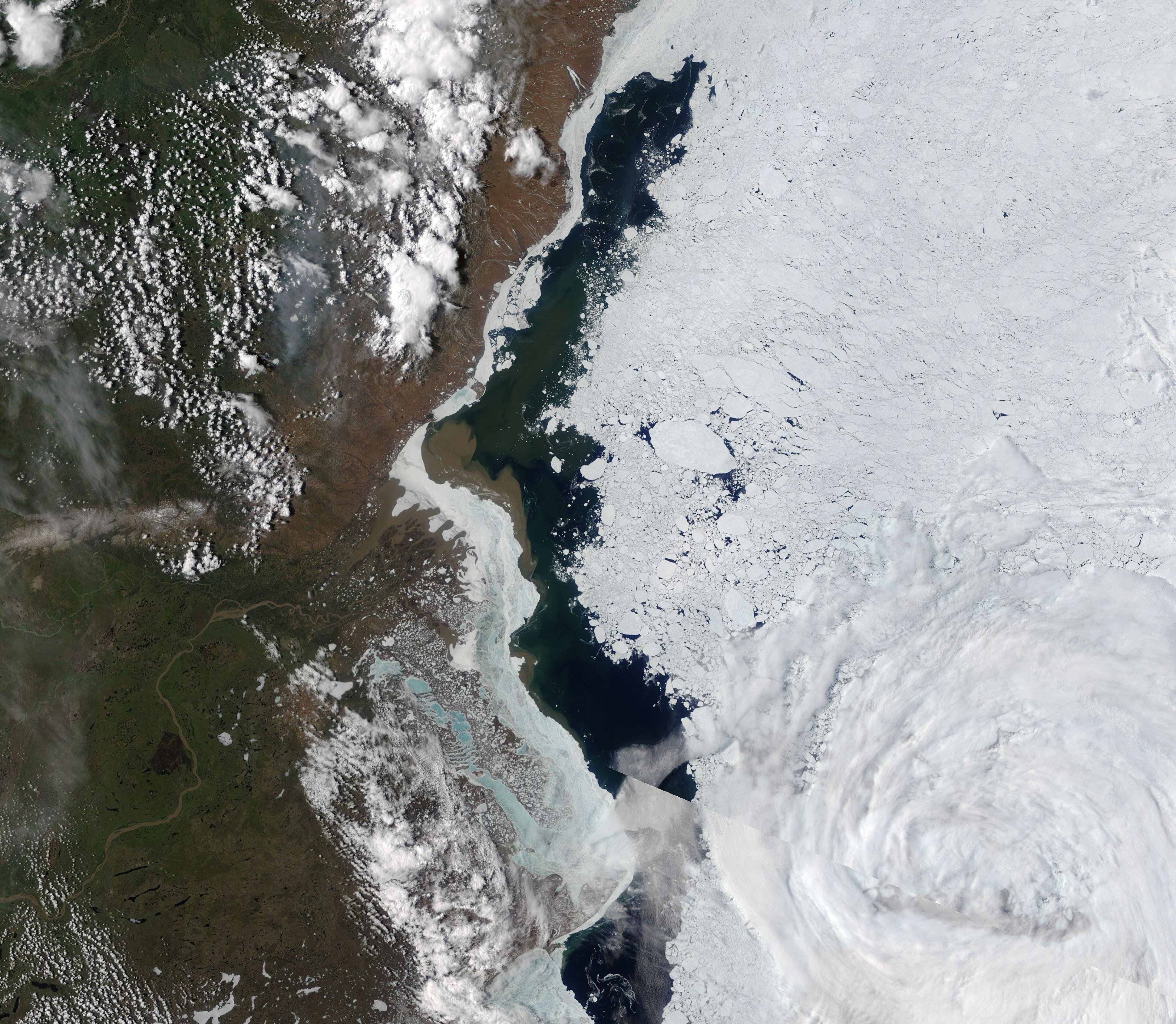
On June 11, 2020, the Moderate Resolution Imaging Spectroradiometer (MODIS) on board NASA’s Terra satellite acquired a true-color image of Mackenzie Bay.
Summary
[edit].jpg&action=edit§ion=1)
| Description |
English: Mackenzie Bay sits in the Canadian Arctic, close to the border of Yukon Territory, Canada. Each winter, a thick coating of ice solidifies over the Bay while deep snow coats the landscape. As temperatures rise in spring, the Mackenzie River, which flows from the warmer south into Mackenzie Bay, swells with meltwater. As it flows towards the Bay, the rushing of warmer meltwater aids in breaking up the ice clinging to the river and aids in spurring sea ice retraction from the shoreline. Spring melt also fills the river with sediment, which is carried to and dumped into the chilly waters of Mackenzie Bay. Eventually, increasing temperatures of spring and the flow of warmer fresh water prevail over the layer of sea ice and by summer the river flows freely into Mackenzie Bay and from there into the Beaufort Sea.
On June 11, 2020, the Moderate Resolution Imaging Spectroradiometer (MODIS) on board NASA’s Terra satellite acquired a true-color image of Mackenzie Bay. A layer of sea ice, broken and retreating, covers the waters of the Bay away from shore and a layer of fast ice clings to the Canadian coastline. The Mackenzie River, swollen with spring meltwater and sediment, curls through the scene from the bottom (south) and flows northward. On the river’s delta, fingers of sediment can be seen encroaching on the ice, while copious muddy-brown sediment spills into the Bay underneath the ice. |
||
| Date | Taken on 11 June 2020 | ||
| Source |
|
||
| Author | MODIS Land Rapid Response Team, NASA GSFC |
| This media is a product of the Terra mission Credit and attribution belongs to the mission team, if not already specified in the "author" row |
Licensing
[edit].jpg&action=edit§ion=2)
| This file is in the public domain in the United States because it was solely created by NASA. NASA copyright policy states that "NASA material is not protected by copyright unless noted". (See Template:PD-USGov, NASA copyright policy page or JPL Image Use Policy.) | ||
 |
Warnings:
|
File history
Click on a date/time to view the file as it appeared at that time.
| Date/Time | Thumbnail | Dimensions | User | Comment | |
|---|---|---|---|---|---|
| current | 03:02, 17 February 2024 | | 3,884 × 3,382 (1.84 MB) | OptimusPrimeBot (talk | contribs) | #Spacemedia - Upload of http://modis.gsfc.nasa.gov/gallery/images/image06142020_250m.jpg via Commons:Spacemedia |
You cannot overwrite this file.
File usage on Commons
There are no pages that use this file.
.jpg&oldid=909380853)