File:Machynlleth railway station, Powys, 2015 (geograph 4680592).jpg
Jump to navigation
Jump to search
Size of this preview: 800 × 600 pixels. Other resolutions: 320 × 240 pixels | 640 × 480 pixels | 1,024 × 768 pixels | 1,280 × 960 pixels | 1,600 × 1,200 pixels.
Original file (1,600 × 1,200 pixels, file size: 319 KB, MIME type: image/jpeg)
Captions
Captions
Add a one-line explanation of what this file represents
Summary
[edit].jpg&action=edit§ion=1)
| Description |
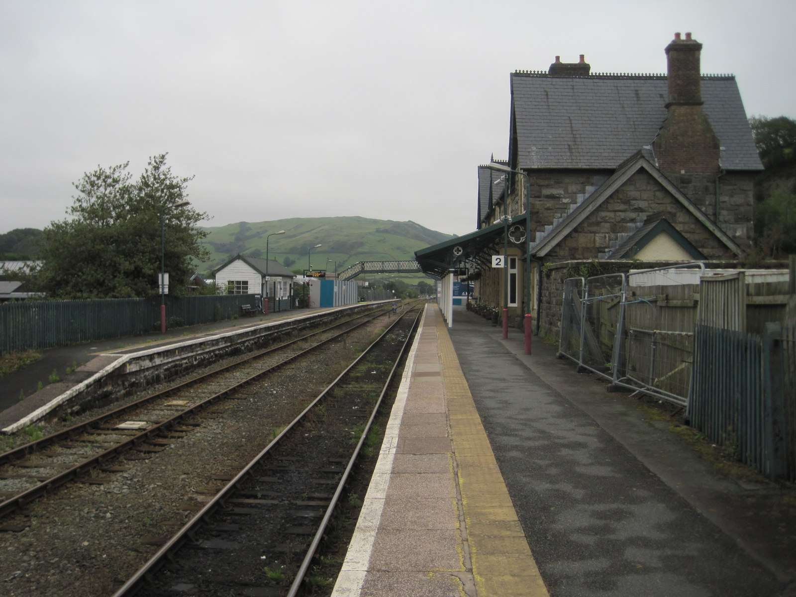
English: Machynlleth railway station, Powys, 2015 Opened in 1863 by the Newtown and Machynlleth Railway, which very soon to become part of the Cambrian Railway empire. View north east towards Cemmes Road and Newtown during some rebuilding work. The following year, a new footbridge and lifts was opened, replacing the one shown here - see SH7401 : Machynlleth railway station, Powys for a 2021 image. |
| Date | |
| Source | From geograph.org.uk |
| Author | Nigel Thompson |
| Permission (Reusing this file) |
Creative Commons Attribution Share-alike license 2.0 |
| Attribution (required by the license) | Nigel Thompson / Machynlleth railway station, Powys, 2015 / |
.jpg)
| Camera location | | View this and other nearby images on: OpenStreetMap |
|---|
.jpg¶ms=052.594944_N_-003.855258_E_globe:Earth_type:camera_source:geograph-osgb36(SH74430130)_heading:67.00&language=en)
| Object location | | View this and other nearby images on: OpenStreetMap |
|---|
.jpg¶ms=052.595220_N_-003.854680_E_globe:Earth_class:object_type:object_source:geograph-osgb36(SH74470133)_heading:67.00&language=en)
Licensing
[edit].jpg&action=edit§ion=2)

|
This image was taken from the Geograph project collection. See this photograph's page on the Geograph website for the photographer's contact details. The copyright on this image is owned by Nigel Thompson and is licensed for reuse under the Creative Commons Attribution-ShareAlike 2.0 license.
|
This file is licensed under the Creative Commons Attribution-Share Alike 2.0 Generic license.
Attribution: Nigel Thompson
- You are free:
- to share – to copy, distribute and transmit the work
- to remix – to adapt the work
- Under the following conditions:
- attribution – You must give appropriate credit, provide a link to the license, and indicate if changes were made. You may do so in any reasonable manner, but not in any way that suggests the licensor endorses you or your use.
- share alike – If you remix, transform, or build upon the material, you must distribute your contributions under the same or compatible license as the original.
File history
Click on a date/time to view the file as it appeared at that time.
| Date/Time | Thumbnail | Dimensions | User | Comment | |
|---|---|---|---|---|---|
| current | 15:06, 16 November 2021 | | 1,600 × 1,200 (319 KB) | Lamberhurst (talk | contribs) | == {{int:filedesc}} == {{Information |Description={{en|1=<b>Machynlleth railway station, Powys, 2015</b><br>Opened in 1863 by the Newtown and Machynlleth Railway, which very soon to become part of the Cambrian Railway empire. View north east towards Cemmes Road and Newtown during some rebuilding work. The following year, a new footbridge and lifts was opened, replacing the one shown here - see [[:File:Machynlleth railway station, Powys (geograph 6836267).jpg|SH7401 : Machynlleth railway stati... |
You cannot overwrite this file.
File usage on Commons
The following 3 pages use this file:
.jpg&oldid=933898127)