File:Maadebogen.jpg
Jump to navigation
Jump to search
Size of this preview: 800 × 533 pixels. Other resolutions: 320 × 213 pixels | 640 × 427 pixels | 1,024 × 683 pixels | 1,280 × 853 pixels | 2,560 × 1,707 pixels | 5,184 × 3,456 pixels.
Original file (5,184 × 3,456 pixels, file size: 7.2 MB, MIME type: image/jpeg)
Captions
Captions
Add a one-line explanation of what this file represents
Summary
[edit]
| Description |
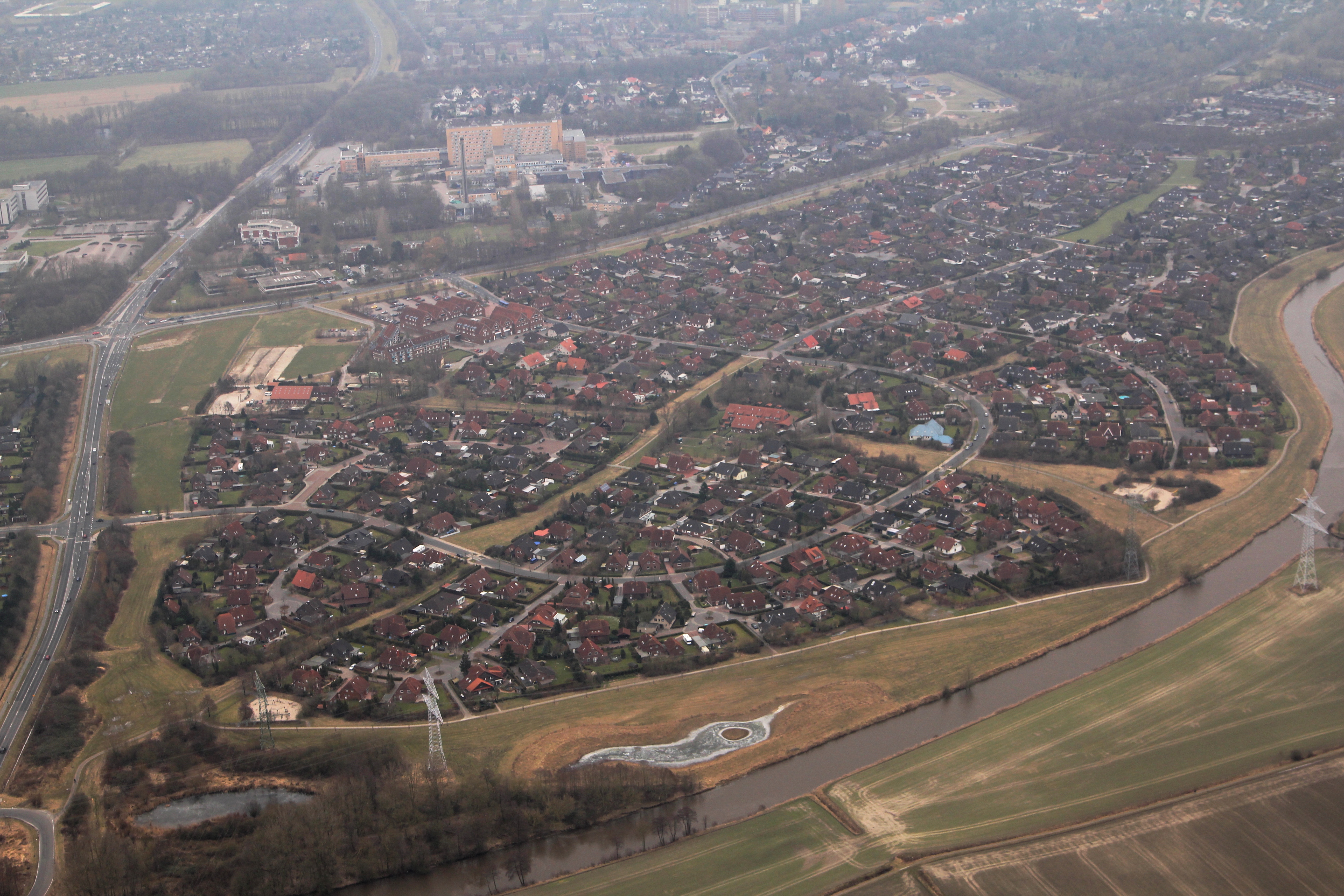
Deutsch: Ein Luftbild des Wilhelmshavener Stadtteils Maadebogen, von Nordnordwesten aus aufgenommen. Gut erkennbar ist im Vordergrund der namensgebende Bogen der Maade, der dortige öffentliche Grünbereich mit Wegen sowie den Hochspannungsleitungen, die Straßenschlaufe der Sven-Hedin-Straße und deren Verbindung durch die Beringallee zum Kolumbusring (hinten bzw. oben rechts), das Versorgungszentrum an der Kurt-Schumacher-Straße Ecke Sven-Hedin-Straße, die generelle Einfamilienhaus-Struktur des Stadtteils sowie die Nähe zum Reinhard-Nieter-Krankenhaus (gelber Klotz) im Hintergrund. Dieses Bild entstand während des Fotoflugkurses 2013. |
| Date | |
| Source | Own work |
| Author | Christallkeks |
| Camera location | | View this and other nearby images on: OpenStreetMap |
|---|
Licensing
[edit]
I, the copyright holder of this work, hereby publish it under the following license:
This file is licensed under the Creative Commons Attribution-Share Alike 4.0 International license.
- You are free:
- to share – to copy, distribute and transmit the work
- to remix – to adapt the work
- Under the following conditions:
- attribution – You must give appropriate credit, provide a link to the license, and indicate if changes were made. You may do so in any reasonable manner, but not in any way that suggests the licensor endorses you or your use.
- share alike – If you remix, transform, or build upon the material, you must distribute your contributions under the same or compatible license as the original.
| Annotations | This image is annotated: View the annotations at Commons |
File history
Click on a date/time to view the file as it appeared at that time.
| Date/Time | Thumbnail | Dimensions | User | Comment | |
|---|---|---|---|---|---|
| current | 14:39, 10 November 2015 | | 5,184 × 3,456 (7.2 MB) | Christallkeks (talk | contribs) | Mehr Kontrast |
| 14:38, 10 November 2015 |  | 5,184 × 3,456 (6.15 MB) | Christallkeks (talk | contribs) | {{Information |Description ={{de|1=Ein Luftbild des de:Wilhelmshavener Stadtteils de:Maadebogen. Gut erkennbar ist im Vordergrund der namensgebende Bogen der de:Maade, der dortige öffentliche Grünbereich mit Wegen sowie den Hochs... |
You cannot overwrite this file.
File usage on Commons
The following 2 pages use this file:
File usage on other wikis
The following other wikis use this file:
- Usage on de.wikipedia.org