File:M 5.1 - 50km NNW of Hualian, Taiwan(USGS).jpg
Jump to navigation
Jump to search

Size of this preview: 536 × 599 pixels. Other resolutions: 215 × 240 pixels | 612 × 684 pixels.
Original file (612 × 684 pixels, file size: 85 KB, MIME type: image/jpeg)
Captions
Captions
Add a one-line explanation of what this file represents
Summary
[edit].jpg&action=edit§ion=1)
| Description |
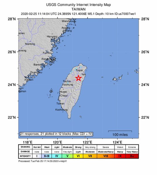
English: M 5.1 - 50km NNW of Hualian, Taiwan(USGS)- intensity |
| Source | https://earthquake.usgs.gov/earthquakes/eventpage/us70007we1/executive |
| Author | USGS Earthquake |
Licensing
[edit].jpg&action=edit§ion=2)
This image is in the public domain in the United States because it only contains materials that originally came from the United States Geological Survey, an agency of the United States Department of the Interior. For more information, see the official USGS copyright policy.
|
File history
Click on a date/time to view the file as it appeared at that time.
| Date/Time | Thumbnail | Dimensions | User | Comment | |
|---|---|---|---|---|---|
| current | 06:53, 26 February 2020 | | 612 × 684 (85 KB) | YOWOT868 (talk | contribs) | {{Information |Description = {{zh|美国地质调查局提供的2020年宜兰地震地震主震烈度分布图。}} |Source = https://earthquake.usgs.gov/earthquakes/eventpage/us70007we1/executive |Author = USGS Earthquake |Permission = https://www.usgs.gov/information-policies-and-instructions/copyrights-and-credits#copyright }} {{GFDL}} |
You cannot overwrite this file.
File usage on Commons
There are no pages that use this file.
.jpg&oldid=698196050)