File:MSC (S63-00950).jpg
Jump to navigation
Jump to search
Size of this preview: 763 × 600 pixels. Other resolutions: 305 × 240 pixels | 611 × 480 pixels | 977 × 768 pixels | 1,280 × 1,007 pixels | 2,560 × 2,013 pixels | 3,000 × 2,359 pixels.
Original file (3,000 × 2,359 pixels, file size: 1.6 MB, MIME type: image/jpeg)
Captions
Captions
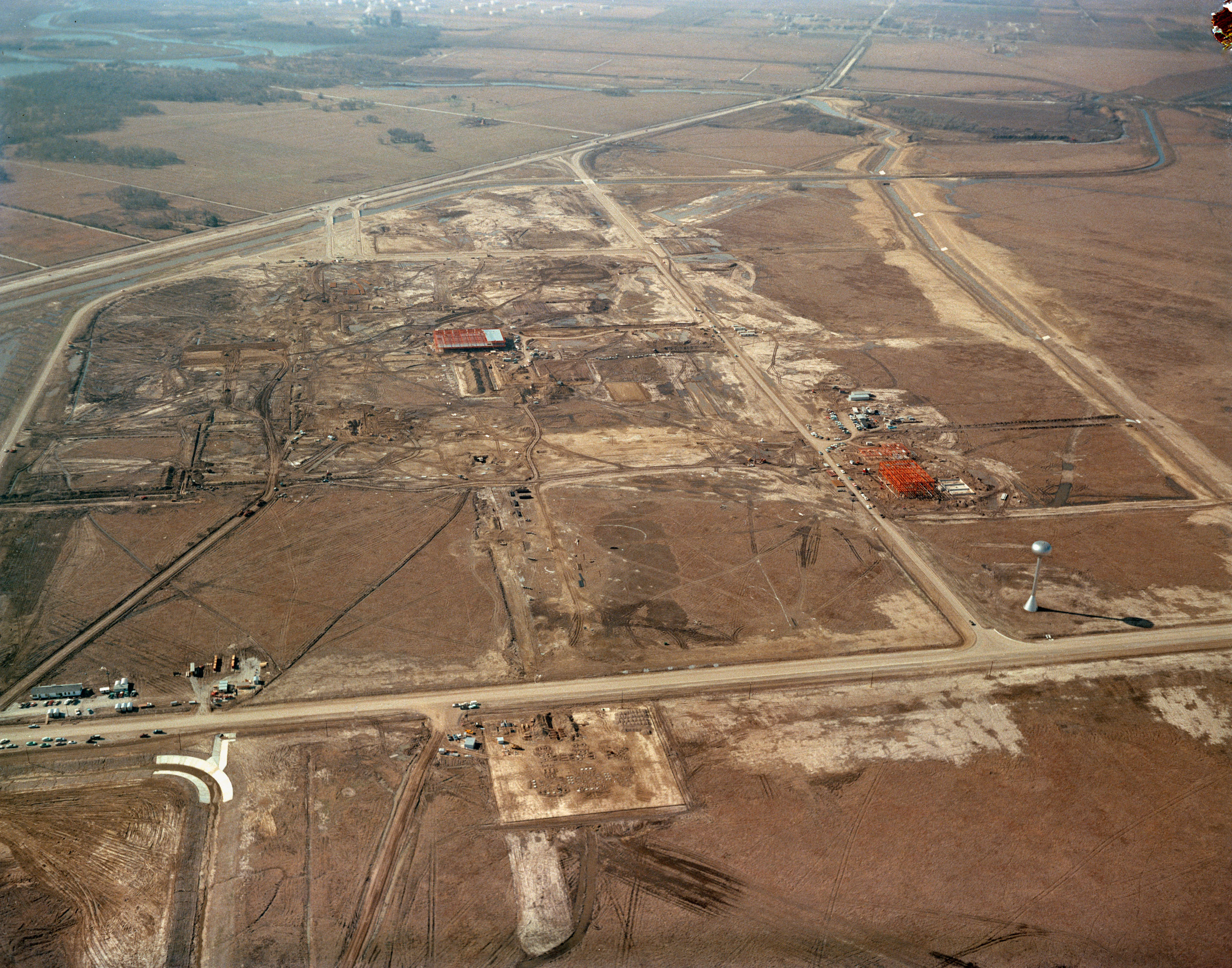
S63-00950 (1963) --- An aerial view of Site 1, the Manned Spacecraft Center, in 1963 during early construction. The view faces the southwest. Highway 528 is at the top of the picture.
Summary
[edit].jpg&action=edit§ion=1)
| Description |
English: S63-00950 (1963) --- An aerial view of Site 1, the Manned Spacecraft Center, in 1963 during early construction. The view faces the southwest. Highway 528 is at the top of the picture. Second Street runs basically north and south on the right side of the image, to the right or west and running parallel to that avenue is a drainage ditch. Winding through the site a Houston Lighting and Power Co. canal crosses over the drainage ditch near the top of the frame. Twin bridges over the canal are pictured at upper left which were constructed to allow traffic to enter and leave through MSC's secondary gateway. The unfinished red structure to the right of center and roughly 100 yards south of the elevated water storage tank is the Central Heating and Cooling Plant. In the upper left quadrant of the frame, construction appears very far along on the Central Data Office. |
||
| Date | Taken on 1 January 1963 | ||
| Source |
|
||
| Author | NASA Johnson Space Center |
Licensing
[edit].jpg&action=edit§ion=2)
| This file is in the public domain in the United States because it was solely created by NASA. NASA copyright policy states that "NASA material is not protected by copyright unless noted". (See Template:PD-USGov, NASA copyright policy page or JPL Image Use Policy.) | ||
 |
Warnings:
|
File history
Click on a date/time to view the file as it appeared at that time.
| Date/Time | Thumbnail | Dimensions | User | Comment | |
|---|---|---|---|---|---|
| current | 18:18, 29 July 2024 | | 3,000 × 2,359 (1.6 MB) | OptimusPrimeBot (talk | contribs) | #Spacemedia - Upload of http://images-assets.nasa.gov/image/S63-00950/S63-00950~orig.jpg via Commons:Spacemedia |
You cannot overwrite this file.
File usage on Commons
There are no pages that use this file.
.jpg&oldid=904744114)