File:MORNINGTON CRESCENT-03 230612 CPS (7567936326).jpg
Jump to navigation
Jump to search
Size of this preview: 607 × 599 pixels. Other resolutions: 243 × 240 pixels | 486 × 480 pixels | 778 × 768 pixels | 1,037 × 1,024 pixels | 2,524 × 2,492 pixels.
Original file (2,524 × 2,492 pixels, file size: 1.25 MB, MIME type: image/jpeg)
Captions
Captions
Add a one-line explanation of what this file represents
Summary
[edit].jpg&action=edit§ion=1)
| Description |
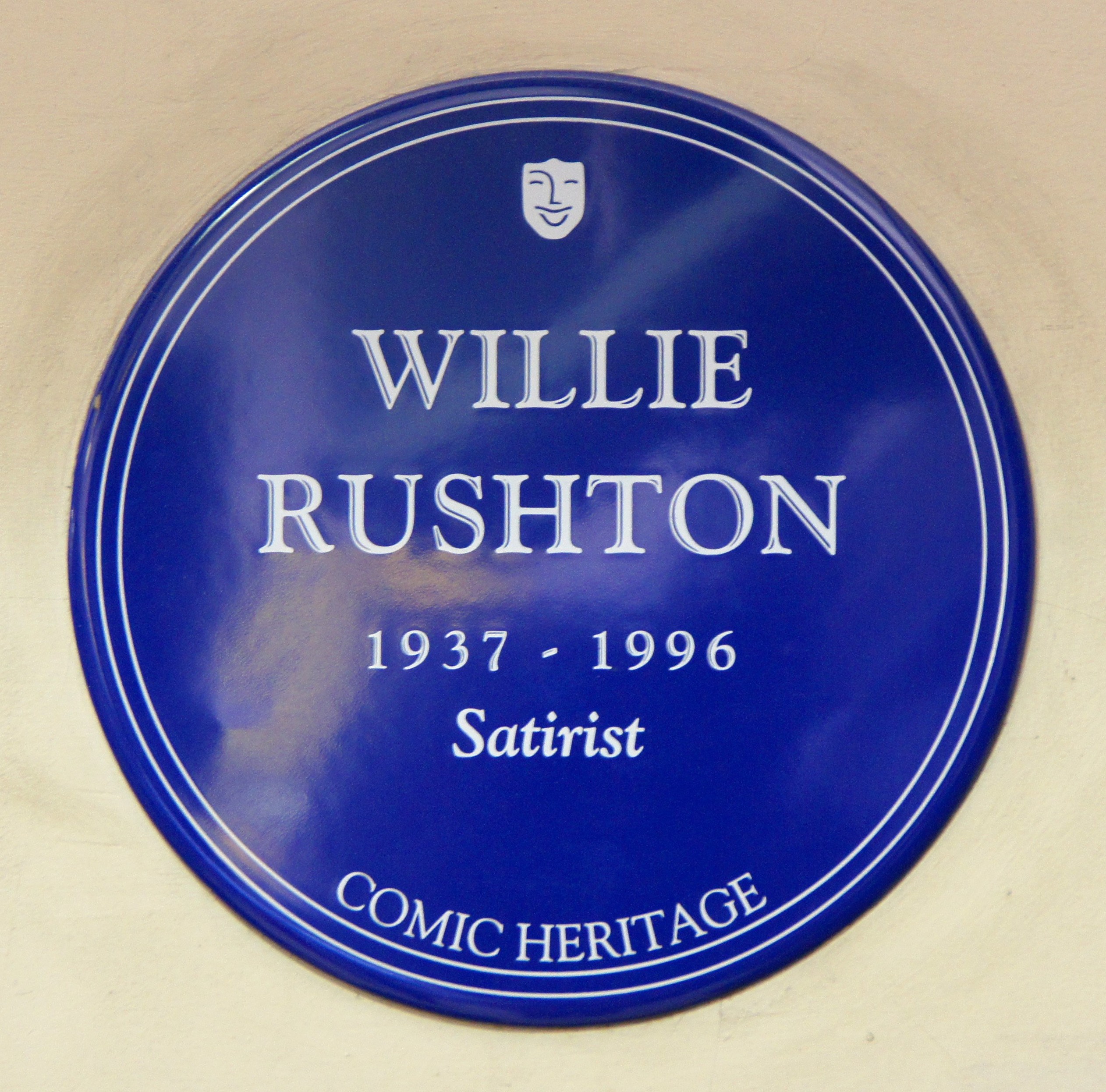
Mornington Crescent again, lovely station. The plaque to Willie Rushton, long serving member of the panel show "I'm sorry I haven't a clue", referencing the game "Mornington Crescent" en.wikipedia.org/wiki/Mornington_Crescent_(game) |
| Date | |
| Source | MORNINGTON CRESCENT-03 230612 CPS |
| Author | Chris Sampson |
| Camera location | | View this and other nearby images on: OpenStreetMap |
|---|
.jpg¶ms=051.534269_N_-000.138820_E_globe:Earth_type:camera_source:Flickr_&language=en)
Licensing
[edit].jpg&action=edit§ion=2)
This file is licensed under the Creative Commons Attribution 2.0 Generic license.
- You are free:
- to share – to copy, distribute and transmit the work
- to remix – to adapt the work
- Under the following conditions:
- attribution – You must give appropriate credit, provide a link to the license, and indicate if changes were made. You may do so in any reasonable manner, but not in any way that suggests the licensor endorses you or your use.
| This image was originally posted to Flickr by HHA124L at https://www.flickr.com/photos/87347455@N00/7567936326. It was reviewed on 10 April 2014 by FlickreviewR and was confirmed to be licensed under the terms of the cc-by-2.0. |
File history
Click on a date/time to view the file as it appeared at that time.
| Date/Time | Thumbnail | Dimensions | User | Comment | |
|---|---|---|---|---|---|
| current | 13:20, 22 September 2019 | | 2,524 × 2,492 (1.25 MB) | Hohum (talk | contribs) | Straighten, cropped to subject |
| 21:11, 10 April 2014 |  | 4,592 × 3,056 (1.81 MB) | Ultra7 (talk | contribs) | Transferred from Flickr via Flickr2commons |
You cannot overwrite this file.
File usage on Commons
The following 3 pages use this file:
File usage on other wikis
The following other wikis use this file:
- Usage on cs.wikipedia.org
- Usage on en.wikipedia.org
- Usage on nl.wikipedia.org
.jpg&oldid=874991890)