File:M9 Autóút Hungary.png
Jump to navigation
Jump to search

Size of this preview: 800 × 509 pixels. Other resolutions: 320 × 204 pixels | 640 × 407 pixels | 1,024 × 651 pixels | 1,531 × 974 pixels.
Original file (1,531 × 974 pixels, file size: 312 KB, MIME type: image/png)
Captions
Captions
Add a one-line explanation of what this file represents
Summary
[edit]
| Description |
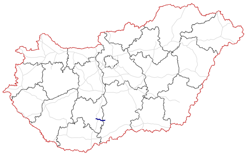
English: Traject the M9 Motorway, Hungary (Blue: in use, Light blue: under construction, Green: planned)
Magyar: Az M9 autóút nyomvonala, Magyarország (Kék: használatban, Világoskék: épülő, Zöld: tervezett) |
| Date | |
| Source | Own work |
| Author | MrSilesian |
Licensing
[edit]
I, the copyright holder of this work, hereby publish it under the following license:
This file is licensed under the Creative Commons Attribution-Share Alike 4.0 International license.
- You are free:
- to share – to copy, distribute and transmit the work
- to remix – to adapt the work
- Under the following conditions:
- attribution – You must give appropriate credit, provide a link to the license, and indicate if changes were made. You may do so in any reasonable manner, but not in any way that suggests the licensor endorses you or your use.
- share alike – If you remix, transform, or build upon the material, you must distribute your contributions under the same or compatible license as the original.
File history
Click on a date/time to view the file as it appeared at that time.
| Date/Time | Thumbnail | Dimensions | User | Comment | |
|---|---|---|---|---|---|
| current | 07:44, 31 August 2020 | | 1,531 × 974 (312 KB) | MrSilesian (talk | contribs) | new version |
| 10:58, 26 October 2016 |  | 1,572 × 1,112 (369 KB) | MrSilesian (talk | contribs) | User created page with UploadWizard |
You cannot overwrite this file.
File usage on Commons
The following 6 pages use this file:
- User:Chumwa/OgreBot/Potential transport maps/2016 October 21-31
- User:Chumwa/OgreBot/Transport Maps/2016 October 21-31
- User:Chumwa/OgreBot/Transport Maps/2020 August 21-31
- User:Chumwa/OgreBot/Travel and communication maps/2016 October 21-31
- User:Chumwa/OgreBot/Travel and communication maps/2020 August 21-31
- Commons:Files used on the AARoads Wiki/87
File usage on other wikis
The following other wikis use this file:
- Usage on cs.wikipedia.org
- Usage on de.wikipedia.org
- Usage on en.wikipedia.org
- Usage on fr.wikipedia.org
- Usage on hu.wikipedia.org
- Usage on nl.wikipedia.org
- Usage on pl.wikipedia.org
- Usage on www.wikidata.org