File:M0095.jpg
Jump to navigation
Jump to search
Size of this preview: 600 × 600 pixels. Other resolutions: 240 × 240 pixels | 480 × 480 pixels | 768 × 768 pixels | 1,024 × 1,024 pixels | 2,048 × 2,048 pixels.
Original file (2,048 × 2,048 pixels, file size: 1.01 MB, MIME type: image/jpeg)
Captions
Captions
Add a one-line explanation of what this file represents
Summary
[edit]
| Description |
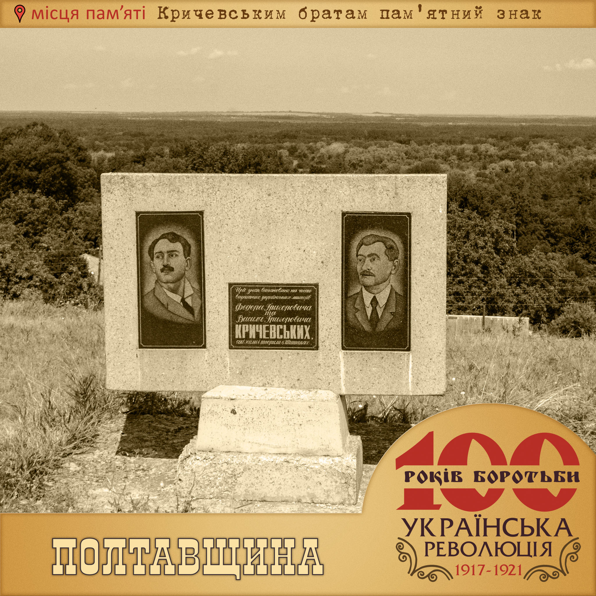
Українська: 🚩 Кричевському В. Г. та Кричевському Ф. Г. пам’ятний знак 👉 Розташований на вул. Кирила Осьмака. Встановлений 1999 на честь братів Кричевських: художника, архітектора, графіка Кричевського Василя Григоровича (1872– 1952) та художника, педагога, заслуженого діяча мистецтв Кричевського Федора Григоровича (1879–1947), біографії яких пов’язані з Шишаччиною. Пам’ятний знак – стела мармурової крихти, на чільній стороні якої закріплено три дошки з чорного граніту: у центрі – пам’ятний напис: «Цей знак встановлено на честь видатних українських митців Федора Григоровича та Василя Григоровича Кричевських, які жили і творили в Шишаках», з лівого та правого боків – з портретними зображеннями братів Кричевських. Встановлена на залізобетонному постаменті. Основою постаменту служить залізобетонний цоколь. |
| Date | |
| Source | Own work |
| Author | Yurii-mr |
| Camera location | | View this and other nearby images on: OpenStreetMap |
|---|
«Створення друкованої та інтерактивної карти «Місця пам’яті Української революції 1917‒1921 років на Полтавщині» - проект від ГО «ВЕЛОПОЛТАВА»
Licensing
[edit]
I, the copyright holder of this work, hereby publish it under the following license:
This file is licensed under the Creative Commons Attribution-Share Alike 4.0 International license.
- You are free:
- to share – to copy, distribute and transmit the work
- to remix – to adapt the work
- Under the following conditions:
- attribution – You must give appropriate credit, provide a link to the license, and indicate if changes were made. You may do so in any reasonable manner, but not in any way that suggests the licensor endorses you or your use.
- share alike – If you remix, transform, or build upon the material, you must distribute your contributions under the same or compatible license as the original.
File history
Click on a date/time to view the file as it appeared at that time.
| Date/Time | Thumbnail | Dimensions | User | Comment | |
|---|---|---|---|---|---|
| current | 20:37, 21 January 2019 | | 2,048 × 2,048 (1.01 MB) | Yurii-mr (talk | contribs) | User created page with UploadWizard |
You cannot overwrite this file.
File usage on Commons
There are no pages that use this file.