File:Mākara pā 03.jpg
Original file (4,096 × 2,804 pixels, file size: 6.47 MB, MIME type: image/jpeg)
Captions
Captions
Summary
[edit]
| Description |
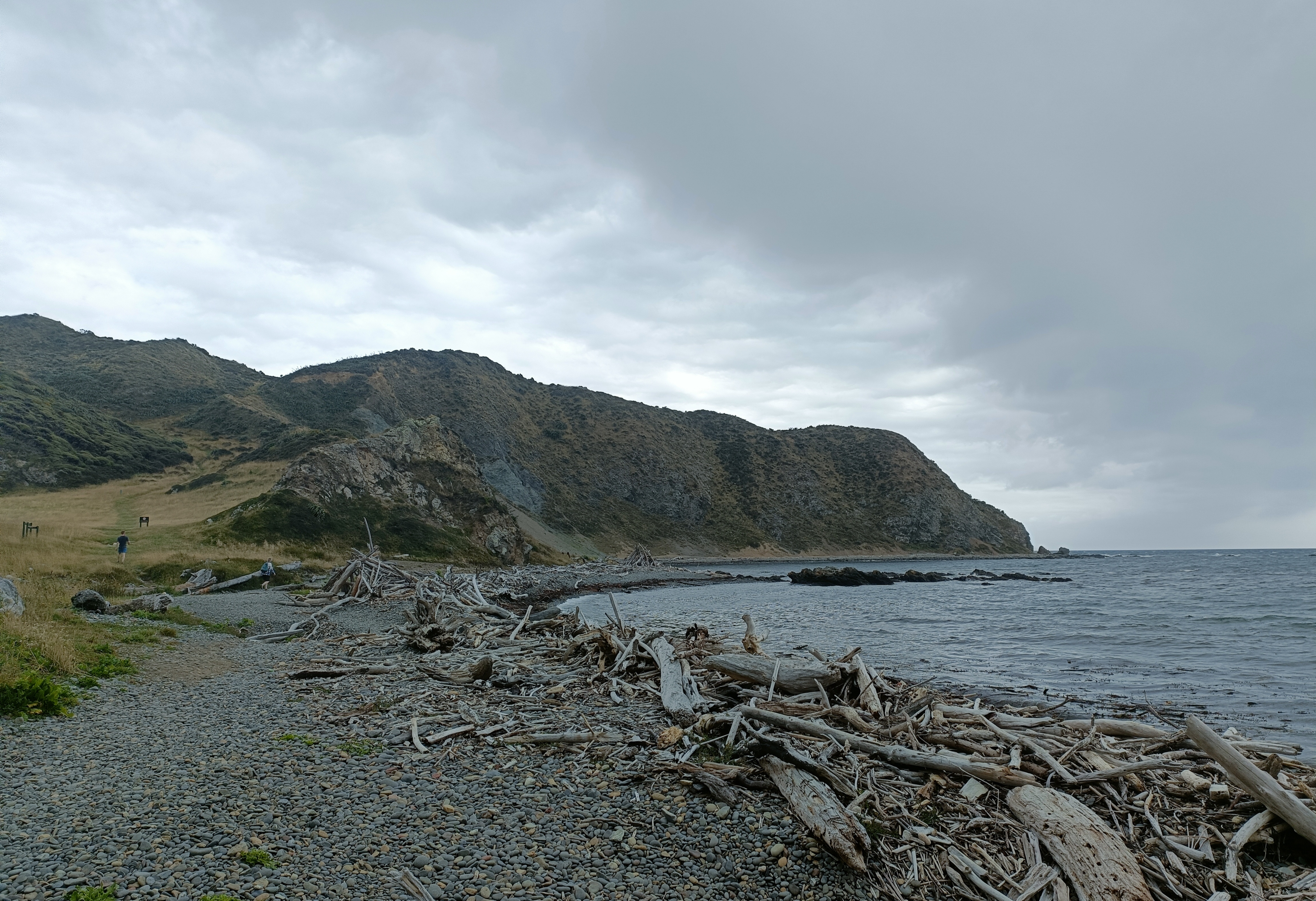
English: Mākara pā.
Historic Place Category 2 List Number 6143 City/District Council Wellington City Region Wellington Region Legal description Sec 1 SO 30658 Block II Port Nicholson SD Setting: On northern (lower) end of long coastal ridge, on west side of Owhariu Bay, overlooking (immediately below to east) Warehou (or ‘Fishermans’ Bay). Wellington West Coast. Site in commanding position with clear view to South Island, and north along coast. Archaeological Features: A small, triangular-shaped, headland pa, with steep, cliffed natural defences on east and west sides, and defended by an artificial ditch and bank on the wide south side, directly above a shallow intersecting transverse gully. Site is terraced, with pallisade post-holes present behind ditch and bank defences. Site was illustrated by the Evening Post (7 December 1957), and Davis (1959, plate 2, 3) but O'Rourke (1962) provided a surveyed plan drawing (also repeated by McFadgen 1974). Supporting Evidence: Excavations on this site by the Wellington Archaeological Society in 1962 (O'Rourke 1962 and 1967); (McFadgen 1974) elucidated the construction of the ditch and bank defences; the 'post holes' were confirmed as pallisade post holes, and terraces were examined. Two fourteenth century dates (Brodie 1962) were obtained from palisade post timber and shells (see McFadgen 1974, p. 63). Site marked by Best et al. (1916) and named ‘Wharehou’. Termed ‘Warehou’ elsewhere. Condition of Site: Slight natural erosion, but in fairly good condition. Terraces and defensive ditch and bank well preserved. Mention of site included in Lands & Survey 'Makara Walkway' brochure and shown on walkway map. Assessment: A small, well preserved, headland pa site, with a spectacular coastal view over Cook Strait. One of the very few surviving sites in the Wellington region with clearly exposed, artificial earthworks. A particularly good imposing and ‘representative’ pa site for the Wellington region with fairly easy access. |
| Date | |
| Source | Own work |
| Author | Lisa Maule |
Licensing
[edit]
- You are free:
- to share – to copy, distribute and transmit the work
- to remix – to adapt the work
- Under the following conditions:
- attribution – You must give appropriate credit, provide a link to the license, and indicate if changes were made. You may do so in any reasonable manner, but not in any way that suggests the licensor endorses you or your use.
File history
Click on a date/time to view the file as it appeared at that time.
| Date/Time | Thumbnail | Dimensions | User | Comment | |
|---|---|---|---|---|---|
| current | 09:48, 7 February 2023 | | 4,096 × 2,804 (6.47 MB) | Pakoire (talk | contribs) | Uploaded own work with UploadWizard |
You cannot overwrite this file.
File usage on Commons
There are no pages that use this file.