File:Métrobus 800 RTC Québec.JPG
Jump to navigation
Jump to search
Size of this preview: 800 × 423 pixels. Other resolutions: 320 × 169 pixels | 640 × 338 pixels | 1,024 × 541 pixels | 1,280 × 676 pixels | 2,560 × 1,353 pixels | 4,607 × 2,434 pixels.
Original file (4,607 × 2,434 pixels, file size: 2.36 MB, MIME type: image/jpeg)
Captions
Captions
Add a one-line explanation of what this file represents
| Wikipédia prend Québec This image was imported on Commons as part of the event Wikipédia prend Québec (Wikipedia Takes Quebec city) by participant number 025, Renaudp10. All images from this participant are under a free license and are categorized in Wikipédia prend Québec - Participant 025. |
Summary
[edit]| Description |
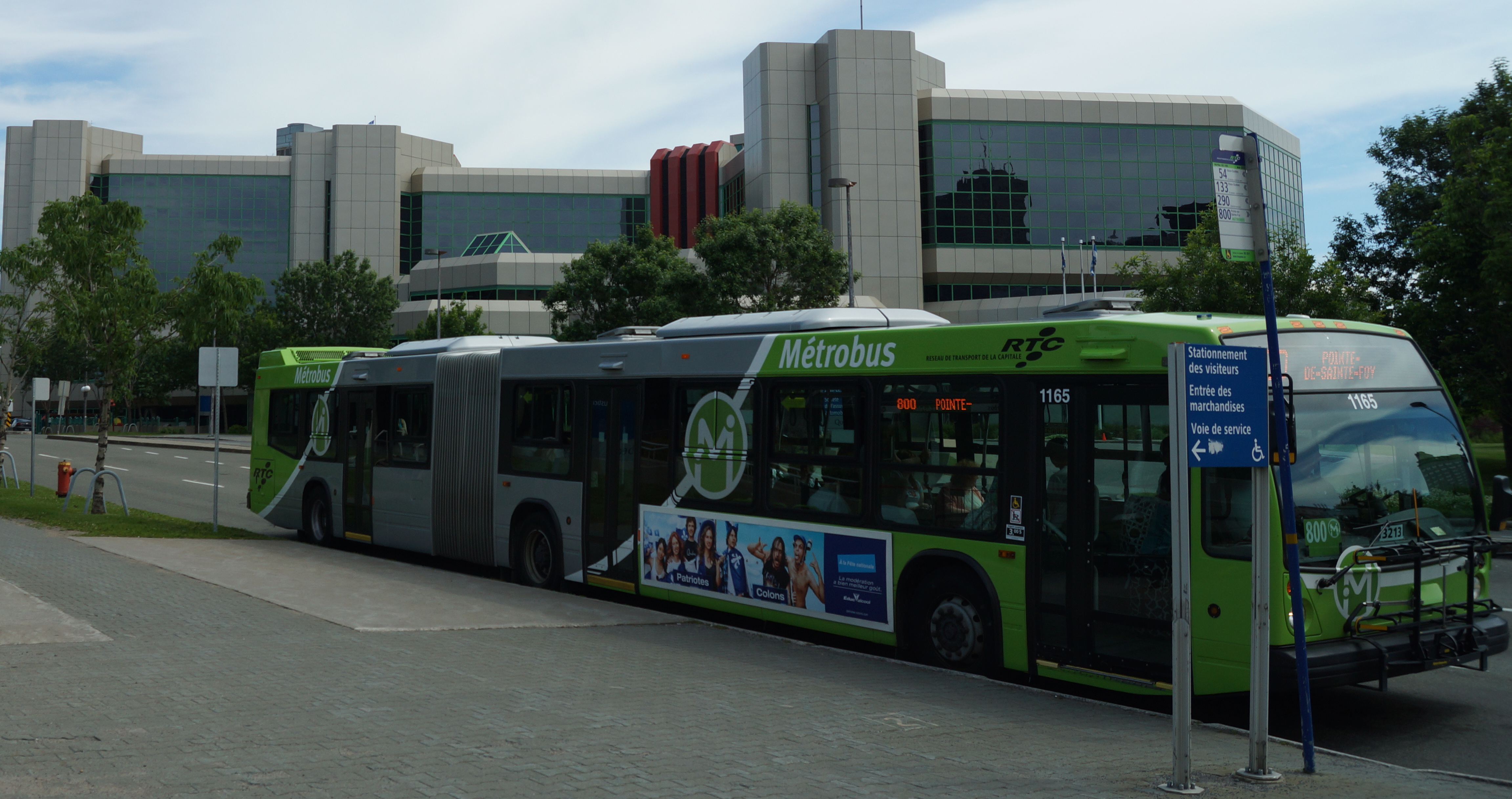
Français : Un autobus articulé Nova Bus LFS effectuant le parcours Métrobus 800 du Réseau de transport de la Capitale est à l'arrêt près du Palais de Justice de Québec, boulevard Jean-Lesage. À l'arrière-plan, l'édifice de la Société d'assurance automobile du Québec.
English: A Nova Bus LFS articulated bus on the Réseau de transport de la capitale Metrobus 800 run makes a stop near the Quebec City courthouse, on Jean-Lesage boulevard. In the background, the head office of the Société de l'assurance-automobile du Québec. |
| Date | |
| Source | Own work |
| Author | Renaudp10 |
| Other versions |

| Camera location | | View this and other nearby images on: OpenStreetMap |
|---|
Licensing
[edit]
Renaudp10, the copyright holder of this work, hereby publishes it under the following license:
This file is licensed under the Creative Commons Attribution-Share Alike 3.0 Unported license.
Attribution: Renaudp10
- You are free:
- to share – to copy, distribute and transmit the work
- to remix – to adapt the work
- Under the following conditions:
- attribution – You must give appropriate credit, provide a link to the license, and indicate if changes were made. You may do so in any reasonable manner, but not in any way that suggests the licensor endorses you or your use.
- share alike – If you remix, transform, or build upon the material, you must distribute your contributions under the same or compatible license as the original.
File history
Click on a date/time to view the file as it appeared at that time.
| Date/Time | Thumbnail | Dimensions | User | Comment | |
|---|---|---|---|---|---|
| current | 23:15, 17 June 2012 | | 4,607 × 2,434 (2.36 MB) | Renaudp10 (talk | contribs) |
You cannot overwrite this file.
File usage on Commons
The following page uses this file:
File usage on other wikis
The following other wikis use this file:
- Usage on fr.wikipedia.org