File:Lytham Windmill (26291370098).jpg
Original file (4,912 × 7,360 pixels, file size: 15.82 MB, MIME type: image/jpeg)
Captions
Captions
Summary
[edit].jpg&action=edit§ion=1)
| Description |
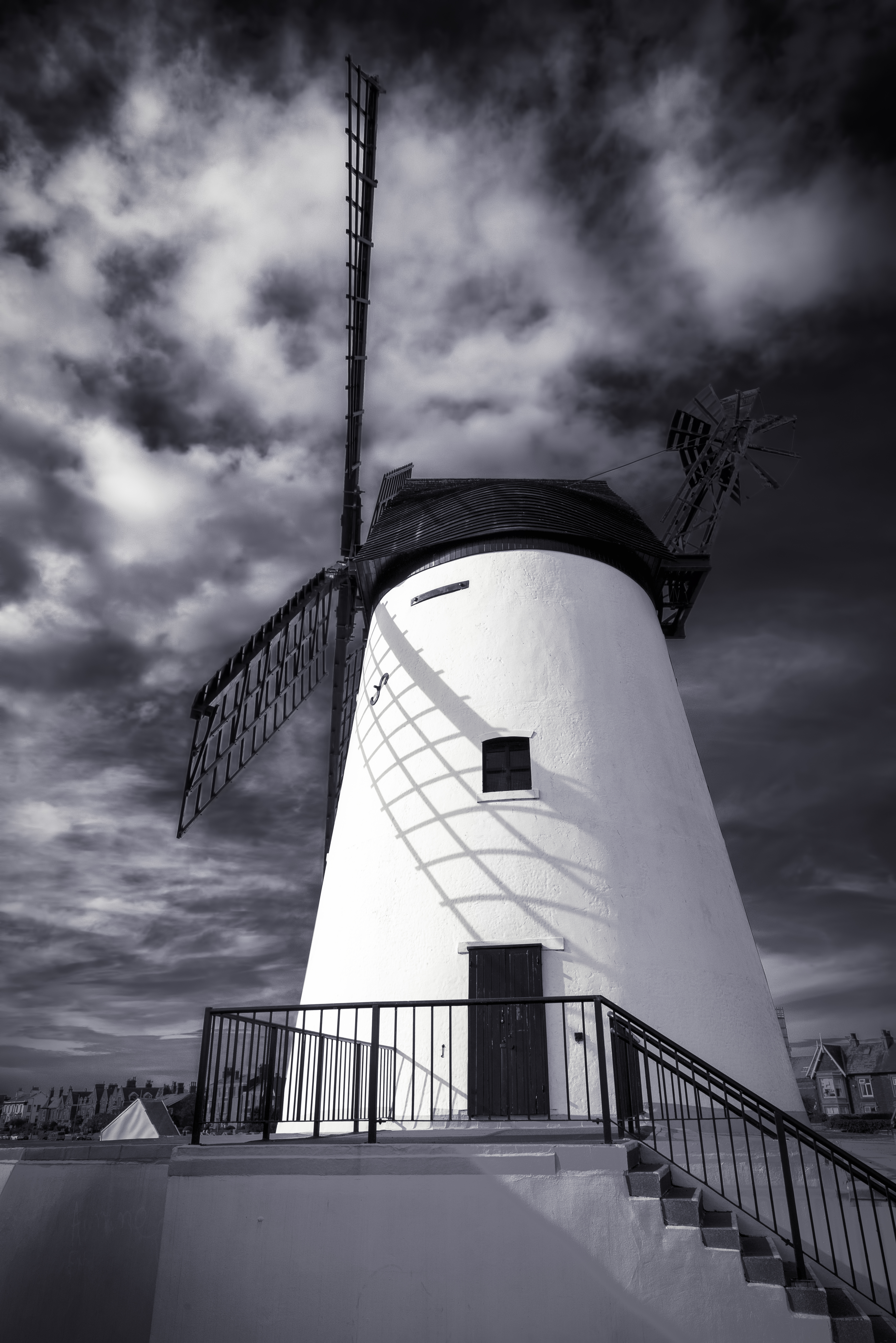
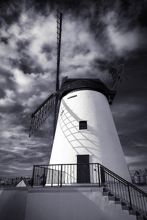
Lytham Windmill is situated on Lytham Green in the coastal town of Lytham St Annes, Lancashire, England. It is of the type known as a tower mill and was designed for grinding wheat and oats to make flour or bran. Since commercial milling on the site ceased in 1921 the mill has belonged to the town and is operated by Fylde Borough Council, who open it to the public during the summer. The mill also contains a museum run by the Lytham Heritage Trust which explains the history and practice of flour milling. The mill was built on Lytham marshes around 1805 on land leased by the local landowner and squire to miller Richard Cookson. Some of the mill's machinery, including a 150-year-old mainshaft of Baltic oak, was salvaged from other local mills. The plinth which now surrounds the mill was added later for safety reasons. The original smoky drying kiln, once adjacent to the mill, was moved to Kiln Street after pressure from well-to-do local residents in the growing town. The surrounding land was later levelled and grassed to form a ribbon green between the houses and the sea, in the middle of which stands the mill. In 1919 a high wind overcame the mill's braking mechanism and the sails spun out of control, causing the mill to be burnt out. Two years later the squire, John T. Clifton, donated the gutted building to the town. The shell was restored, given a new cap, a set of mock sails and used variously as a cafe, as headquarters of Lytham Cruising Club, Motorboat Club and Sea Cadets and even as an Electricity Board sub-station. In 1951 the mill was designated a grade II listed building. In 1989 it was totally restored by Fylde Borough Council and opened to the public. |
| Date | Taken on 10 October 2017 13:16 |
| Source | Lytham Windmill |
| Author | James Johnstone from Ecclefechan, Scotland |
| Camera location | | View this and other nearby images on: OpenStreetMap |
|---|
.jpg¶ms=053.735597_N_-002.955314_E_globe:Earth_type:camera_source:Flickr_&language=en)
Licensing
[edit].jpg&action=edit§ion=2)
- You are free:
- to share – to copy, distribute and transmit the work
- to remix – to adapt the work
- Under the following conditions:
- attribution – You must give appropriate credit, provide a link to the license, and indicate if changes were made. You may do so in any reasonable manner, but not in any way that suggests the licensor endorses you or your use.
| This image was originally posted to Flickr by TrotterFechan at https://flickr.com/photos/89786933@N02/26291370098. It was reviewed on 17 August 2023 by FlickreviewR 2 and was confirmed to be licensed under the terms of the cc-by-2.0. |
File history
Click on a date/time to view the file as it appeared at that time.
| Date/Time | Thumbnail | Dimensions | User | Comment | |
|---|---|---|---|---|---|
| current | 23:26, 17 August 2023 | | 4,912 × 7,360 (15.82 MB) | Юрий Д.К. (talk | contribs) | Transferred from Flickr via #flickr2commons |
You cannot overwrite this file.
File usage on Commons
There are no pages that use this file.
.jpg&oldid=859393972)