File:LysyeGory 012 1532.jpg
Jump to navigation
Jump to search

Size of this preview: 800 × 386 pixels. Other resolutions: 320 × 154 pixels | 640 × 309 pixels | 1,024 × 494 pixels | 1,280 × 617 pixels | 2,560 × 1,234 pixels | 12,448 × 6,002 pixels.
Original file (12,448 × 6,002 pixels, file size: 85.93 MB, MIME type: image/jpeg)
Captions
Captions
Add a one-line explanation of what this file represents
Summary
[edit]
| Description |
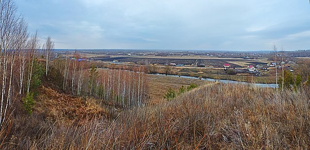
Русский: Геологический памятник позднего миоцена (парастратотип Горелкинской свиты): совхоз "Селезневский", Лысые Горы, Тамбовский район, Тамбовская область
|
|||
| Date | ||||
| Source | Own work | |||
| Author | Ludvig14 |
| Camera location | | View this and other nearby images on: OpenStreetMap |
|---|

|
Эта фотография сделана в ходе вики-экспедиции в Черноземье, апрель 2021.
This picture was taken during a Russian Wikivoyage expedition. |
Licensing
[edit]
I, the copyright holder of this work, hereby publish it under the following license:
This file is licensed under the Creative Commons Attribution-Share Alike 4.0 International license.
- You are free:
- to share – to copy, distribute and transmit the work
- to remix – to adapt the work
- Under the following conditions:
- attribution – You must give appropriate credit, provide a link to the license, and indicate if changes were made. You may do so in any reasonable manner, but not in any way that suggests the licensor endorses you or your use.
- share alike – If you remix, transform, or build upon the material, you must distribute your contributions under the same or compatible license as the original.
File history
Click on a date/time to view the file as it appeared at that time.
| Date/Time | Thumbnail | Dimensions | User | Comment | |
|---|---|---|---|---|---|
| current | 20:22, 26 November 2021 | | 12,448 × 6,002 (85.93 MB) | Ludvig14 (talk | contribs) | Uploaded own work with UploadWizard |
You cannot overwrite this file.
File usage on Commons
The following page uses this file:
File usage on other wikis
The following other wikis use this file:
- Usage on arz.wikipedia.org
- Usage on ceb.wikipedia.org
- Usage on it.wikipedia.org
- Usage on ru.wikipedia.org
- Usage on www.wikidata.org