File:Lydgate Lane, Crookes - geograph.org.uk - 1147964.jpg
Lydgate_Lane,_Crookes_-_geograph.org.uk_-_1147964.jpg (640 × 480 pixels, file size: 84 KB, MIME type: image/jpeg)
Captions
Captions
Summary
[edit]
| Description |
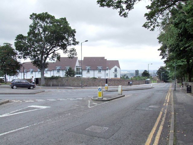
English: Lydgate Lane, Crookes This is the junction of Lydgate Lane, Crookes and Crookes Road. Years ago, just out of sight and to the left of the picture, was a clump of early 19th century (at least) cottages and a pub; all gone by the 70s.
Over the wall where the new build is, there was nothing of note that I can remember. An 1894 map shows a small building at the other side of the wall, which may have been some sort of store/maintenance shed; after all, there is a sizeable quantity of grass to mow. Beyond the new build was/is an underground reservoir. Whether this is still in use or not, I have yet to find out. The above ground was utilised for sports, such as cricket and football. It may still be in use. Back in 1855, this reservoir was called Pisgah Dam, but since 1893, Hadfield Dam. The name may have been in use much earlier, but I have no evidence to back that up. The monolith in the distance is the Sheffield University Arts Tower. |
| Date | |
| Source | From geograph.org.uk |
| Author | Dave Hitchborne |
| Attribution (required by the license) | Dave Hitchborne / Lydgate Lane, Crookes / |
| Camera location | | View this and other nearby images on: OpenStreetMap |
|---|
_heading:67.00&language=en)
| Object location | | View this and other nearby images on: OpenStreetMap |
|---|
_heading:67.00&language=en)
Licensing
[edit]

|
This image was taken from the Geograph project collection. See this photograph's page on the Geograph website for the photographer's contact details. The copyright on this image is owned by Dave Hitchborne and is licensed for reuse under the Creative Commons Attribution-ShareAlike 2.0 license.
|
- You are free:
- to share – to copy, distribute and transmit the work
- to remix – to adapt the work
- Under the following conditions:
- attribution – You must give appropriate credit, provide a link to the license, and indicate if changes were made. You may do so in any reasonable manner, but not in any way that suggests the licensor endorses you or your use.
- share alike – If you remix, transform, or build upon the material, you must distribute your contributions under the same or compatible license as the original.
File history
Click on a date/time to view the file as it appeared at that time.
| Date/Time | Thumbnail | Dimensions | User | Comment | |
|---|---|---|---|---|---|
| current | 07:27, 25 February 2011 | | 640 × 480 (84 KB) | GeographBot (talk | contribs) | == {{int:filedesc}} == {{Information |description={{en|1=Lydgate Lane, Crookes This is the junction of Lydgate Lane, Crookes and Crookes Road. Years ago, just out of sight and to the left of the picture, was a clump of early 19th century (at least) cottag |
You cannot overwrite this file.
File usage on Commons
There are no pages that use this file.