File:Luxembourg location map - cantons.svg
Jump to navigation
Jump to search

Size of this PNG preview of this SVG file: 433 × 599 pixels. Other resolutions: 173 × 240 pixels | 347 × 480 pixels | 555 × 768 pixels | 740 × 1,024 pixels | 1,480 × 2,048 pixels | 746 × 1,032 pixels.
Original file (SVG file, nominally 746 × 1,032 pixels, file size: 203 KB)
Captions
Captions
Add a one-line explanation of what this file represents
Summary
[edit]
| Description |
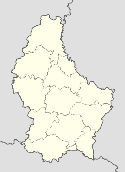
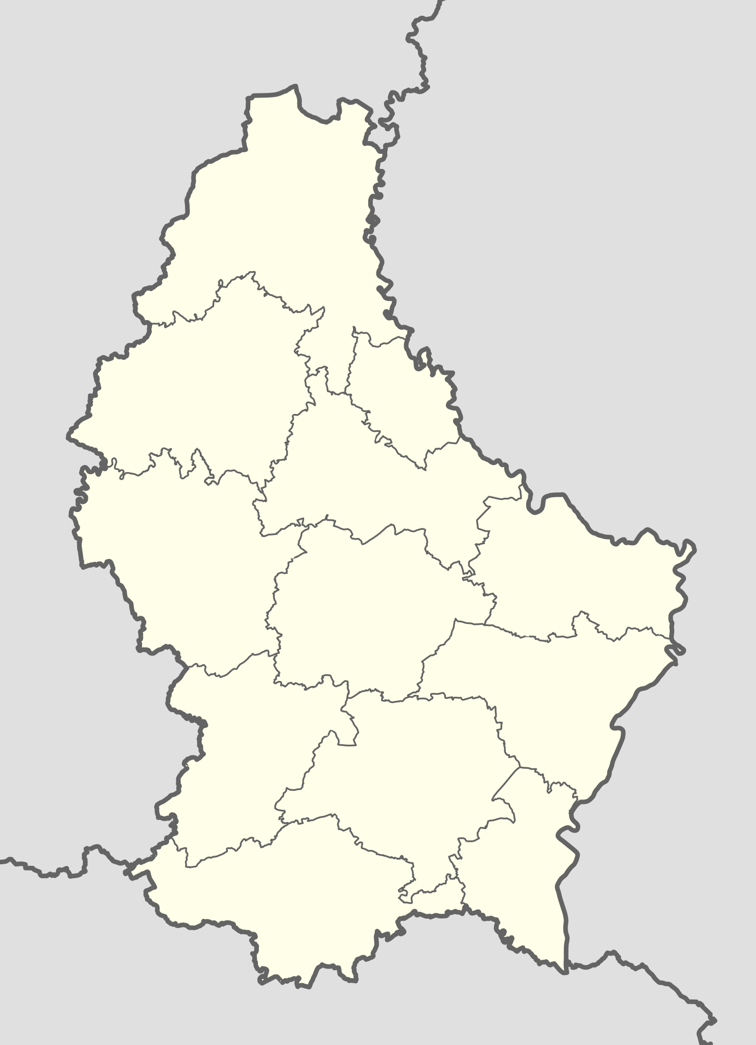
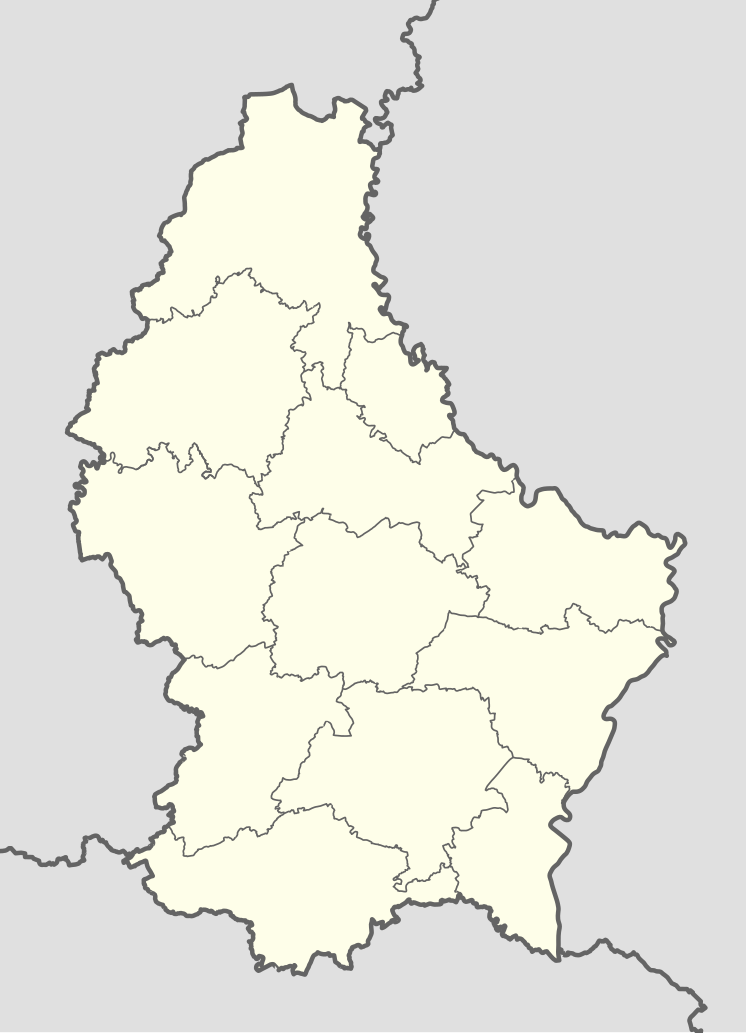
English: Location map of Luxembourg |
| Date | |
| Source |
This file was derived from: Luxembourg adm location map.svg:  |
| Author |
|
|
Equirectangular projection, vertical stretching – % | ||
|---|---|---|
| 50.25 | ||
| 5.65 | ←↕→ | 6.6 |
| 49.4 | ||
![]() Info This map is part of a series of location maps with unified standards: SVG as file format, standardised colours and name scheme. The boundaries on these maps always show the de facto situation and do not imply any endorsement or acceptance. In case of changes of the shown area the file is updated. The old version will be uploaded as a new file and thus is still available.
Info This map is part of a series of location maps with unified standards: SVG as file format, standardised colours and name scheme. The boundaries on these maps always show the de facto situation and do not imply any endorsement or acceptance. In case of changes of the shown area the file is updated. The old version will be uploaded as a new file and thus is still available.
Licensing
[edit]
This file is licensed under the Creative Commons Attribution-Share Alike 3.0 Czech Republic license.
- You are free:
- to share – to copy, distribute and transmit the work
- to remix – to adapt the work
- Under the following conditions:
- attribution – You must give appropriate credit, provide a link to the license, and indicate if changes were made. You may do so in any reasonable manner, but not in any way that suggests the licensor endorses you or your use.
- share alike – If you remix, transform, or build upon the material, you must distribute your contributions under the same or compatible license as the original.

File history
Click on a date/time to view the file as it appeared at that time.
| Date/Time | Thumbnail | Dimensions | User | Comment | |
|---|---|---|---|---|---|
| current | 09:17, 15 September 2016 | | 746 × 1,032 (203 KB) | Jann (talk | contribs) | Smazány řeky |
| 12:36, 14 September 2016 |  | 746 × 1,032 (287 KB) | Jann (talk | contribs) | {{Information |Description ={{en|1=Location map of Luxembourg }} |Source ={{Derived from|Luxembourg adm location map.svg|display=50}} |Author =*Luxembourg adm location map.svg: [[User:NordNor... |
You cannot overwrite this file.
File usage on Commons
The following 3 pages use this file:
File usage on other wikis
The following other wikis use this file:
- Usage on af.wikipedia.org
- Usage on ba.wikipedia.org
- Usage on be-tarask.wikipedia.org
- Usage on be.wikipedia.org
- Люксембург (горад)
- Шаблон:На карце/Люксембург
- Вільц
- Сір
- Шэнген
- Башараж
- Беванж-сюр-Атэр
- Бекерых
- Бердорф
- Бертранж
- Бетэмбур
- Бетэндорф
- Бех (Люксембург)
- Бецдорф
- Бівер (Люксембург)
- Бісэн
- Бафор (Люксембург)
- Булед
- Бурмеранж
- Буршэйд
- Бус (Люксембург)
- Валь (Люксембург)
- Вальдбіліг
- Вальдбрэдзімю
- Вальферданж
- Вейлер-ла-Тур
- Вейсвампах
- Веленштэйн
- Вінкранж
- Вінселер
- Віхтэн
- Вормельданж
- Віяндэн
- Гарніш
- Гёсдорф
- Грэвенмахер
- Гросбус
- Дальхайм
- Дзікірх
- Дзіпах (Люксембург)
View more global usage of this file.