File:Lut Desert, Iran (MODIS 2021-01-22).jpg

Original file (2,379 × 1,875 pixels, file size: 375 KB, MIME type: image/jpeg)
Captions
Captions
Summary
[edit].jpg&action=edit§ion=1)
| Description |
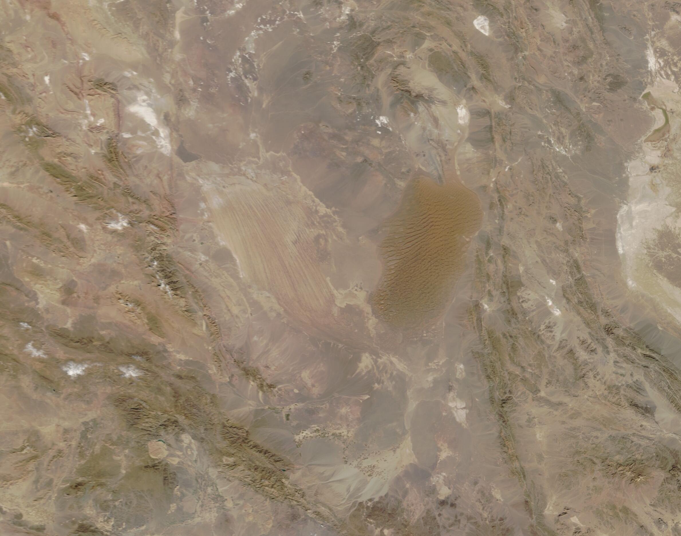
English: On January 18, 2021, the Moderate Resolution Imaging Spectroradiometer (MODIS) on NASA’s Terra satellite acquired a stunning true-color image of south-eastern Iran’s Lut Desert.
Also known as Dasht-e-lut, the 2,278,015-hectare arid region straddles the provinces of Kermān, Sistāno Balūchestān and Khorāsān-e Jonūbi. The desert sits in a low-lying interior basin that reaches 185 meters (607 feet) below sea level. Because the basin is surrounded by mountains, it is in a rain shadow which creates a hyper-arid climate. The Lut Desert is a land of dramatic and extreme environmental conditions—very low precipitation, long periods of high wind, unique land formations, and some of the hottest temperatures ever recorded on Earth. A temperature of 70.7˚C (159.26˚F) has been recorded on the property. The region is so unique that it was inscribed as a UNESCO World Heritage Site in 2016. According to their description, in the Persian language “Lut” refers to bare land without water and devoid of vegetation. Between June and October each year, strong winds whip across the desert, carrying 1 mm quartz sand grains at high velocity. This creates a “sand blasting” effect (aeolian erosion) that has created stunning landforms, such as stony deserts, vast tall-dune fields, and yardangs. According to UNESCO, “Yardangs are bedrock features carved and streamlined by sandblasting, although they are also eroded by gullying from rainfall runoff and by mass movement. Some are also undercut by floodwaters. Yardangs appear as massive and dramatic corrugations across the landscape with ridges and corridors oriented parallel to the dominant prevailing wind. The ridges are known as kaluts. In the Lut Desert some are up to 155 m high and their ridges can be followed for more than 40 km.” In the image, yardangs and kaluts can be seen in western section of the Lut Desert basin where they appear as a large area of roughly parallel ridges. In contrast, the dark tan area in the eastern basin is filled with long rippling lines. This is a huge sand sea (erg) where actively moving dunes can reach heights of 475 meters (1,558 feet). Not only are these among the largest dunes in the world, but they also take a variety of forms: linear, compound crescentic, star, and funnel shaped. Where a few plants live in the slightly moisture edges of the dune field, the sand piles into nebkhas, which are basically hummock-like dunes that form around vegetation. |
||
| Date | Taken on 18 January 2021 | ||
| Source |
Lut Desert, Iran (direct link)
|
||
| Author | MODIS Land Rapid Response Team, NASA GSFC |
| This media is a product of the Terra mission Credit and attribution belongs to the mission team, if not already specified in the "author" row |
Licensing
[edit].jpg&action=edit§ion=2)
| This file is in the public domain in the United States because it was solely created by NASA. NASA copyright policy states that "NASA material is not protected by copyright unless noted". (See Template:PD-USGov, NASA copyright policy page or JPL Image Use Policy.) | ||
 |
Warnings:
|
File history
Click on a date/time to view the file as it appeared at that time.
| Date/Time | Thumbnail | Dimensions | User | Comment | |
|---|---|---|---|---|---|
| current | 18:06, 30 January 2024 | | 2,379 × 1,875 (375 KB) | OptimusPrimeBot (talk | contribs) | #Spacemedia - Upload of http://modis.gsfc.nasa.gov/gallery/images/image01222021_250m.jpg via Commons:Spacemedia |
You cannot overwrite this file.
File usage on Commons
There are no pages that use this file.
.jpg&oldid=909384550)