File:Lunch stop at Port na Beiste - geograph.org.uk - 1761588.jpg
Jump to navigation
Jump to search

Size of this preview: 783 × 599 pixels. Other resolutions: 314 × 240 pixels | 627 × 480 pixels | 1,003 × 768 pixels | 1,280 × 980 pixels | 1,920 × 1,470 pixels.
Original file (1,920 × 1,470 pixels, file size: 998 KB, MIME type: image/jpeg)
Captions
Captions
Add a one-line explanation of what this file represents
Summary
[edit]| Description |
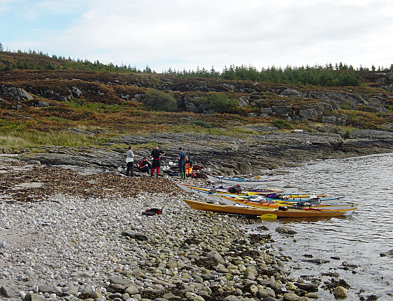
English: Lunch stop at Port na Beiste Part of a late season two-day sea kayak trip, putting in at Portavadie. Port na Beiste, just east of Sgat Beag, was as far down Loch Fyne as we went, before returning north to camp at Port Leathan (1188994). The weather was very kind to us for September, enablng us to cross the Loch for a fine brealfast in Ardrishaig on Sunday before taking out at Otter Ferry (1661206). |
| Date | |
| Source | From geograph.org.uk |
| Author | Andy Waddington |
| Attribution (required by the license) | Andy Waddington / Lunch stop at Port na Beiste / |
| Camera location | | View this and other nearby images on: OpenStreetMap |
|---|
| Object location | | View this and other nearby images on: OpenStreetMap |
|---|
Licensing
[edit]
|
This image was taken from the Geograph project collection. See this photograph's page on the Geograph website for the photographer's contact details. The copyright on this image is owned by Andy Waddington and is licensed for reuse under the Creative Commons Attribution-ShareAlike 2.0 license.
|
This file is licensed under the Creative Commons Attribution-Share Alike 2.0 Generic license.
Attribution: Andy Waddington
- You are free:
- to share – to copy, distribute and transmit the work
- to remix – to adapt the work
- Under the following conditions:
- attribution – You must give appropriate credit, provide a link to the license, and indicate if changes were made. You may do so in any reasonable manner, but not in any way that suggests the licensor endorses you or your use.
- share alike – If you remix, transform, or build upon the material, you must distribute your contributions under the same or compatible license as the original.

_heading:112.00&language=en)
_heading:112.00&language=en)
File history
Click on a date/time to view the file as it appeared at that time.
| Date/Time | Thumbnail | Dimensions | User | Comment | |
|---|---|---|---|---|---|
| current | 21:19, 11 March 2011 | | 1,920 × 1,470 (998 KB) | GeographBot (talk | contribs) | == {{int:filedesc}} == {{Information |description={{en|1=Lunch stop at Port na Beiste Part of a late season two-day sea kayak trip, putting in at Portavadie. Port na Beiste, just east of Sgat Beag, was as far down Loch Fyne as we went, before returning no |
You cannot overwrite this file.
File usage on Commons
There are no pages that use this file.