File:Lumber Mill Bridge.JPG
Jump to navigation
Jump to search

Size of this preview: 800 × 600 pixels. Other resolutions: 320 × 240 pixels | 640 × 480 pixels | 1,024 × 768 pixels | 1,280 × 960 pixels | 2,592 × 1,944 pixels.
Original file (2,592 × 1,944 pixels, file size: 2.59 MB, MIME type: image/jpeg)
Captions
Captions
Add a one-line explanation of what this file represents
|
This is an image of a place or building that is listed on the National Register of Historic Places in the United States of America. Its reference number is 74000227. |
Summary
[edit]
| Description |
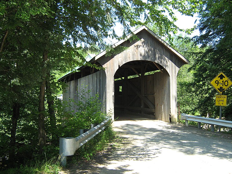
English: Mill (a/k/a Lumber Mill, Lower) Covered Bridge, Belvidere, Vermont. Lewis Robinson, 1890. Queenpost, 71', spanning North Branch Lamoille River on Back Road (west end), approximately .5 mile north of Route 109. |
| Date | |
| Source | Own work |
| Author | Mfwills |
| OpenStreetMap | Way 1035091247 |
| Object location | | View this and other nearby images on: OpenStreetMap |
|---|
Licensing
[edit]
I, the copyright holder of this work, hereby publish it under the following licenses:
This file is licensed under the Creative Commons Attribution-Share Alike 3.0 Unported license.
- You are free:
- to share – to copy, distribute and transmit the work
- to remix – to adapt the work
- Under the following conditions:
- attribution – You must give appropriate credit, provide a link to the license, and indicate if changes were made. You may do so in any reasonable manner, but not in any way that suggests the licensor endorses you or your use.
- share alike – If you remix, transform, or build upon the material, you must distribute your contributions under the same or compatible license as the original.

|
Permission is granted to copy, distribute and/or modify this document under the terms of the GNU Free Documentation License, Version 1.2 or any later version published by the Free Software Foundation; with no Invariant Sections, no Front-Cover Texts, and no Back-Cover Texts. A copy of the license is included in the section entitled GNU Free Documentation License. |
You may select the license of your choice.
File history
Click on a date/time to view the file as it appeared at that time.
| Date/Time | Thumbnail | Dimensions | User | Comment | |
|---|---|---|---|---|---|
| current | 20:28, 13 December 2009 | | 2,592 × 1,944 (2.59 MB) | Mfwills (talk | contribs) | {{Information |Description={{en|1=Mill (a/k/a Lumber Mill, Lower) Covered Bridge, Belvidere, Vermont. Lewis Robinson, 1890. Queenpost, 71', spanning North Branch Lamoille River on Back Road (west end), approximately .5 mile north of Route 109.}} |Source={ |
You cannot overwrite this file.
File usage on Commons
The following 2 pages use this file:
File usage on other wikis
The following other wikis use this file:
- Usage on de.wikipedia.org
- Usage on en.wikipedia.org