File:Lughaya district.svg
Jump to navigation
Jump to search

Size of this PNG preview of this SVG file: 800 × 566 pixels. Other resolutions: 320 × 226 pixels | 640 × 453 pixels | 1,024 × 724 pixels | 1,280 × 905 pixels | 2,560 × 1,810 pixels | 1,052 × 744 pixels.
Original file (SVG file, nominally 1,052 × 744 pixels, file size: 18 KB)
Captions
Captions
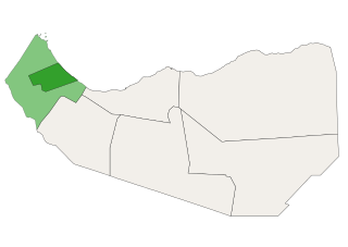
Lughaya district (dark green) shown within Awdal region (light green)
Summary
[edit]
| Description |
English: Lughaya district (dark green) shown within Awdal region (light green). This map is not correct (and an estimate at best) as the geographical boundaries of districts in Somaliland have not been established. See the (Somaliland) Regions and Districts Self-management Law, No. 23/2019. Also to be found here. This law mentions all the districts, but not where their boundaries are. |
| Date | |
| Source | Own work |
| Author | Jacob300 |
Licensing
[edit]
I, the copyright holder of this work, hereby publish it under the following license:
This file is licensed under the Creative Commons Attribution-Share Alike 4.0 International license.
- You are free:
- to share – to copy, distribute and transmit the work
- to remix – to adapt the work
- Under the following conditions:
- attribution – You must give appropriate credit, provide a link to the license, and indicate if changes were made. You may do so in any reasonable manner, but not in any way that suggests the licensor endorses you or your use.
- share alike – If you remix, transform, or build upon the material, you must distribute your contributions under the same or compatible license as the original.
File history
Click on a date/time to view the file as it appeared at that time.
| Date/Time | Thumbnail | Dimensions | User | Comment | |
|---|---|---|---|---|---|
| current | 11:56, 29 December 2020 | | 1,052 × 744 (18 KB) | Jacob300 (talk | contribs) | Minor adjustments |
| 18:03, 28 November 2020 | No thumbnail | 1,052 × 744 (35 KB) | Jacob300 (talk | contribs) | Uploaded own work with UploadWizard |
You cannot overwrite this file.
File usage on Commons
The following page uses this file: