File:Luftbild Henne.jpg
Jump to navigation
Jump to search

Size of this preview: 800 × 514 pixels. Other resolutions: 320 × 205 pixels | 640 × 411 pixels | 827 × 531 pixels.
Original file (827 × 531 pixels, file size: 347 KB, MIME type: image/jpeg)
Captions
Captions
Add a one-line explanation of what this file represents
Summary
[edit]
| Description |
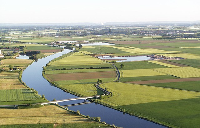
Deutsch: Luftbild der Mittelweser mit Kiesabbauteichen in Landesbergen; im Hintergrund 380-kV-Freileitungskreuzungen der Weser (die hohen rot-weißen Masten gehören zur Ltg. 3017 Landesbergen–Wehrendorf) |
| Date | |
| Source | Own work |
| Author | Backhaus141 |
| Camera location | | View this and other nearby images on: OpenStreetMap |
|---|
The geographical information in this file was retrospectively estimated.
The location may therefore be somewhat imprecise. Verifying and refining these coordinates is strongly encouraged. |
Licensing
[edit]
I, the copyright holder of this work, hereby publish it under the following license:
This file is licensed under the Creative Commons Attribution 3.0 Unported license.
- You are free:
- to share – to copy, distribute and transmit the work
- to remix – to adapt the work
- Under the following conditions:
- attribution – You must give appropriate credit, provide a link to the license, and indicate if changes were made. You may do so in any reasonable manner, but not in any way that suggests the licensor endorses you or your use.
| Annotations | This image is annotated: View the annotations at Commons |
File history
Click on a date/time to view the file as it appeared at that time.
| Date/Time | Thumbnail | Dimensions | User | Comment | |
|---|---|---|---|---|---|
| current | 17:42, 23 October 2009 | | 827 × 531 (347 KB) | Backhaus141 (talk | contribs) | {{Information |Description={{de|1=Luftbild Mittelweser}} |Source={{own}} |Author=Backhaus141 |Date=23.10.2009 |Permission= |other_versions= }} |
You cannot overwrite this file.
File usage on Commons
There are no pages that use this file.
File usage on other wikis
The following other wikis use this file:
- Usage on de.wikipedia.org