File:Lt topo 626.jpg
Jump to navigation
Jump to search

Size of this preview: 595 × 600 pixels. Other resolutions: 238 × 240 pixels | 476 × 480 pixels | 762 × 768 pixels | 1,016 × 1,024 pixels | 2,032 × 2,048 pixels | 8,599 × 8,668 pixels.
Original file (8,599 × 8,668 pixels, file size: 20.08 MB, MIME type: image/jpeg)
Captions
Captions
Add a one-line explanation of what this file represents
| Lithuanian interwar maps, 1 : 25 000 | ||||||||||
|---|---|---|---|---|---|---|---|---|---|---|
 |
305 | 306 | 307 | 308 | 309 | 310 | 311 | 312 | 313 | |
| 342 | 343 | 344 | 345 | 346 | 347 | 348 | 349 | 350 | ||
| 379 | 380 | 381 | 382 | 383 | 384 | 385 | 386 | 387 | ||
| 413 | 414 | 415 | 416 | 417 | 418 | 419 | 420 | 421 | ||
| 443 | 444 | 445 | 446 | 447 | 448 | 449 | 450 | 451 | 452 | |
| 471 | 472 | 473 | 474 | 475 | 476 | 477 | 478 | 479 | ||
| 496 | 497 | 498 | 499 | 500 | 501 | 502 | 503 | 504 | ||
| 522 | 523 | 524 | 525 | 526 | 527 | 528 | 529 | 530 | ||
| 548 | 551 | 552 | 553 | 554 | 555 | |||||
| 575 | 576 | 577 | 578 | 579 | 580 | |||||
| 601 | 602 | 603 | ||||||||
| 626 | 627 | 628 | ||||||||
Summary
[edit]
| Warning | The original file is very high-resolution. It might not load properly or could cause your browser to freeze when opened at full size. |
|---|
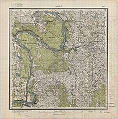
| Description | Map scaled 1 : 25 000, page 626 | ||||
| Date | |||||
| Source | http://igrek.amzp.pl/maplist.php?cat=LIT025 | ||||
| Author | Lietuvos karo topografijos skyrius | ||||
| Permission (Reusing this file) |
|
||||
File history
Click on a date/time to view the file as it appeared at that time.
| Date/Time | Thumbnail | Dimensions | User | Comment | |
|---|---|---|---|---|---|
| current | 04:49, 3 September 2022 | | 8,599 × 8,668 (20.08 MB) | CD (talk | contribs) | {{LargeImage}} {{Information |Description=Map scaled 1 : 25 000, page 626 |Source=http://igrek.amzp.pl/maplist.php?cat=LIT025 |Date=1934 |Author=Lietuvos karo topografijos skyrius |Permission={{PD-old}} |other_versions= }} Category:Maps by Lithuanian war topography department (1 : 25 000) |
You cannot overwrite this file.
File usage on Commons
There are no pages that use this file.