File:Louvre Access Map.png
Jump to navigation
Jump to search
Size of this preview: 800 × 533 pixels. Other resolutions: 320 × 213 pixels | 640 × 427 pixels | 1,024 × 682 pixels | 1,280 × 853 pixels | 2,000 × 1,333 pixels.
Original file (2,000 × 1,333 pixels, file size: 2.17 MB, MIME type: image/png)
Captions
Captions
Add a one-line explanation of what this file represents
Summary
[edit]
| Description |
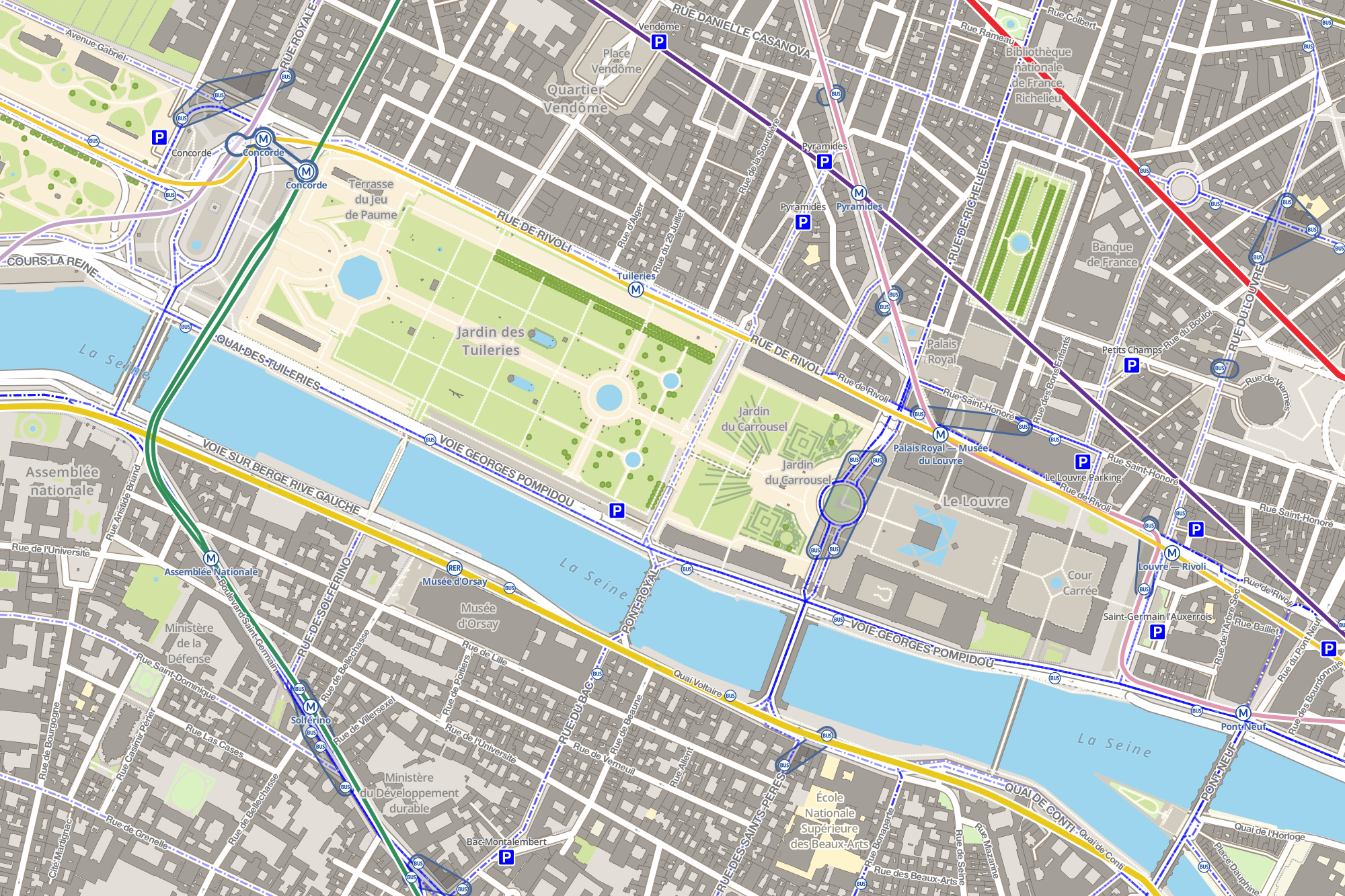
Français : Carte montrant les stations de métro, de bus et les parcs de stationnements autour du musée du Louvre de Paris. Cette carte est réalisée grâce aux données d'OpenStreetMap et grâce aux logiciels libres TileMill, PostgreSQL, PostGIS et osm2pgsql. Les logos RATP de la carte proviennent de File:Metro-M.svg et File:Paris_logo_bus_jms.svg. |
| Date | |
| Source | Own work |
| Author | Benh LIEU SONG |
Licensing
[edit]
I, the copyright holder of this work, hereby publish it under the following license:
This file is licensed under the Creative Commons Attribution-Share Alike 3.0 Unported license.
- You are free:
- to share – to copy, distribute and transmit the work
- to remix – to adapt the work
- Under the following conditions:
- attribution – You must give appropriate credit, provide a link to the license, and indicate if changes were made. You may do so in any reasonable manner, but not in any way that suggests the licensor endorses you or your use.
- share alike – If you remix, transform, or build upon the material, you must distribute your contributions under the same or compatible license as the original.
File history
Click on a date/time to view the file as it appeared at that time.
| Date/Time | Thumbnail | Dimensions | User | Comment | |
|---|---|---|---|---|---|
| current | 10:43, 30 November 2012 | | 2,000 × 1,333 (2.17 MB) | Benh (talk | contribs) | Added many missing bus stops (in OpenStreetMap), grouped bus stops with same name, added interchange lines between metro stations with same name. |
| 14:50, 28 November 2012 |  | 2,000 × 1,335 (2.14 MB) | Benh (talk | contribs) | Fixed Musée d'Orsay station (metro -> RER) and made text bigger. | |
| 13:34, 28 November 2012 |  | 1,999 × 1,334 (2.12 MB) | Benh (talk | contribs) | added metro and RER lines (with color scheme), bus lines (without color scheme to not clutter the map) | |
| 00:06, 28 November 2012 |  | 2,000 × 1,334 (1.98 MB) | Benh (talk | contribs) | User created page with UploadWizard |
You cannot overwrite this file.
File usage on Commons
The following page uses this file:
File usage on other wikis
The following other wikis use this file:
- Usage on ar.wikipedia.org
- Usage on fr.wikipedia.org
- Usage on ja.wikipedia.org
- Usage on ko.wikipedia.org
- Usage on pt.wikipedia.org