File:LounsBredningmm.jpg
Jump to navigation
Jump to search
Size of this preview: 647 × 600 pixels. Other resolutions: 259 × 240 pixels | 518 × 480 pixels | 828 × 768 pixels | 1,104 × 1,024 pixels | 1,554 × 1,441 pixels.
Original file (1,554 × 1,441 pixels, file size: 1.92 MB, MIME type: image/jpeg)
Captions
Captions
Add a one-line explanation of what this file represents
| Description |
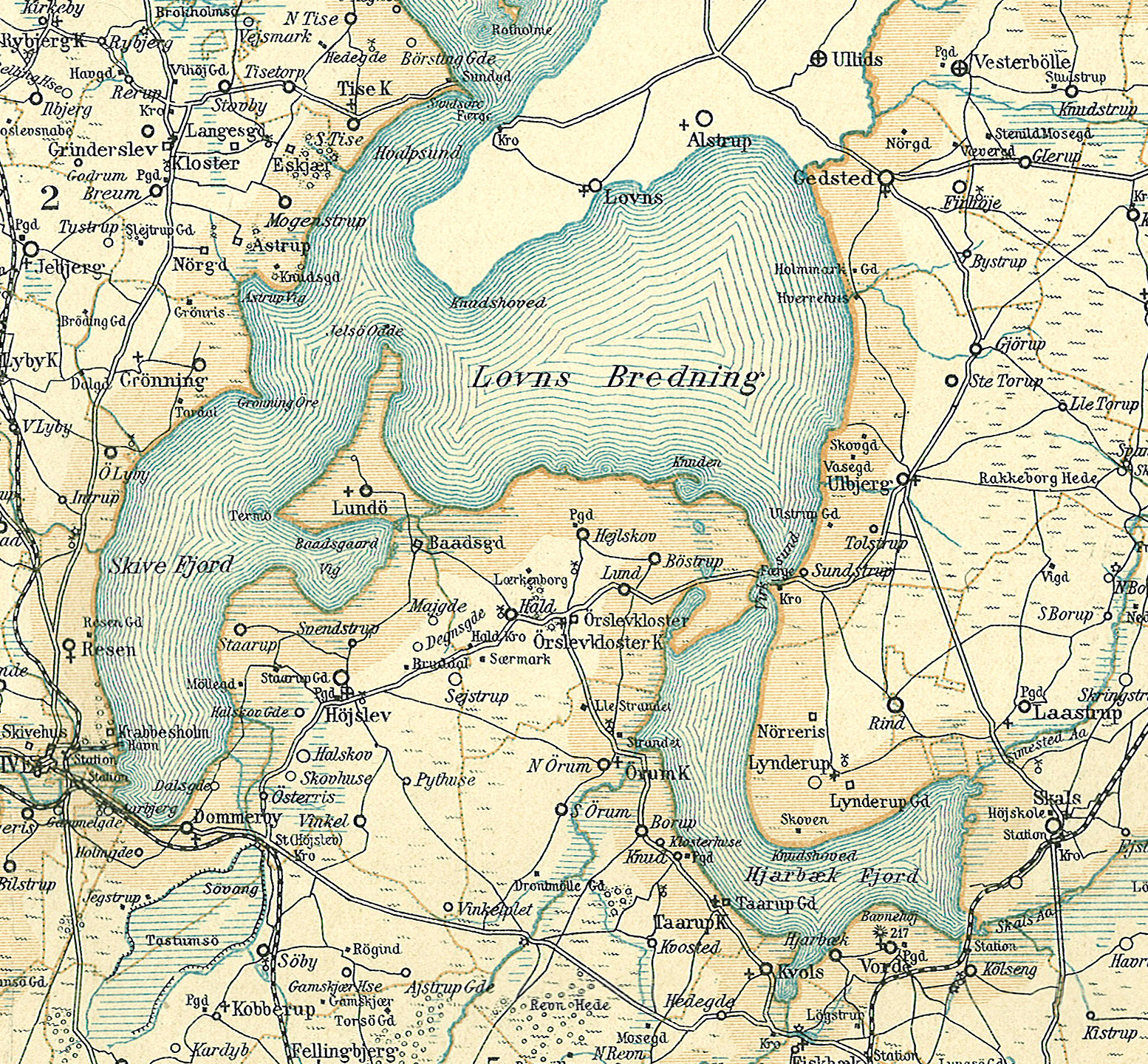
Dansk: Kort over Louns Bredning, Hjarbæk- og Skive Fjord i den nordvestlige del af Viborg Amt
English: Map of Louns Bredning, Hjarbæk- og Skive Fjord in the northwestern part of Viborg County in Denmark |
||||
| Date | circa 1900 | ||||
| Source | Frems Amtskort over Danmark | ||||
| Author | Fotolitograferede i Generalstabens Topografiske Afdeling | ||||
| Permission (Reusing this file) |
|
||||
| Other versions |
Derivative works of this file: da:Viborg Amt |
||||

| This is a retouched picture, which means that it has been digitally altered from its original version. Modifications: LounsBredning, Hjarbæk Fjord Skive Fjord mm. The original can be viewed here: Viborg Amt nordvest.jpg:
|
File history
Click on a date/time to view the file as it appeared at that time.
| Date/Time | Thumbnail | Dimensions | User | Comment | |
|---|---|---|---|---|---|
| current | 22:19, 2 November 2010 | | 1,554 × 1,441 (1.92 MB) | Cropbot (talk | contribs) | <!-- Uploaded with Cropbot operated by User:Nico-dk --> {{Information |Description=da:Kort over den nordvestlige del af Viborg Amt<br/>en:Map of the northwestern part of Viborg County in Denmark |Source=''Frems Amtskort over Danmark'' |Date=ca. 1900 |
You cannot overwrite this file.
File usage on Commons
The following page uses this file:
File usage on other wikis
The following other wikis use this file:
- Usage on da.wikipedia.org
- Usage on www.wikidata.org