File:Louis Macneice plaque, Carrickfergus - geograph.org.uk - 324837.jpg
Jump to navigation
Jump to search
No higher resolution available.
Louis_Macneice_plaque,_Carrickfergus_-_geograph.org.uk_-_324837.jpg (640 × 426 pixels, file size: 151 KB, MIME type: image/jpeg)
Captions
Captions
Add a one-line explanation of what this file represents
Summary
[edit]
| Description |
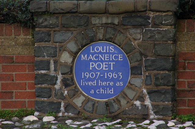
English: Louis Macneice plaque, Carrickfergus. The poet Louis Macneice lived in the North Road, Carrickfergus - his father was rector of St Nicholas's Church. The site is now occupied by sheltered housing. This plaque is at the entrance to the Macneice Fold. For more information see http://www.ulsterhistory.co.uk/louismcneice.htm. He was buried at Christ Church, Carrowdore 437068. |
| Date | |
| Source | From geograph.org.uk |
| Author | Albert Bridge |
| Attribution (required by the license) | Albert Bridge / Louis Macneice plaque, Carrickfergus / |
| Camera location | | View this and other nearby images on: OpenStreetMap |
|---|
_heading:0.00&language=en)
| Object location | | View this and other nearby images on: OpenStreetMap |
|---|
_heading:0.00&language=en)
Licensing
[edit]

|
This image was taken from the Geograph project collection. See this photograph's page on the Geograph website for the photographer's contact details. The copyright on this image is owned by Albert Bridge and is licensed for reuse under the Creative Commons Attribution-ShareAlike 2.0 license.
|
This file is licensed under the Creative Commons Attribution-Share Alike 2.0 Generic license.
Attribution: Albert Bridge
- You are free:
- to share – to copy, distribute and transmit the work
- to remix – to adapt the work
- Under the following conditions:
- attribution – You must give appropriate credit, provide a link to the license, and indicate if changes were made. You may do so in any reasonable manner, but not in any way that suggests the licensor endorses you or your use.
- share alike – If you remix, transform, or build upon the material, you must distribute your contributions under the same or compatible license as the original.
File history
Click on a date/time to view the file as it appeared at that time.
| Date/Time | Thumbnail | Dimensions | User | Comment | |
|---|---|---|---|---|---|
| current | 18:57, 30 December 2010 | | 640 × 426 (151 KB) | GeographBot (talk | contribs) | == {{int:filedesc}} == {{Information |description={{en|1=Louis Macneice plaque, Carrickfergus The poet Louis Macneice lived in the North Road, Carrickfergus his father was rector of St Nicholas's Church. The site is now occupied by sheltered housing. |
You cannot overwrite this file.
File usage on Commons
The following page uses this file:
File usage on other wikis
The following other wikis use this file:
- Usage on ca.wikipedia.org
- Usage on cy.wikipedia.org
- Usage on de.wikipedia.org
- Usage on en.wikipedia.org
- Usage on en.wikiquote.org
- Usage on eu.wikipedia.org
- Usage on fr.wikipedia.org
- Usage on pl.wikipedia.org
- Usage on www.wikidata.org