File:LoughFoyleLocation.png
Jump to navigation
Jump to search
No higher resolution available.
LoughFoyleLocation.png (700 × 360 pixels, file size: 186 KB, MIME type: image/png)
Captions
Captions
Add a one-line explanation of what this file represents
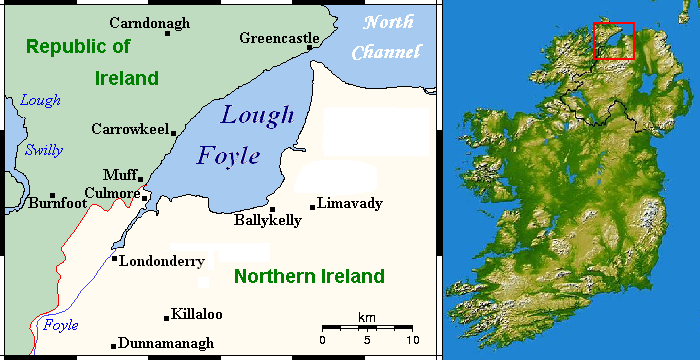
| Description | Lough Foyle location map | ||
| Date | |||
| Source | [1] and File:600x748-Carte-de-l'Irlande-R.jpg | ||
| Author | User:Hogweard | ||
| Permission (Reusing this file) |
|
![[1]](https://en.wikipedia.org/wiki/File:LoughFoyleCloseup.png)
File history
Click on a date/time to view the file as it appeared at that time.
| Date/Time | Thumbnail | Dimensions | User | Comment | |
|---|---|---|---|---|---|
| current | 11:45, 30 December 2010 | | 700 × 360 (186 KB) | Hogweard (talk | contribs) | {{Information |Description=Lough Foyle location map |Source=[http://en.wikipedia.org/wiki/File:LoughFoyleCloseup.png], |Date=30 Dec 2010 |Author=User:Hogweard |Permission={{PD-self}} |other_versions= }} Category:Lough Foyle |
You cannot overwrite this file.
File usage on Commons
There are no pages that use this file.
File usage on other wikis
The following other wikis use this file:
- Usage on en.wikipedia.org
- Usage on fy.wikipedia.org
- Usage on nl.wikipedia.org