File:Longest Rivers of Canada.jpg
Jump to navigation
Jump to search
Size of this preview: 800 × 537 pixels. Other resolutions: 320 × 215 pixels | 640 × 429 pixels | 1,024 × 687 pixels | 1,398 × 938 pixels.
Original file (1,398 × 938 pixels, file size: 737 KB, MIME type: image/jpeg)
Captions
Captions
Add a one-line explanation of what this file represents
Summary
[edit]
| Description |
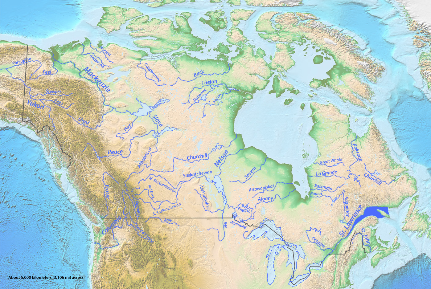
English: Map to go with List of longest rivers of Canada |
| Date | |
| Source | Topography from USGS, stream courses' data from DEMIS Mapserver, (BOTH public domain) all other graphics by me |
| Author | Shannon1 |
Licensing
[edit]
I, the copyright holder of this work, hereby publish it under the following licenses:

|
Permission is granted to copy, distribute and/or modify this document under the terms of the GNU Free Documentation License, Version 1.2 or any later version published by the Free Software Foundation; with no Invariant Sections, no Front-Cover Texts, and no Back-Cover Texts. A copy of the license is included in the section entitled GNU Free Documentation License. |
This file is licensed under the Creative Commons Attribution-Share Alike 4.0 International, 3.0 Unported, 2.5 Generic, 2.0 Generic and 1.0 Generic license.
- You are free:
- to share – to copy, distribute and transmit the work
- to remix – to adapt the work
- Under the following conditions:
- attribution – You must give appropriate credit, provide a link to the license, and indicate if changes were made. You may do so in any reasonable manner, but not in any way that suggests the licensor endorses you or your use.
- share alike – If you remix, transform, or build upon the material, you must distribute your contributions under the same or compatible license as the original.
You may select the license of your choice.
File history
Click on a date/time to view the file as it appeared at that time.
| Date/Time | Thumbnail | Dimensions | User | Comment | |
|---|---|---|---|---|---|
| current | 18:19, 16 January 2012 | | 1,398 × 938 (737 KB) | Shannon1 (talk | contribs) | label st. john |
| 00:11, 7 June 2011 |  | 1,398 × 938 (728 KB) | Shannon1 (talk | contribs) | Changed numbers to labels per Finetooth's comment, add Pend Oreille per my realization/idea | |
| 22:11, 31 May 2011 |  | 1,398 × 938 (708 KB) | Shannon1 (talk | contribs) | {{Information |Description ={{en|1=Map to go with en:List of longest rivers of Canada}} |Source =Topography from USGS, stream courses' data from DEMIS Mapserver, (BOTH public domain) all other graphics by me |Author =[[User:Shannon1 |
You cannot overwrite this file.
File usage on Commons
There are no pages that use this file.
File usage on other wikis
The following other wikis use this file:
- Usage on arz.wikipedia.org
- Usage on be.wikipedia.org
- Usage on ga.wikipedia.org
- Usage on sk.wikipedia.org
- Usage on www.wikidata.org