File:London Chiswick Bath Road Halt site geograph-3257423-by-Ben-Brooksbank.jpg
Jump to navigation
Jump to search

Size of this preview: 800 × 470 pixels. Other resolutions: 320 × 188 pixels | 640 × 376 pixels | 1,024 × 602 pixels | 1,280 × 753 pixels | 2,350 × 1,382 pixels.
Original file (2,350 × 1,382 pixels, file size: 3.82 MB, MIME type: image/jpeg)
Captions
Captions
Add a one-line explanation of what this file represents
Summary
[edit]
| Description |
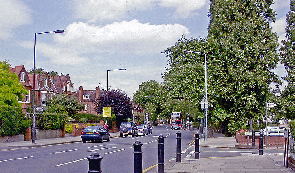
English: Bath Road, Chiswick at site of Bath Road Halt
View eastward on B409 towards Shepherds Bush. On the right had been the Halt on the North & South Western Junction Railway branch to Hammersmith & Chiswick from South Acton. The Halt was there for only eight years (until 1/1/17), but the branch persisted until 3/5/65. |
| Date | |
| Source | From geograph.org.uk |
| Author | Ben Brooksbank |
| Permission (Reusing this file) |
Creative Commons Attribution Share-alike license 2.0 |
| Attribution (required by the license) | Ben Brooksbank / Bath Road, Chiswick at site of Bath Road Halt / |
| Camera location | | View this and other nearby images on: OpenStreetMap |
|---|
Licensing
[edit]

|
This image was taken from the Geograph project collection. See this photograph's page on the Geograph website for the photographer's contact details. The copyright on this image is owned by Ben Brooksbank and is licensed for reuse under the Creative Commons Attribution-ShareAlike 2.0 license.
|
This file is licensed under the Creative Commons Attribution-Share Alike 2.0 Generic license.
Attribution: Ben Brooksbank
- You are free:
- to share – to copy, distribute and transmit the work
- to remix – to adapt the work
- Under the following conditions:
- attribution – You must give appropriate credit, provide a link to the license, and indicate if changes were made. You may do so in any reasonable manner, but not in any way that suggests the licensor endorses you or your use.
- share alike – If you remix, transform, or build upon the material, you must distribute your contributions under the same or compatible license as the original.
File history
Click on a date/time to view the file as it appeared at that time.
| Date/Time | Thumbnail | Dimensions | User | Comment | |
|---|---|---|---|---|---|
| current | 15:25, 27 December 2012 | | 2,350 × 1,382 (3.82 MB) | Chevin (talk | contribs) | == {{int:filedesc}} == {{Information |Description={{en|1='''Bath Road, Chiswick at site of Bath Road Halt''' View eastward on B409 towards Shepherds Bush. On the right had been the Halt on the North & South Western Junction Railway branch to Hammersmit... |
You cannot overwrite this file.
File usage on Commons
The following page uses this file:
Metadata
Categories:
- Bedford Park, London
- Disused railway stations in London
- Former level crossings in the United Kingdom
- Railway stations opened in 1909
- Railway stations closed in 1917
- 2005 in the London Borough of Hounslow
- Roads and streets named after Bath, Somerset
- Roads and streets in the United Kingdom named after towns
- B roads in London
- August 2005 in London